





Devil Mountain Trail
The entire Devil Mountain Trail (600) begins at Devil Mountain Road (FR 626) and ends at Piedra Stock Drive Trail (583) with intersections with Monument Park ATV Trail (590), Beaver Lakes Trail (604), Dudley Trail (601), and Middle Mountain Trail (654).
This multi-use trail is divided into 3 sections. Please see Motor Vehicle Use Map for more details.
The most popular part of the trail is the section from Monument Park ATV Trail (590) to Middle Mountain Trail (654) which is open to OHV 50-inches or less. This portion of the trail is a popular ATV trail that is challenging and popular with hunters in the fall. It has lots of easy sections winding through the forest on an easy dirt trail, but it also has some moderate rocky ledges that add a challenge for ATVs. The west end starts out really wide at the intersection with Monument Park ATV Trail (590), but it narrows up through the forest with more embedded rock and tighter curves through the trees. It has a few rock obstacles that are made of bigger embedded rock slabs making some small ledges, but it is ramped and not very steep, so it's not overly difficult to get up or down. There is a reroute on the east end before it connects with Middle Mountain after 3.5 miles and 550 feet of elevation gain. This trail is open 5/15 - 11/30 for motorized use.
- Distance (one-way): 3.6 miles
- Starting elevation: 9,230 feet at intersection with Monument Park ATV Trail (590)
- Minimum elevation: 9,090 feet
- Maximum elevation: 9,560 feet
The 4.2-miles section travels south from the intersection with Monument Park ATV Trail (590) ends at Devil Mountain Road (FR 626). This portion of the trail is open to single-track motorcycles. Just before reaching Devil Mountain, the trail intersects with Mule Mountain Trail (591). This trail is open 5/15 - 11/30 for motorcycle use.
- Distance (one-way): 4.2 miles
- Minimum elevation: 9,230 feet at intersection with Monument Park ATV Trail (590)
- Maximum elevation: 9,940 feet
The 0.9-mile section descends 630 feet from the intersection with Middle Mountain Trail (654) to Piedra Stock Drive Trail (583) and is for non-motorized use only.
- Distance (one-way): 0.9 miles
- Minimum elevation: 8,880 feet
- Maximum elevation: 9,510 feet
Specific Trail Information
Trail Number
General Information
This is a multi-use trail with portions open to motorized vehicles from 5/15 - 11/30. Please see Motor Vehicle Use Map for more details.
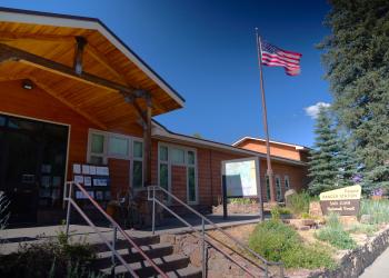
Address: 180 Pagosa Street Pagosa Springs, CO 81147
Phone: (719) 851-7377
Hours: Monday - Friday: 8am - 12pm; 1pm - 4:30pm (Closed on federal holidays)
Office Email: SM.FS.PagosaRD@usda.gov
Getting There
Trailhead/Starting Points
From Monument Park Trailhead, take Monument Park ATV Trail (590) for approximately 1.75 miles until the junction with Devil Mountain Trail.
Directions
Monument Park Trailhead
From downtown Pagosa Springs, head west on US-160 about 22 miles to Forest Road 622, First Fork Road. Turn right onto FR 622. Travel 6.8 miles. Turn right onto Monument Park West (FR 630.1) (across the street from the into Sheep Creek Trailhead parking area) and travel 6.25 miles to the trailhead of Monument Park ATV Trail (590).
Devil Mountain Trailhead
From downtown Pagosa Springs, head west on US-160 about 19 miles to Devil Mountain Road (FR 626). Turn right/north on Devil Mountain Road, follow for 12 miles.
Recreation Opportunities


 OHV Trail Riding
OHV Trail Riding Info
This is a multi-use trail with portions open to motorized vehicles from 5/15 - 11/30. Please see Motor Vehicle Use Map for more details.


