

The Rolls OHV Permit Zone
The Rolls OHV Permit Zone motorized use area on the Mesa Ranger District.
Located in the Mesa Ranger District about one hour from Phoenix, this 24,000 acre area has approximately 150 miles of motorized routes that vary in width and challenge. A highlight of this area is Four Peaks Road which travels to the saddle of Four Peaks in the Mazatzal mountain range and over to State Highway 188 at Roosevelt Lake. A section of the Great Western Trail lies just on the northern boundary of The Rolls area. Access points to The Rolls area includes four staging areas: Four Peaks, Pobrecito, Cottonwood and Palo Fierro. Please remember to stay on the routes. Driving off-road is prohibited on the Tonto National Forest.
Four Peaks Road and the Great Western Trail lie outside the boundaries of The Rolls OHV Permit Zone; a Tonto NF OHV Permit is not required for motorized use on these two routes.
Motorized use requires a Tonto NF OHV Permit. See the OHV Permit FAQ for details about when a motorized use permit is needed. Be sure you’ve reviewed the Rules and Regulations of the OHV areas and please recreate responsibly!
The Rolls OHV Trails map [PDF, 1 page]
Pobrecito OHV Staging Area is accessed directly behind Pobrecito Boat Staging Area off of Bush Highway.

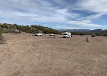
The Four Peaks OHV Staging Area is the first parking lot on Forest Road 143, Four Peaks Road, and a common staging area that accesses The Rolls OHV Permit Zone.
Located along Forest Road 143, Four Peaks Road, this staging area accesses The Rolls OHV Permit Zone and the trails that lead to the coves of Saguaro Lake.
This is the 3rd staging area you come to as you travel up FR143 (Four Peaks Road) from SR-87.