
Visitor Maps and Guides
The Ashley National Forest offers a number of maps and a visitor guide to help the public navigate and explore safely. Whether you are hiking, camping, driving, or even cross-country skiing, these resources will ensure you have a well-prepared and memorable experience.
Exploring a National Forest is an incredible experience, but safety comes first! As a visitor, it is your responsibility to know and follow Forest regulations, stay on designated rouses, and respect wildlife and other visitors. Practice Leave No Trace and Tread Lightly! principles to help keep these lands for future generations. Be prepared for rapidly changing weather.
Maps are available online, as well as at most Ranger District and Forest Services offices.
Interactive Forest Map Finder
The Interactive Forest Map Finder link below is the quickest access to find and purchase the Forest Visitor Maps. The Forest Visitor Maps of each National Forest and Grassland provide forest-wide information on attractions, facilities, services, and opportunities. Some maps are readily available to purchase at your Forest District offices. Please contact the local forest directly to check on availability.
Map Finder
The links found in the Forest Map Finder will take you to the following sites: district offices selling the maps locally, US Geological Survey for online sales, Avenza Map Store for electronic (GeoPDF) maps, and links to the free official Motor Vehicle Use Map (MVUM) displaying roads, trails, and areas open to motor vehicle use in the National Forest.
Also learn more about Geospatial Data for the Intermountain Region forests.
Motorized Vehicle Use Maps (MVUM)
A Motorized Vehicle Use Map (MVUM) is a legal document that shows which roads and trails are open to public motor vehicle use. If a road or trail does not appear on the map, it means that it is not open to public motor vehicular use.
The MVUM is a black and white map with no topographic features. It is best used with a Forest Visitor Map or other detailed map. The MVUM will be updated as needed to correct mapping errors or discrepancies and update travel decisions.
If you plan on camping, driving off-highway vehicles, hunting, or exploring the backcountry; please make sure you review the appropriate MVUM to know which routes are open to motor vehicle use. For more information, please visit MVUM Frequently Asked Questions and KNOW BEFORE YOU GO!
Cross-Country Ski Trail Maps
Whether you're exploring on foot, skis, or wheels this cross-country trail system offers a quiet escape into nature. The trail into Grizzly Ridge Yurt is a moderately challenging route and offers year-round beauty with few crowds. Dogs are welcome, with a few off-leash areas available.
This trail winds through aspen stands, open landscapes and conifer forest offering adventurers solitude and the chance to see winter wildlife. This trail does not lead to Grizzly Ridge Yurt, please see the Basset Springs Trail.
For those seeking a true winter challenge, the Limber Flag Cross-Country Ski Trail delivers. This route will take adventurers through aspen groves, open meadows, and dense forests, requiring careful navigation around trees and following the marked blue diamonds. A steady climb leads to the Limber Flag Yurt, an incredible reward for the effort!
This trail is a thrilling backcountry experience for those willing to put in a little extra work. Routed through Aspen stands and pine trees, explorers can complete a 3.5 mile loop or branch off and meet with the Basset Springs Trail and head on to Grizzly Ridge Yurt.
High Uintas
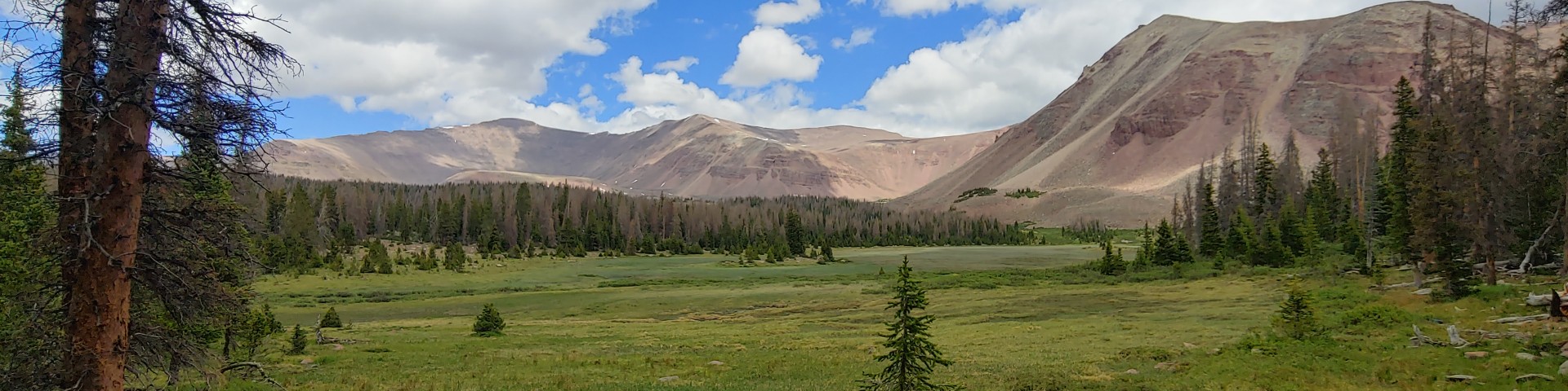
Home to Utah's highest peaks, countless lakes, and a unique alpine ecosystem, the High Uintas Wilderness stands as one of the nation's exceptional wilderness areas.
The High Uintas Wilderness may be accessed from 16 developed trailheads located near the perimeter of the wilderness.
State highway maps will guide you into the general area but do not show enough detail to help locate National Forest trailheads. Ashley and Wasatch-Cache National Forest “travel maps” or “forest maps” are best for this purpose.
To purchase a forest map or to request a free travel map or state highway map, contact your local Forest Service office.
Those on the north slope of the Uinta Mountains are generally approached through Wyoming, while those on the south slope are approached through Utah. This map is intended to supplement a state highway map.
If your group will not be leaving popular designated trails, or as a valuable supplement to USGS quadrangle maps, you may wish to consider a less detailed map produced by the Forest Service expressly for the High Uintas Wilderness.
The Forest Service recommends the use of 7.5 minute quadrangle maps produced by the US Geological Survey (USGS), particularly for off-trail travel or visits deep into the wilderness. These maps are often out of date, so they may not show constructed features such as roads and facilities, but they show topographic features in great detail and are still considered a vital orienteering tool. To purchase USGS topographic maps, contact the Forest Service or visit the USGS Store. Use this map to find the names of 7.5 minute quadrangle maps that cover the High Uintas Wilderness.
Forest Service Digital Maps

Forest Service Digital Maps cover all lands administered by the Forest Service. There are available at a variety of scales. Maps are free as a digital download.