
Bald Eagle (Curry Gap) Trail 650
This trail provides access to Henry M. Jackson Wilderness. It also provides access to Glacier Peak Wilderness via the Pacific Crest Trail at Dishpan Gap. From the Blad Eagle Trailhead follow an old logging road for approximately 2.5 miles. About a half mile past the end of the old road, the trail enters Henry M Jackson Wilderness and opens into Curry Gap, a wide corridor with meadows. Camping space is available at Curry Gap.
Just south of Curry Gap the trail reaches a junction. The right fork is Quartz Creek Trail 1050, which joins the North Fork Skykomish Road 63 on the Skykomish Ranger District. The left fork continues east and ascends to a ridge and passes near Bald Eagle Mountain and Long John Mountain. The trail passes over June Mountain and shortly after is the junction with Pilot Ridge Trail 651 on the left. Bald Eagle trail continues to the Pacific Crest Trail at Dishpan Gap 9.5 miles from the trailhead.
Water is sometimes scarce along this trail in late summer and fall. You will usually find a spring crossing the trail just above Curry Gap. Near Long John Mountain you’ll find some nice places to camp, but you may have to search a bit on the north side of the trail to find water.
Specific Trail Information
Trail Number
Trail Type
General Information
Maps:
- Darrington Ranger District
- Green Trails: Sloan Peak 111, Monte Cristo 143 and Benchmark 144
A valid Recreation Pass required a Bald Eagle Trailhead.
This trail enters the Henry M. Jackson Wilderness and wilderness regulations apply.
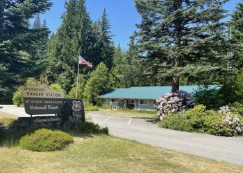
Address: 74920 NE Stevens Pass Hwy Skykomish, WA 98288
Phone: (360) 677-2414
Hours: This U.S. Department of Agriculture office is currently closed due to the lapse in Federal Government funding. The office will reopen once Congress restores funding. (Closed on federal holidays)
Getting There
Trailhead/Starting Points
Directions
From the Verlot Public Service Center (11 miles east of Granite Falls, WA), drive east along Mt. Loop Highway 27 miles and turn right onto Sloan Creek Road (Forest Service road 49). Follow it for 9.5 miles, passing Sloan Creek Campground at 6.5 miles to the trailhead a half mile past the stock unloading ramp and toilet.
From the Darrington Ranger District office, take Mt. Loop Highway 20 along the west side of the Sauk River. Drive 16.3 miles to the Sloan Creek Road (Forest Service road 49) and turn left. Follow above directions from here.