

Visitor Maps and Guides
Map Purchases
On-line
- Available for purchase online at the U.S. Geological Survey Store.
- For those using the Avenza app, many georeferenced forest products are also available for free or purchase as georeferenced PDFs on Avenza, for use on mobile devices.
ALERT: Beginning April 2026, the Forest Service can no longer update or add new digital maps to the Avenza Map Store. When a paper map is updated, the previous digital version will be removed from the store and not replaced. Digital maps that have not yet been updated will remain available on the store. MVUMs are reissued each year. It is the responsibility of motor vehicle users to acquire the current MVUM.
|
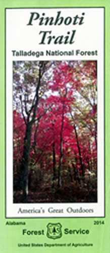
Image

|
Image

|
Image
|
Image

|
Image

|
Image

|
To download a map product of the National Forests in Alabama visit the Avenza Map store and follow these steps:
- Search the Find Maps feature by entering: US Forest Service R8
- On the map display, zoom to the desired area
- Click the "search this area" button for a list of available products
Free Downloadable Maps
The following maps are downloadable free of charge.
Free Forest Service Digital Maps

Motor Vehicle Use Maps
| Bankhead District (1.4 mb) |
| Conecuh District (.8 mb) |
Oakmulgee District (.9 mb) |
| Shoal Creek District (1.2 mb) |
Talladega District (1 mb) |
| Tuskegee District (.6 mb) |
Guidelines for Road Maintenance Levels
How to Purchase Maps In-person
Maps are available for purchase at any one of the six ranger districts.
| Bankhead National Forest, 1070 Highway 33, Double Springs, Alabama (205-489-5111) |
| Conecuh National Forest, 24481 Alabama Hwy 55, Andalusia, Alabama (334-222-2555) |
| Talladega National Forest - Oakmulgee District, 9901 Highway 5, Brent, Alabama (205-926-9765) |
| Talladega National Forest - Shoal Creek District, 45 Highway 281, Heflin, Alabama (256-463-2272) |
| Talladega National Forest - Talladega District, 1001 North Street (Hwy 21 North), Talladega, Alabama (256-362-2909) |
| Tuskegee National Forest, 125 National Forest Road 949, Tuskegee, Alabama (334-552-3145) |
Geospatial Data
Access to the National Forests in Alabama geospatial data is available through the Forest Service Enterprise Data webpage, a single point of access for data collected and managed by the Agency. For forest unit data files, or to create a custom download file, visit the Geospatial Data Discovery Tool.
Submit questions regarding this page or National Forests in Alabama geospatial data to: GIS Questions