
Archaeology and Cultural Resources
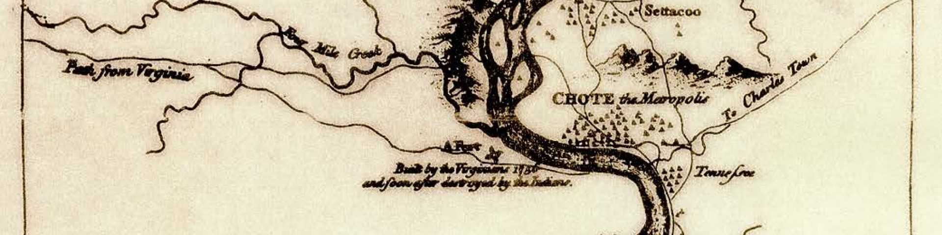
Up until the time of the Revolutionary War, most of the continent’s Euro-American population lived within 100 miles of the Atlantic or Gulf coasts. The Appalachian Mountains created a challenging barrier that, for many years, delayed expansion into the nation’s interior. Well before any European ever set foot on the North American continent, the primary path across the Southern Appalachians was the route known today as the Unicoi Turnpike.
Winding through the mountains’ lowest gaps and passes, this travel way connected the principal
Cherokee settlements located between the Savannah River Valley in South Carolina and southeast
Tennessee. This passageway was the main route used by early explorers, beginning with the conquistadors
led by De Soto in 1540. Later Spanish, French and English traders followed the same path to barter with the Indians for deer skins and furs. Before the Revolutionary War, the Cherokee and colonists used this overmountain trail as a diplomatic and military link between Cherokee settlements and the British headquarters in Charleston, S.C.
By 1775, settlers began to infiltrate the heartland of the Cherokee people. The first significant nonmilitary settlements on the western side of the Appalachians were Sycamore Shoals and Carter’s Valley in northeast Tennessee. With the influx of people, territorial wars between the Cherokee and settlers began in earnest and continued throughout the Great Valley of Tennessee until the mid 1790s. The Cherokee’s lands began to shrink as they were pushed south down the Tennessee Valley. At the same time, the young United States government established “federal roads” for access into frontier settlements.
Accompanying these settlements were protective fortifications called blockhouses or stations. The blockhouse at the mouth of Paint Creek on the French Broad River protected settlers who took the Greeneville Road between Warm Springs (now Hot Springs, North Carolina) and Greeneville, Tennessee. The fortification also prevented settlers from fording the river into the lands of the Cherokee Nation. Another blockhouse, Camp Armistead, was located on the Unicoi Turnpike near Coker Creek. It was established in the early 1830s to keep gold-seekers out of the Cherokee Nation. A few years later, it was used as a military base during the Cherokee removal along the Trail of Tears.