
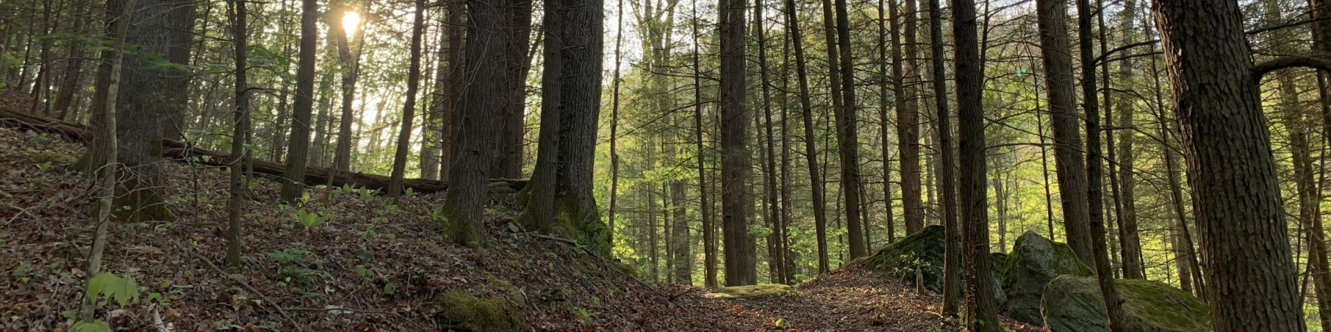
South Fork - Cumberland River
Much of the Stearns Ranger District lies within the South Fork of the Cumberland River, located in the remote foothills of the Jellico Mountains. Steeply-sloped ridges and narrow ravines characterize the land. The terrain is rugged but scenic. Visitors will enjoy camping, hiking, fishing and other outdoor recreation opportunities. Dense hardwood forest, cascading waterfalls and towering sandstone cliffs are some of the area’s best natural attractions.
Two Kentucky Wild Rivers (Rock Creek and Cumberland River) and two candidates for National Wild and Scenic River designation (Marsh Creek and Rock Creek) occur in the area. The district surrounds the northern portion of Big South Fork National River and Recreation Area.
Complexes

Barren Fork Horse Camp is located off Barren Fork Road (#684) about 1 mile past US 27 and the Stearns Ranger District Office.

The picnic shelter is located at the Barren Fork Horse Camp and can fit groups of up to 50 people.
Barren Fork Heritage Trailhead is located off Barren Fork Road just behind the Stea
Beaver Creek Wildlife Management Area is cooperatively managed with the Kentucky Department of Fish and Wildlife Resources to promote and sustain native wildlife popul

Towering sandstone cliffs, natural arches and rippling streams are just some of the special features that led to the designation of Beaver Creek Wilderness in 1975.
Middle Ridge Trailhead is located off Middle Ridge Road (Forest Road 839) on the southern end of Beaver Creek Wilderness. The site has parking and visitor information.
Swain Ridge Trailhead is located off Forest Road 52 near Beaver Creek Wilderness.
Bowman Ridge Trailhead is located off Forest Road 51 near Beaver Creek Wilderness.
Three Forks of Beaver Trailhead is located off Forest Road 51 near Beaver Creek Wilderness and provides access to several trails.
Natural Arch Scenic Area is a great place to enjoy the outdoors with family and friends. The main attraction is a spectacular sandstone arch that spans nearly 100 feet. An overlook provides visitors with a panoramic view of the arch. Picnic sites, group picnic shelters, playgrounds and hiking trails provide year-round enjoyment. The amphitheater and group picnic shelters may be reserved for special events.
Natural Arch Scenic Area Guide and Map
11x17 with Trails #508, 510 and 528

Natural Arch Picnic Area is located off Day Ridge Road (#927) in McCreary County near the nearly 100-foot-long sandstone Natural Arch.
Rock Creek is a beautiful stream, with magnificent boulders, riffles, glides, and pools. Flowing through southeastern Kentucky, it is both a Blue Ribbon trout fishery and a Kentucky Wild River.
However, highly acidic water flowing from abandoned mine lands left the stream virtually dead from White Oak Junction to the Big South Fork of the Cumberland River. The acid mine drainage had killed most of the vegetation and aquatic life in the stream.
The Rock Creek Task Force was formed with the cooperation of ten state and federal agencies and Trout Unlimited to tend to the needs of the Rock Creek watershed. Restoration work began in 2000 to improve water quality, sustain aquatic life and bring back the beauty of the steam.
Innovative wetlands were constructed to treat the mine flow heading into the stream. Limestone sand was placed in Rock Creek to neutralize the acidic water coming from the mines. Tons of coal refuse material was removed, treated, and relocated to designated storage locations. Limestone rock was placed along the channels as they enter Rock Creek to boost alkalinity.
Bell Farm Horse Camp is located off Road 1363 in McCreary County and is a popular place for wagon train riders who come to "rest a spell." In the early 1900s, this ar
Great Meadows Campground is located off Rock Creek-Bell Farm Road (Forest #137) in McCreary County and features 18 primitive sites for tent and RV camping, picnic tables, p
Hemlock Grove Picnic Area is located off Rock Creek- Bell Farm Road (Forest #137) in McCreary County and features three double sites, three single sites and a first come, f