
Edith's Gap Launch Site
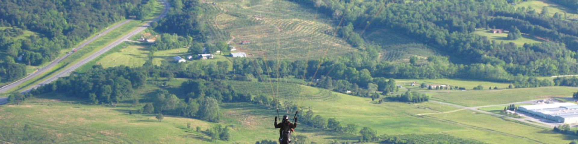
Experience the thrill of flying without an airplane! Feel your adrenaline and excitement build as you approach the launch site perched high on the southeastern slope of the Massanutten Mountain Ridge in Luray, Virginia. Launch from this steep slope and soar like an eagle while enjoying a bird’s eye view of Page County, South Fork River, and the Shenandoah Valley.
General Information
- LAT 38.725306 LONG -78.507861
- Lat/Long Conversion Table
Open year round
Day use only: open sunrise to sunset
Alcoholic Beverages Prohibited. When recreating on Forest Service Lands, follow the safety and outdoor ethics recommendations.
No Fees are required for this site.

Address: 102 Koontz St. Edinburg, VA 22824
Phone: 540-984-4101
Hours: Monday - Friday; 8:00 AM - 4:30 PM (Closed on federal holidays)
Getting There
Latitude / Longitude
Latitude: 38.72527778
Longitude: -78.50944444
Directions
From I-81: Take exit 279. Turn east on SR 675. At intersection of US 11 and SR 675 in the center of Edinburg (T-intersection), turn left onto US 11. Make another right turn back onto SR 675 at the north end of Edinburg. Follow SR 675 for 5.9 miles over Massanutten Mountain to STOP sign at Kings Crossing (T-intersection). Turn right and continue on SR 675 for 3.4 miles to an X-intersection of SR 675, FDR 274, and SR 730. Turn left, still on SR 675, called (Also called Camp Roosevelt Road and Fort Valley Road) to top of the steep hill and the sharp S-turn (Intersection of dirt road and trail head at Mountain Top Drive). The hang gliding launch and parking area is located here.
Facility and Amenity Information
Water
Potable water is not available at this site.