Berryman Campground
This small, remote campground and picnic area located at the site of a Civilian Conservation Corps camp of 1937 provides a quiet setting for escaping from your normal routine. With just 8 individual campsites and a picnic shelter, it is enjoyed by campers, picnickers, mountain bikers, equestrians, and hikers.
The Berryman Trail leaves from this recreation area, and traverses 24 miles of scenic Ozark countryside and winding through timbered stands and fields. The hiking, mountain biking, and horseback riding offer one a pleasant measure of solitude and quiet.
The western section of the trail also serves as part of the Courtois Section of the Ozark Trail.
History of the Berryman CCC Camp
The Berryman CCC Camp, also known as Lost Creek, was home to the 3733rd Company and was designated Camp Number F-MO-13.
The camp’s initial construction began on May 29, 1935, under the command of Lieutenant Charles C. Isely. Twelve men were selected from Company 732 at Boss, Missouri to be the first enrollees of the 3733rd Company and were to be in charge of the cooking, road work, and other work that required special training.
The early camp conditions were described by Robert Fechner, author of What the CCC Is and Does: Company 3733, Berryman, MO, as follows: “The men lived in one of the uncompleted buildings for two weeks, cooking and eating in the open, and in all enduring hardships that in the light of the present conditions, seem unreal.” The initial camp enrollees were tasked with “lifting the camp out of the mud and brush” (Direct Advertising Company 1937:146). Presumably this colorful language meant that the camp location was cleared of brush, trees, and other vegetation and the landforms leveled so that construction of buildings could begin.
By July 5, 1935, George E. Maness, Relief Director for Washington County, directed that a total of 41 men and seven alternates between the ages of 18 and 28 on the county relief rolls were to be sent to the Berryman CCC Camp. A total of 176 recruits arrived on July 5, 1935, to begin the construction of the camp. Frank D. Crawford was assigned by the Forest Service to be Project Superintendent and he arrived at the camp on July 9, 1935. The forestry office was temporarily housed in the Camp Headquarters Building until the completion of the Forestry Building in November 1935. The initial camp projects completed were the construction of the camp road and the establishment of a telephone line into the camp.
Between 1935 and 1937, the Berryman (Lost Creek) CCC Camp had “built over 50 miles of forest road, erected five steel fire lookout towers, built more than 40 miles of telephone line, planted approximately 320,000 pine trees, 280,000 black walnut trees and cleaned up several hundred acres of standing timber” (Direct Advertising Company 1937:147).
In June of 1938, an open house for the general public was held at the Berryman (Lost Creek) CCC Camp, at which over 5,000 people attended.
By 1942 and the participation of the United States in World War II, all activities of the CCC were discontinued. It is likely that most of the buildings, supplies, and materials from the Berryman (Lost Creek) CCC Camp were removed and put to other uses. A series of foundation remnants remain in the site area, which currently serves as a trailhead and campground.
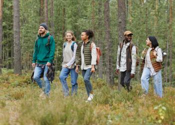
Photos of Berryman Campground


General Information
Campground Camping
This is the site of a 1930's Civilian Conservation Corps (CCC) Camp of the same name. You'll find 8 campsites, each with table, lantern post and fire ring. Centralized vault toilet, but no drinking water.
No. of Sites
Single sites: 8
RV Camping
There are no hookups available at this location.
Each site has a picnic table, lantern post and fire ring.
There is a centralized vault toilet, but no drinking water.
Size Restrictions
No longer than 21 feet.
Vehicle Clearance
No restrictions
Pavement Type of Parking
Paved
January - December
Campground
- Open 24 Hours a day to campers.
- Quiet Hours: 10:00 PM to 6:00 AM
Day Use Hours:
- 6:00 AM to 10:00 PM
Day Use Fees
Day Use Fees can be paid on-site using the provided fee tubes.
- Fees must be paid using cash or check, no credit card machines are available at any sites.
- Annual and Lifetime passes can be purchased to cover day use fees at USDA Forest Service operated sites.
Camping Discount
- There is a 50% discount for camping for anyone with an Interagency Access or Senior Pass.
- The discount applies only to the fee for the campsite physically occupied by the pass holder, not to any additional fee or campsite(s) occupied by members of the pass holder's party.
Campground
- No horses in the recreation area
On the Trail
- No motorized vehicles are allowed on the trail or past designated parking areas.
- Camping is allowed along the Ozark Trail; NO trailside camping on non-National Forest land north of the Narrows trailhead on the Courtois section of the Ozark Trail.
- Camp 100 feet away from trails and water sources.
- Human waste (Feces) must be buried at least 6 inches deep and covered.
- Pack out all of your garbage.
- Dogs are allowed on hiking trails, please ensure they are under control.
- Leashing is encouraged. Unleashed dogs can pose a danger to other pets, the natural resources of the area, wildlife, and other forest visitors.
At the Trailheads
- No overnight camping in day use areas/trailheads at any time of year.
- Dogs must be on a 6 foot leash in the day use area
- No trash containers; please pack out all your trash.
- Fireworks are prohibited.
- Horses may not be tied directly to trees.
Overnight Use:
Single Site: $15 per night
Day Use:
$5 per vehicle per day
Group Use: $50 per day (up to 74 people)
$40 per annual
Trail Use
Dogs are allowed on hiking trails. Please leash your dog, unleashed dogs can pose a danger to your pet, the natural resources of the area, and other forest visitors.
- Leashes must be six feet, or shorter, when in developed recreation sites, including trails within the boundaries (36 CFR 261.16(j)) when they are not inside an enclosed vehicle or tent.
- Yield your leashed dog around other hikers and horses.
- Pack out your dogs waste or bury it 100 feet from water and trails.
Camping
- Keep dogs on a six-foot, or shorter, leash when they are not inside a tent.
- Store dog food in bear-resistant containers and feed your pet away from the campsite.
- Pick up and bag your dog’s waste. Place it in a provided trash receptacle or pack it out.
- Do not leave your dog unattended at any time.
- Do not leave your dog in the vehicle on a hot day.
- Keep your dog in your tent or vehicle at night.
- Ensure that there is ample water available for your pet.
Wildlife
- Do not allow them to interact with wildlife

Address: 10019 W. State Hwy. 8 Potosi, MO 63664
Phone: 573-438-5427
Hours: 8:00 am - 4:30 pm, Monday to Friday; District Offices closed 1 - 1:30 for lunch (Closed on federal holidays)
Office Email: sm.fs.marktwainnf@usda.gov
Getting There
Latitude / Longitude
Latitude: 37.927808
Longitude: -91.062235
Directions
From St. Louis
- Take Highway 21 south 60 miles to Potosi
- then, turn right/west onto Highway 8 and travel 16 miles to FR 2266
- follow FR2266 to the Berryman Campground
Parking
Trailhead - 15 vehicles
Facility and Amenity Information
Accessibility
- sidewalks connecting some sites to restroom and picnic pavilion.
- some picnic tables are wheelchair accessible
Restrooms
Restrooms are available at this site.
Water
Potable water is not available at this site.
No drinking water; stock water nearby
Picnic Tables
Picnic tables are available at this site.
Each campsite has a picnic table and there is a day use picnic area available.
Horse/Pack Animal Information
Horse/Pack animals are allowed at this site.
If you are camping and have horses they will need to stay outside of the campsites tied up at the tie-ups.
You will need to bring water for your horses.
Nearby Trails
Recreation Opportunities
Biking - Mountain Info
Berryman Trail - 24 miles
The 24-mile loop Berryman Trail follows scenic Ozark countryside, winding through stands of oak, pine and bottomland hardwood, climbing switchback fashion, from low bottoms to high cherty (flint-like rock) ridges.
Interesting flora and fauna abound in the old fields, glade-like rock outcroppings and deep forest.
Courtois Section of the Ozark Trail
The western half of this trail also serves as part of the Courtois Section of the Ozark Trail, and can be used as part of a multi-day thru-hike, or a longer point -to- point trip.
Horse Camping Info
If you are camping and have horses they will need to stay outside of the campsites tied up at the tie-ups.
You will need to bring water for your horses.
Horseback Riding Info
Berryman Trail - 24 miles
The 24-mile loop Berryman Trail follows scenic Ozark countryside, winding through stands of oak, pine and bottomland hardwood, climbing switchback fashion, from low bottoms to high cherty (flint-like rock) ridges.
Interesting flora and fauna abound in the old fields, glade-like rock outcroppings and deep forest.
Courtois Section of the Ozark Trail
The western half of this trail also serves as part of the Courtois Section of the Ozark Trail, and can be used as part of a multi-day thru-hike, or a longer point -to- point trip.
Picnicking - Groups Info
A open-sided picnic pavilion provides shelter from sun and rain for groups of up to 30. It is available free of charge on a first come, first served basis.
There are grills available in the picnic area near the pavilion. You will need to bring your own water. There is no trash service available. Please pack out anything you bring with you.
No. of Accessible Sites
The pavilion and tables are accessible.
Picnicking - Single Info
Each picnic site has a grill.
You will need to bring your own water and there is no trash service available. Please pack out anything you bring with you.
No. of Sites
3 picnic sites and a pavilion.
No. of Accessible Sites
The pavilion is accessible
Day Hikes Info
Berryman Trail - 24 miles
The 24-mile loop Berryman Trail follows scenic Ozark countryside, winding through stands of oak, pine and bottomland hardwood, climbing switchback fashion, from low bottoms to high cherty (flint-like rock) ridges.
Interesting flora and fauna abound in the old fields, glade-like rock outcroppings and deep forest.
Courtois Section of the Ozark Trail
The western half of this trail also serves as part of the Courtois Section of the Ozark Trail, and can be used as part of a multi-day thru-hike, or a longer point -to- point trip.
Backpacking Info
Berryman Trail - 24 miles
The 24-mile loop Berryman Trail follows scenic Ozark countryside, winding through stands of oak, pine and bottomland hardwood, climbing switchback fashion, from low bottoms to high cherty (flint-like rock) ridges.
Interesting flora and fauna abound in the old fields, glade-like rock outcroppings and deep forest.
Courtois Section of the Ozark Trail
The western half of this trail also serves as part of the Courtois Section of the Ozark Trail, and can be used as part of a multi-day thru-hike, or a longer point -to- point trip.
Recreation Groups