
Big Piney Equestrian Camp
Situated in an open pine forest, this area serves as one of 3 trailheads for the 18-mile Big Piney Trail, which travels through the Paddy Creek Wilderness.
Designed as an equestrian camp, the area has a trail register station and 5 campsites accommodating horse trailers, with picnic tables, fire rings and high line posts.
Hitching rails available near the bathroom and a mounting block area is available at the trail register station. A vault toilet is on site, but drinking water is not available.
General Information
Camping
There are five campsites on the outer loop, and the inside of the loop can accommodate six trucks with trailers for horse camping.
Each campsite has a table, fire ring and highline post.
Safety:
- During temperate months, be prepared for biting insects, poison ivy and high temperatures.
- A good map and compass , along with knowledge of utilizing these, are strongly suggested.
- Be aware of hunting seasons.
- Avoid using the trail during excessively wet periods.
- Be sure to tell someone your plans,
- don’t hike the wilderness alone and
- carry extra supplies so you are prepared to take care of yourself in case you get lost, injured, or delayed.
- The universal distress signal is three of anything: shots, shouts, smokes, whistles.
The Ozark climate is mild enough to make Wilderness visits feasible throughout the year, as long as visitors bring proper gear. When possible, take advantage of this opportunity and plan your visit outside the peak spring and fall use seasons.
For more safety tips visit the Safety section of the website.
January - December
Campground
- Open 24 Hours a day to campers.
- Quiet Hours: 10:00 PM to 6:00 AM
Day Use Hours:
- 6:00 AM to 10:00 PM
Wilderness
- No motorized vehicles are allowed on the trail or past designated parking areas.
- Camping is allowed along the trail.
- Camp 100 feet away from trails, other camps, and water sources.
- Human waste (Feces) must be buried at least 6 inches deep and covered.
- Pack out all of your garbage.
- Stock: never tie stock directly to trees.
- Limit your party size to 10 persons
- Practice Leave No Trace outdoor ethics;
Trailheads and Campground
- No overnight camping in day use areas at any time of year.
- Dogs must be on a 6 foot leash in the day use area
- No trash containers; please pack out all your trash.
- Fireworks are prohibited.
- No trash containers; please pack out all your trash.
- Dogs must be on a 6 foot leash in the campground.
- Campsite parking allows for two vehicles per site.
- Park only in designated parking areas.
- No more than 8 people are permitted at single sites (16 for double
- sites).
- Only collect dead and downed wood for campfires.
No fees are required for this site
Trail Use
Dogs are allowed on hiking trails. Please leash your dog, unleashed dogs can pose a danger to your pet, the natural resources of the area, and other forest visitors.
- Leashes must be six feet, or shorter, when in developed recreation sites, including trails within the boundaries (36 CFR 261.16(j)) when they are not inside an enclosed vehicle or tent.
- Yield your leashed dog around other hikers and horses.
- Pack out your dogs waste or bury it 100 feet from water and trails.
Camping
- Keep dogs on a six-foot, or shorter, leash when they are not inside a tent.
- Store dog food in bear-resistant containers and feed your pet away from the campsite.
- Pick up and bag your dog’s waste. Place it in a provided trash receptacle or pack it out.
- Do not leave your dog unattended at any time.
- Do not leave your dog in the vehicle on a hot day.
- Keep your dog in your tent or vehicle at night.
- Ensure that there is ample water available for your pet.
Wildlife
- Do not allow them to interact with wildlife

Address: 108 S. Sam Houston Blvd. Houston, MO 65483
Phone: 417-967-4194
Hours: 8:00 am - 4:30 pm, Monday to Friday; District Offices closed 1 - 1:30 for lunch (Closed on federal holidays)
Office Email: sm.fs.marktwainnf@usda.gov
Getting There
Latitude / Longitude
Latitude: 37.566008
Longitude: -92.04445584
Directions
From Licking
- take Hwy 32 west 4 miles to Hwy N;
- turn right on Hwy N and go 2 miles to Hwy AF
- turn left onto Hwy AF, and travel 5 miles to Slabtown Road;
- continue straight past the asphalt for Slabtown road, and continue for 1.5 miles.
- Big Piney Trail Camp will be on the left.
Facility and Amenity Information
Accessibility
The toilet is accessible.
Restrooms
Restrooms are available at this site.
Water
Potable water is not available at this site.
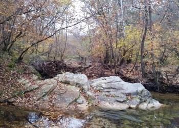
Drinking water is not available in Paddy Creek Wilderness, Paddy Creek Recreation Area, Paddy Creek Campground, Big Piney Equestrian Camp, or Roby Lake. Open water sources within the wilderness are not recommended for drinking. Bring your own drinking water or be prepared to boil or treat water chemically.
Picnic Tables
Picnic tables are available at this site.
Horse/Pack Animal Information
Horse/Pack animals are allowed at this site.
Nearby Trails
Recreation Opportunities
Horseback Riding Info
Big Piney Trail - 17 miles
The elevation of the area changes 500 feet between a point near Roby Tower on the western edge of the area, and Paddy Creek as it meets the eastern boundary of the Wilderness. Signs and trail marking are minimal or non-existent and the use of maps and compass is recommended. Travel is by foot or on horseback.
Horse Camping Info
There are hitching posts installed by the vault toilet. At each single site there are highline poles, tables and a fire ring.
Please scatter manure outside of the campground.
No. of Sites
- Group: The center loop can accommodate 6 vehicles with trailers for horse camping.
- Single Sites: 5
Day Hikes Info
Big Piney Trail - 17 miles
The elevation of the area changes 500 feet between a point near Roby Tower on the western edge of the area, and Paddy Creek as it meets the eastern boundary of the Wilderness. Signs and trail marking are minimal or non-existent and the use of maps and compass is recommended. Travel is by foot or on horseback.
Backpacking Info
Big Piney Trail - 17 miles
The elevation of the area changes 500 feet between a point near Roby Tower on the western edge of the area, and Paddy Creek as it meets the eastern boundary of the Wilderness. Signs and trail marking are minimal or non-existent and the use of maps and compass is recommended. Travel is by foot or on horseback.
Biking - Mountain Info
Mountain biking is only allowed east from Paddy Creek Road.
This section, which is part of the Big Piney Trail, is outside of the wilderness, and is about 2 miles long. There is no mountain biking in the wilderness so please be aware of your location. Each entrance on the trail is marked with a wilderness sign.
Big Piney Trail - 17-miles
The elevation of the area changes 500 feet between a point near Roby Tower on the western edge of the area, and Paddy Creek as it meets the eastern boundary of the Wilderness. Signs and trail marking are minimal or non-existent and the use of maps and compass is recommended. Travel is by foot or on horseback.
Recreation Groups
This 7,035-acre wilderness is located in northwestern Texas County 35 miles southwest of Rolla, Missouri, and 16 miles west of Licking, Missouri.