Balfour-Klickitat Area & Trail (#4414)
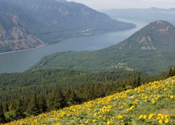
This day use area offers an easy paved trail with Gorge views, wildflowers, and birdwatching opportunities just west of the Klickitat River's convergence with the Columbia River. Once a ranch, the site was acquired by the Forest Service in 1994 and has undergone efforts to restore native bunchgrasses and wildflowers. Astute naturalists will note native plants thriving in some areas while other plots are still actively being restored. A grove of non-native Osage Orange trees, planted as a windbreak in the late 1800s, have intentionally been left as a remant of the site's cultural heritage.
The trail's paved 0-15% gradient makes most of it ADA accessible, however, some people with disabilities may need assistance on steep or rugged sections, particularly during winter and spring months. Winter snow is not cleared, nor is the pavement salted - so check the Gorge weather and conditions before heading out.
Part of the Washington Audubon Great Birdwatching Trail, Balfour-Klickitat is a prime eagle watching spot around February and good for spotting songbirds and waterfowl year-round. To watch the spectacle of eagles congregating to feed on spring runs of salmon, head left from the trailhead towards Klickitat Cove, where Mill Creek flows into the Klickitat River from the west. Near the interpretive sign, veer left and uphill, following the signs marked “Wildlife Viewing Area.” A small platform provides a bird blind, allowing you to watch the eagles without disturbing them.
At a Glance
Open Season: | Year round |
---|---|
Usage: | Light-Medium |
Best Season: | Late winter through early summer or fall |
Restrictions: | Motor vehicles amd bikes are prohibited. Fires not allowed within 200 feet of trail. Dogs on leash |
Closest Towns: | Lyle, WA |
Water: | No |
Restroom: | Vault Toilet |
Operated By: | Forest Service |
Information Center: | Columbia River Gorge National Scenic Area |
General Information
Directions:From Lyle, WA: Travel west on State Highway 14 approximately 1/4 mile. Take an immediate right (north) after crossing the Klickitat River onto Canyon Road and travel approximately 1/4 mile to the parking lot on the east side of the road.
From Bingen, WA: Travel east on State Highway 14 approximately 10 miles. Take a left (north) onto Old Highway 8 (Canyon Road) and travel 1/4 mile to the parking lot on the east side of the road.
Activities
Day Hiking
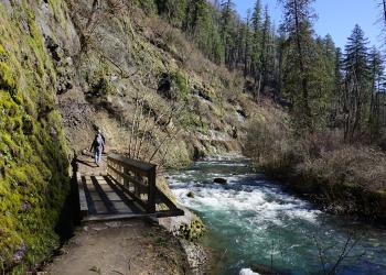
A paved 0.7 mile loop, Balfour-Klickitat Trail (#4414) is a great day hike for all ages and abilities. Reflect on the site's history with the interpretive signs or enjoy a picnic at one of the tables available. From the trail, there are both east and west-facing views of the Gorge. Two small spur trails near Klickitat Cove provide opportunities to watch wildlife.
General Info:
AccessibilitySee video for details.
Parking
A small parking lot is available at the trailhead.
Permit required?: | Y |
---|
Viewing Wildlife
A backwater cove located on the western banks of the Klickitat River is an important over-wintering area for immature and adult bald eagles. Please respect the wildlife by not traveling down to the cove -- instead, watch the birds by heading left and uphill at the interpretive sign, following the "Wildlife Viewing Area" sign to a small platform which acts as a bird blind. Other species of interest are Lewis' woodpeckers, red tailed hawks, and California ground squirrels.
Viewing Plants
Acute naturalists will note native plants thriving in some areas while other plots are still actively being restorated. Holdover patches of blackberries and other invasives remain in some spots. A grove of non-native Osage Orange trees, planted as a windbreak in the late 1800s, have been left as a remant of the site's cultural heritage.
Viewing Scenery
The trail provides east and west-facing views of the Columbia River, and the site faces the Rowena Plateau on the Oregon side. Look for evidence of the Missoula Floods in the flatness of Rowena Plateau, a noticeable contrast to the surrounding landscape. The east end of the loop provides excellent views of Klickitat Canyon.
Interpretive Areas
Descriptive history and nature signs, located near the beginning of the trail, unveil site's history, from Native American habitation through Lewis and Clark to early European settlers. The property was the likely site of a Klickitat Indian village visited by Lewis and Clark. English nobleman Sir Thomas Balfour developed an extensive agricultural operation in the 1890's, of which barely a trace remains today.
Picnicking
Two accessible tables are available for use on a first-come basis. Please carefully pack out all crumbs and trash.
Best Season: | Late winter to early summer or fall |
---|
Alerts & Warnings
- Microwave Tower Fire Closure/Historic Columbia River Highway State Trail Reopens
- Prescribed Fire Notice for Fall Burning
- Klickitat Mile One Overnight Use & Large Boat Launch Prohibition
- Concept Development for Mosier to The Dalles Trail Underway
- Drones prohibited in wilderness and select recreation sites
- Check road and weather conditions