Recreation


A hiker on a high country trail with mountain and forest views behind her.

Discover an Area by Activity

Select an activity to find an area to visit.

During the inception of national forest reserves in the late 1800s, the San Bernardino National Forest was recognized as one of the premier forests for recreation, and a top destination for people to escape their urban lives for a peaceful retreat in the mountains.

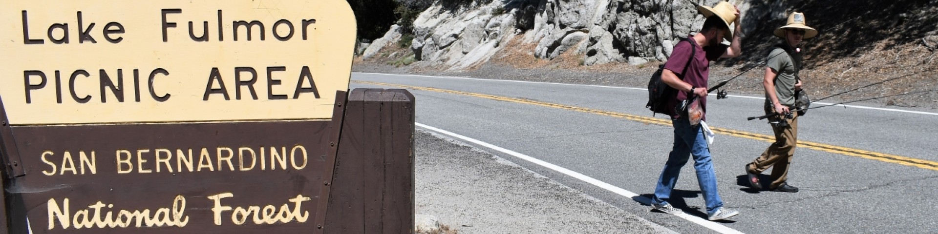
Now, with hundreds of miles of nationally recognized hiking trails, seven designated Wildernesses, 42 campgrounds, four winter recreation resorts, seven wild and scenic rivers, the two tallest mountains in Southern California, and one of the best destinations for off-highway vehicle riding, there is more than a lifetime of activities to do on the San Bernardino National Forest. Which adventure will you choose next?

Recreation Fees

  • Share the Experience Photo Contest

    Share the Experience Photo Contest

    The Share the Experience Photo Contest is an annual photography competition encouraging all nature lovers and amateur shutterbugs to capture their favorite views, moments and adventures on the nation's public lands.

  • Impact of Tropical Storm Hilary

    Water Damage fro Troplical Storm Hilary at the Santa Ana Interpretive Site

    Personnel of the San Bernardino National Forest are conducting surveys and assessments of damage to sites and areas on the forest due to Tropical Storm Hilary’s landfall, Aug. 20-21. The storm dropped large amounts of rain on all three districts of the forest resulting in damage to roads, recreation sites, facilities and permitted areas.

Recreation Map

Map showing recreational areas. Map Information

Current Recreation Conditions

Area Name Status Area Conditions
1N09 Recreational Shooting Sites Temporarily Closed Temporarily Closed Yellow Warning Triangle Symbol As of 9/17/2023 recreational shooting is temporarily prohibited due to high fire restrictions, this order 05-12-00-23-07 is in effect until 01/31/2024.   Forest Service Road 1N09 is NOT an OHV route. Green Sticker and Red Sticker vehicles are NOT allowed, street legal vehicles ONLY.
Alpine Pedal Path Trail 1E50 Open Open
Applewhite Campground Open Open Open and available for reservation online!  Closed Tuesday 12pm to Thursday 12pm for maintenance. 
Applewhite Picnic Area Open Open Wood and charcoal fires and stoves prohibited.
Arrastre Recreational Shooting Site 1 Temporarily Closed Temporarily Closed Yellow Warning Triangle Symbol As of 9/17/2023 recreational shooting is temporarily prohibited due to high fire restrictions, this order 05-12-00-23-07 is in effect until 01/31/2024.   Winter Road conditions will vary with snow, ice and mud. Please be cautious in driving on unpredictable Forest Service Roads. 
Arrastre Recreational Shooting Site 2 Temporarily Closed Temporarily Closed Yellow Warning Triangle Symbol As of 9/17/2023 recreational shooting is temporarily prohibited due to high fire restrictions, this order 05-12-00-23-07 is in effect until 01/31/2024.   Winter Road conditions will vary with snow, ice and mud. Please be cautious in driving on unpredictable Forest Service Roads. 
Arrastre/Deer Springs PCT Trail Camp (hike-in only Open Open Yellow Warning Triangle Symbol As of Thursday, 05/26/2022, No wood or charcoal fires or barbecues are allowed due to high fire danger. Gas/Propane appliances are permitted with fuel shut-off valve, stoves, fire-rings, etc. CA Campfire Permit: https://www.readyforwildfire.org/permits/campfire-permit/ 
Arrowhead Fish & Game - Shooting Range Open Open
Aspen Glen Picnic Area Open Open Yellow Warning Triangle Symbol  Permanent restrooms are closed. Recreational Fee Passes- Adventure Passes are not required at this time. wood or charcoal fires or barbecues are allowed in the agency provided grills.  Gas/Propane appliances are permitted with fuel shut-off valve, stoves, fire-rings, etc. CA Campfire Permit: https://www.readyforwildfire.org/permits/campfire-permit/ 
Aspen Glen Snow Play Area Open Open Please note. Snow sledding conditions will vary depending on recent snowfall and expected warmer temperature. There is limited parking. 
Aspen Grove Trail 2E05 Open Open Yellow Warning Triangle Symbol   A portion of the trail was burned over in the 2015 Lake Fire. Potential hazards include falling trees and limbs, loose rocks and ash pits. Portions of the trail may be damaged or blocked with debris.
Baldy Mesa (Trestles) OHV Staging Area Open Open Wood and charcoal fires and stoves prohibited.
Baldy Mesa OHV Road 3N21 Open Open
Barton Flats Family Campground Open Open
Barton Flats Snow Play Area Temporarily Closed Temporarily Closed Please call for current snow conditions. 
Baylis Park Picnic Area Temporarily Closed Temporarily Closed
Bear Mountain Ski Resort Open Open Winter Recreational Area Winter Chair Lift-Ski Lift Winter Downhill Skiing Winter SnowboardingWinter Cross Country SkiingWinter SnowshoeingMountain BikingGolfing
Bee Canyon OHV Road 5S07 Temporarily Closed Temporarily Closed As of 1/19/23, road is closed for safety precautions, due to a sink hole in the road.  Road is closed by Forest Order #05-12-55-23-03.
Bee Canyon Recreational Shooting Sites Temporarily Closed Temporarily Closed Bee Canyon road 5S07 is closed due to sink hole in the road, as of 1/19/2023.  Road is closed by Forest Order #05-12-55-23-03. Yellow Warning Triangle Symbol As of 9/17/2023 recreational shooting is temporarily prohibited due to high fire restrictions, this order 05-12-00-23-07 is in effect until 01/31/2024.
Big Bear Snow Play Closed Closed Winter Recreational Area Winter Snow Tubing   
Big Bear Valley Sportsman's Club - Shooting Range Closed Closed Call ahead to determine range status days, hours and shooting options vary. Range phone during hours of operation only. (909) 585-4686
Big Bear Yellow Post Sites Open Open Yellow Warning Triangle Symbol . Wood or charcoal fires or barbecues are allowed only in the agency provided fire rings and barbecues. Gas/Propane appliances are permitted with fuel shut-off valve, stoves, fire-rings, etc. Get your CA Campfire Permit.
Big Falls Trail 1E13 Open Open
Big Pine Flat Equestrian Group Campground Open Open
Big Pine Flat Family Campground Open Open
Big Pine Flat Recreational Shooting Site # 1 Temporarily Closed Temporarily Closed Yellow Warning Triangle Symbol As of 9/17/2023 recreational shooting is temporarily prohibited due to high fire restrictions, this order 05-12-00-23-07 is in effect until 01/31/2024.   Winter Road conditions will vary with snow, ice and mud. Please be cautious in driving on unpredictable Forest Service Roads.
Big Pine Flat Recreational Shooting Site # 2 Temporarily Closed Temporarily Closed Yellow Warning Triangle Symbol As of 9/17/2023 recreational shooting is temporarily prohibited due to high fire restrictions, this order 05-12-00-23-07 is in effect until 01/31/2024.   Winter Road conditions will vary with snow, ice and mud. Please be cautious in driving on unpredictable Forest Service Roads. 
Big Pine Flat Recreational Shooting Site # 3 Temporarily Closed Temporarily Closed Yellow Warning Triangle Symbol As of 9/17/2023 recreational shooting is temporarily prohibited due to high fire restrictions, this order 05-12-00-23-07 is in effect until 01/31/2024.   Winter Road conditions will vary with snow, ice and mud. Please be cautious in driving on unpredictable Forest Service Roads. 
Black Mountain Fire Lookout Open Open
Black Mountain Group Campground Open Open Black Mountain road 4S01 has storm damage. Four wheel drive with high clearance is highly recommended.  
Black Mountain Trail 2E35 Open Open Trail begins 1.3 miles south of Vista Grande Fire Station.
Black Mountain Yellow Post Sites Open Open Black Mountain road 4S01 has storm damage. 
Bluff Mesa Group Campground Open Open
Boo Hoff Trail Open Open Please report trail conditions to (760) 862-9984
Boulder Basin Campground Open Open Black Mountain road has storm damage.  Four wheel drive with high clearance is highly recommended. 
Butler Peak Fire Lookout Closed Closed
Buttercup Group Campground Open Open
Cactus Flat OHV Staging Area Open Open Yellow Warning Triangle Symbol No wood or charcoal fires or barbecues are allowed due to high fire danger. Gas/Propane appliances are permitted with fuel shut-off valve, stoves, fire-rings, etc. CA Campfire Permit: https://www.readyforwildfire.org/permits/campfire-permit/ 
Cactus Spring Trail 5E01 Open Open Please report trail conditions to (760) 862-9984
Cahuilla Mountain Trail 2E45 Open Open Trailhead may be unreachable due to road damage on 6S22.  Call for updates. Please report trail conditions to Idyllwild Ranger Station 1-909-382-2921.
Cahuilla Tewanet Scenic Overlook Open Open
Carumba Trail 3E04 Temporarily Closed Temporarily Closed This is a connector trail in the San Jacinto Wilderness.  The Caramba trail is not maintained from the Skunk Cabbage junction to Laws junction.  
Cedar (Laws) Trail 3E16 Temporarily Closed Temporarily Closed The trail has been unmaintained since the Mountain Fire (July 2013).  This trail has many downed trees, trail is hard to follow. This is a connector trail within the wilderness.
Cedar Springs Trail 4EI7 Open Open
Champion Lodgepole Trail 1W11 Open Open
Clark's Ranch Yellow Post Site Temporarily Closed Temporarily Closed Yellow Warning Triangle Symbol As of Thursday, 05/26/2022, No wood or charcoal fires or barbecues are allowed due to high fire danger. Gas/Propane appliances are permitted with fuel shut-off valve, stoves, fire-rings, etc. Start by getting a campfire permit. Get your campfire permit
Cleghorn Ridge OHV Road 2N47 Temporarily Closed Temporarily Closed
Climbers Trail 3E06 to Suicide Rock Open Open
Coldwater Canyon Yellow Post Sites Open Open The road has been severely impacted by past storms and is difficult to drive anytime of the year. Additionally, icy conditions make the roads to these sites very difficult to drive in winter months. Visitors should take extreme caution.
Coon Creek Cabin Group Campground Temporarily Closed Temporarily Closed
Coon Creek Yellow Post Sites Open Open
Cougar Crest Trail 1E22 Open Open Gas/Propane appliances are permitted with fuel shut-off valve, stoves, fire-rings, etc. CA Campfire Permit: https://www.readyforwildfire.org/permits/campfire-permit/ 
Council Group Campground Temporarily Closed Temporarily Closed
Crab Flat Loop OHV Route 2N31Y Temporarily Closed Temporarily Closed
Crab Flats Family Campground Open Open
Crab Flats OHV Road 3N34 Open Open
Crest Park Picnic Area Open Open Yellow Warning Triangle Symbol Wood or charcoal fires are only allowed in agency provided grills. Gas/Propane appliances are permitted with fuel shut-off valve, stoves, fire-rings, etc. CA Campfire Permit: https://www.readyforwildfire.org/permits/campfire-permit/ 
Dark Canyon Campground Closed Closed Closed for the 2023 season.  
Deep Creek None None Road Closed SignA portion of the creek is closed between Splinters Cabin and Devils Hole, including Splinters Cabin Road (3N34C) and Hook Creek Road (2N26Y). More information can be read in the press release.
Deep Creek Hot Springs Open Open
  • No overnight camping or campfires.
  • No trash service or restrooms available.
  • PACK IT IN AND PACK IT OUT!
Deer Group Campground Open Open
Deer Hunt Zone D19 - San Jacinto / Santa Rosa Mtns Closed Closed Be aware of the Fairview Fire Closure area.  Click on Alerts and Notices for Forest Order.  Be aware of State Game Refuge, know your boundaries.  
Deer Springs Trail to Suicide Rock 3E17 to 3E33 Open Open
Desert Front OHV Road 3N24 Open Open
Devils Slide Trail 3E05 Open Open Humber Park will be closed for two weeks to motorists, pedestrians and cyclists beginning Sunday, October 1 at 6 a.m.  Day use permits are required for all wilderness trails.  Devil's Slide permits are limited on Saturdays and Sundays beginning Memorial weekend until Labor Day weekend.  You must have a permit stamped for that date, issued by the staff, all others are not valid.  Send in your permit request in advance by mail or fax.  Have a second choice in mind, in case you cannot get a Devil's Slide permit for Saturday or Sunday during that period.  San Jacinto Wilderness Visitor Permit Application
Dogwood Family Campground Open Open ...
Dollar Lake Spur Trail 1E03 Open Open
Dry Lake Trail 1E05.3 Open Open
East Indian Creek OHV Road 4S10 Open Open 5S07 Bee Canyon Road is closed for public safety, due to a sink hole in the road per Forest Order 05-12-55-23-03.
Ernie Maxwell Scenic Trail 3E07 Open Open Humber Park will be closed for two weeks to motorists, pedestrians and cyclists beginning Sunday, October 1 at 6 a.m.
Falls Picnic Area Open Open Yellow Warning Triangle SymbolUpper Big Fall Trail closed 
Farview Point Open Open Black Mountain road 4S01 has damage from storms.  High clearance, and four-wheel drive is highly recommended.  
Fern Basin Campground Open Open Water is not available at the campground, however you can go to Marion Mountain Campground for water.    
Fish Creek Trail 1W07 Open Open Yellow Warning Triangle Symbol Forest Service Road 1N02 and 1N05 are closed to motorized vehicles for the winter season. A portion of the trail was burned over in the 2015 Lake Fire. Potential hazards include falling trees and limbs, loose rocks and ash pits. Portions of the trail may be damaged or blocked with debris.
Fisherman's Group Campground Closed Closed ...
Fobes Trail 4E04 Open Open
Forsee Basin / Johns Meadow Trail 1E16 Open Open
  • A portion of the trail was burned over in the 2020 El Dorado Fire. Potential hazards include falling trees and limbs, loose rocks and ash pits. Portions of the trail may be damaged or blocked with debris.
Forsee Creek Trail 1E06 Open Open
  • A portion of the trail was burned over in the 2020 El Dorado Fire. Potential hazards include falling trees and limbs, loose rocks and ash pits. Portions of the trail may be damaged or blocked with debris.
  • John's Meadow is currently unavailable for overnight camping due to damage from the fire. 
Fuller Mill Creek Picnic Area Open Open www.preventwildfiresca.org   Must stay 10 feet away from the creek from March 31, 2023 to October 31, 2023, for the endangered Mountain Yellow Legged Frog.  
Fuller Ridge Trail Open Open Black Mountain road 4S01 is damaged from storms.  Four-wheel drive, with high clearance is highly recommended.
Garstin Trail Open Open Please report trail conditions to (760) 862-9984
Gobbler's Knob Yellow Post Sites Open Open Icy conditions make the roads to these sites very difficult to drive in winter months. Visitors using vehicles should take extreme caution.
Goff Flat Yellow Post Site Open Open Road may be in bad condition due to recent storms.  Please report conditions to 909-382-2921.
Gold Fever Interpretive Site Open Open 4WD high clearance vehicles, mud or snow tires, chains and a shovel are the recommendations.
Gray's Peak Group Campground Open Open
Grays Peak Trail 1W06 Open Open
Green Spot Equestrian Group Closed Closed
Green Valley Family Campground Open Open ...
Grout Bay Picnic Area Open Open   Yellow Warning Triangle Symbol  Closed for eagle habitat.
Halfway Trail 1E18 Open Open
Hanna Flat Family Campground Open Open Opens 04/21/2023
Heaps Peak Arboretum Day Use Area Open Open Yellow Warning Triangle SymbolVisitors are strongly encouraged to remain on the trails.
Heaps Peak Arboretum Trail 3W05 Open Open Yellow Warning Triangle SymbolVisitors are strongly encouraged to remain on trails. 
Heart Bar Equestrian Group Campground Temporarily Closed Temporarily Closed
Heart Bar Family Campground Temporarily Closed Temporarily Closed
Holcomb Valley Campground Open Open Yellow Warning Triangle Symbol  Wood or charcoal fires and barbecues are allowed in the agency provided campfire rings and barbecues. Gas/Propane appliances are permitted with fuel shut-off valve, stoves, fire-rings, etc.
Humber Park Trailhead Parking Open Open Humber Park will be closed for two weeks to motorists, pedestrians and cyclists beginning Sunday, October 1 at 6 a.m.
Indian Canyon OHV Road 4S06 Open Open 5S07 Bee Canyon Road is closed to vehicle traffic for public safety, due to a sink hole in the road per Forest Order 05-12-55-23-03.
Indian Mountain OHV Road 4S21 Open Open OHV - DD3 - Most Difficult - Black DiamondBlack Diamond Trail.  5S07 Bee Canyon Road is closed to vehicle traffic for public safety, due to a sink hole in the road per Forest Order 05-12-55-23-03.
Ironwood Group Campground Open Open
Jenks Lake Day Use Area Open Open
Juan Bautista de Anza National Historic Trail Temporarily Closed Temporarily Closed
Juan Diego OHV Road 6S89 Open Open
Juniper Point Picnic Area Open Open
Juniper Springs Group Campground Temporarily Closed Temporarily Closed Road Closed SignJuniper Springs Group Campground is closed for the rest of the season due to road damage from Tropical Storm Hilary.
Keller Peak Fire Lookout Open Open ...
Keller Peak Yellow Post Sites Unreachable Unreachable Yellow Warning Triangle Symbol Forest Service Road 1N96, Keller Peak Road is currently closed to motorized vehicles. It's one of our seasonal winter closures. 
Lake Fulmor Day Use Area Open Open  A full closure of this site will make way for improvements funded by the 2020 Great America Outdoors Act, which established a fund to address the agency's deferred maintenance backlog. The north side restroom building will be replaced, paved walkways will be improved. Due to weather and contracting, completion is expected July 2023.  Call for updates.
Lake Gregory County Regional Park Open Open
Lake Hemet Day Use Area Open Open Fully open, day use only.  A fee machine is available in the first parking lot.  Adventure passes can be bought using a debit or credit card.    
Little San Gorgonio Trail 1E11.2 Open Open Day use permits required. For overnight permits, reserve through the San Gorgonio Wilderness Association.
Little Tahquitz Valley Trail 3E41 Open Open
Lobo Group Campground Temporarily Closed Temporarily Closed
Lodgepole Trail 1E14 Open Open
Lost Creek Trail 1E09 Open Open Yellow Warning Triangle SymbolA portion of the trail was burned over in the 2015 Lake Fire. Potential hazards include falling trees and limbs, loose rocks and ash pits. Portions of the trail may be damaged or blocked with debris. The trail may be hard to follow at times.
Lost Lake Day Use Area Open Open
Lytle Creek Firing Line - Shooting Range Open Open Subject to weather related closure. Please call ahead to: 1-951-782-7438
Marion Mountain Campground Open Open
Marion Mountain Trail 2E14 Open Open
Mellor Ranch OHV Road 4S05 Open Open 5S07 Bee Canyon Road is closed to vehicle traffic for public safety, due to a sink hole in the road per Forest Order 05-12-55-23-03.
Metate / Rock Camp Trail 3W15 Open Open
Metate OHV Trail 3W11 Temporarily Closed Temporarily Closed
Miller Canyon Creek Open Open
Miller Canyon OHV Connector Trail 3W14 Open Open
Miller Canyon OHV Road 2N37 Open Open
Miller Canyon OHV Staging Area Open Open Yellow Warning Triangle Symbol No wood or charcoal fires or barbecues are allowed due to high fire danger. Gas/Propane appliances are permitted with fuel shut-off valve, stoves, fire-rings, etc. CA Campfire Permit: https://www.readyforwildfire.org/permits/campfire-permit/ 
Mission Springs PCT Trail Camp Temporarily Closed Temporarily Closed  Yellow Warning Triangle Symbol  Forest Service Road 1N02, Coon Creek Jump is closed to motorized vehicles. It is one of the district's season winter road closures. As of Thursday, 05/26/2022, No wood or charcoal fires or barbecues are allowed due to high fire danger. Gas/Propane appliances are permitted with fuel shut-off valve, stoves, fire-rings, etc. CA Campfire Permit: https://www.readyforwildfire.org/permits/campfire-permit/ 
Momyer Creek Trail 1E06 Not Cleared Not Cleared
North Fork Meadows (Big Tree) Trail 1E05.3A Open Open
North Shore Family Campground Open Open ...
Oso Group Campground Temporarily Closed Temporarily Closed
Pacific Crest Trail (PCT) Garner Valley to I-10 Open Open
Pacific Crest Trail (PCT) Holcomb Ck to Silverwood Open Open
  • Splinter's Cabin Access: This access point is currently closed to day hikes starting and ending here. Hikers with a "PCT Long-distance permit" are allowed. For more information, read the press release about this closure.
  • Equestrian Use: The segment between Splinter's Cabin and Highway 173 is not recommended for stock. Northbound equestrians can bypass this segment of 3N34C, by traveling west on 3N34 and north on SR173, rejoining the trail at the SR173/PCT crossing.
Pacific Crest Trail (PCT) Onyx Peak to Holcomb Ck Open Open
Pacific Crest Trail (PCT) Silverwood to Wrightwood Open Open
Pacific Crest Trail (PCT) Whitewater to Onyx Peak Open Open
Paiute Canyon Yellow Post Sites Closed Closed Icy conditions make the roads to these sites very difficult to drive in winter months. Visitors should take extreme caution.
Palm Canyon Creek - National Wild & Scenic River Open Open
Palm Canyon Trail 4E01 Open Open
Palms to Pines Scenic Byway Open Open Yellow Warning Triangle Symbol Exercise caution entering and exiting the highway. Slower traffic please use designated turn-outs.
Pilot Fuelbreak OHV Route 2N17X Open Open
  • Splinter's Cabin Access: This access point is currently closed to day hikes starting and ending here. Hikers with a PCT Long-distance permit are allowed. For more information, read the press release about this closure.
  • Equestrian Use: The segment between Splinter's Cabin and Highway 173 is not recommended for stock. Northbound equestrians can bypass this segment of 3N34C, by traveling west on 3N34 and north on SR173, rejoining the trail at the SR173/PCT crossing.
Pilot Rock OHV Road 2N33 Open Open
Pilot Rock Ridge OHV Road 2N36 Open Open
Pineknot Family Campground Open Open
Pinnacles OHV Staging Area Open Open Yellow Warning Triangle Symbol  Wood or charcoal fires or barbecues are only allowed n agency provided grills.  Gas/Propane appliances are permitted with fuel shut-off valve, stoves, fire-rings, etc. CA Campfire Permit: https://www.readyforwildfire.org/permits/campfire-permit/ 
Pinnacles Trail 3W16 Open Open
Pinyon Flat Campground Open Open Check our fire restrictions page for details and exemptions.
Ponderosa Vista Nature Trail 1E19 Open Open
Poopout Hill Trail 1E21 Open Open
Ramona Trail 3E26 Open Open   
Red Mountain Fire Lookout Closed Closed
Red Mountain OHV Road 6S22 Temporarily Closed Temporarily Closed Closed due to Fairview Fire Closure Order.
Ribbonwood Equestrian Campground Open Open Available by reservation only. Check our fire restrictions page for details and exemptions.
Rim Nordic Ski Area Open Open Winter Recreational Area Winter Chair Lift-Ski Lift Winter Downhill Skiing Winter SnowboardingWinter Cross Country SkiingWinter SnowshoeingMountain Biking
Rim of the World Scenic Byway Open Open Yellow Warning Triangle Symbol Exercise caution entering and exiting the highway. Slower traffic please use designated turn-outs.
San Bernardino Peak Trail 1W07 Open Open A portion of the trail was burned over in the 2020 El Dorado Fire. Potential hazards include falling trees and limbs, loose rocks and ash pits. Portions of the trail may be damaged or blocked with debris.
San Gorgonio Family Campground Open Open
San Gorgonio Mountain Trail 1E02 Open Open
Sand to Snow National Monument Open Open
Santa Ana River Trail 2E03 Open Open
Santa Rosa Road (7S02) Open Open Road is damaged from storms, four wheel drive and high clearance recommended.  Call for current fire restrictions 760-862-9984 or 909-382-2921.
Santa Rosa Yellow Post Sites Open Open Santa Rosa road 7S02 is open.  Road is in rough condition, four wheel drive and high clearance recommended.  
Serrano Family Campground Open Open
Seven Pines Trail 2E13 Unreachable Unreachable Trailhead may be unreachable during winter and spring months.  Trail has many downed trees.  Call for information.  Dark Canyon road is closed as of November 7, 2022 for the season.  
Skunk Cabbage Trail 3E42 Open Open
Sky High Trail 1W07.3 Open Open
Skyline Group Campground Temporarily Closed Temporarily Closed
Snow Summit Ski Resort Open Open Winter Recreational AreaWinter Chair Lift-Ski LiftWinter SnowboardingWinter Downhill Skiing Winter Cross Country Skiing Mountain Biking Hiking
Snow Valley Mountain Resort Open Open Winter Recreational AreaWinter Chair Lift-Ski LiftWinter SnowboardingWinter Downhill Skiing Winter Cross Country Skiing Mountain Biking Hiking
South Fork Family Campground Temporarily Closed Temporarily Closed
South Fork Trail 1E04 Open Open Yellow Warning Triangle Symbol  A portion of the trail was burned over in the 2015 Lake Fire. Potential hazards include falling trees and limbs, loose rocks and ash pits. Portions of the trail may be damaged or blocked with debris.
South Fork Trail 2E17 (San Jacinto District) Open Open Please report trail conditions to (909) 382-2921.
South Ridge Road Temporarily Closed Temporarily Closed Closed.  High clearance and four-wheel drive is highly recommended when open.
South Ridge Trail (3E08) Open Open South Ridge road is closed, this will add one mile to the one way distance.  
Spitler Peak Trail 3E22 Open Open
Stockton Flats Yellow Post Sites Closed Closed The road has been severely impacted by past storms and is difficult to drive anytime of the year. Additionally, icy conditions make the roads to these sites very difficult to drive in winter months. Visitors should take extreme caution.
Stone Creek Yellow Post Sites (5S09) Open Open Bee Canyon road, 5S07 is closed due to a major washout and sink hole. 
Stonehouse Yellow Post Site Closed Closed Wood and charcoal fires and stoves prohibited.
Strawberry Peak Fire Lookout Open Open ...
Summit OHV Staging Area Open Open Wood and charcoal fires and stoves prohibited.
Switzer Park Picnic Area Open Open Yellow Warning Triangle Symbol Wood or charcoal fires are only allowed in agency provided grills. Gas/Propane appliances are permitted with fuel shut-off valve, stoves, fire-rings, etc. CA Campfire Permit: https://www.readyforwildfire.org/permits/campfire-permit/ 
Tahquitz Peak Fire Lookout Open Open Humber Park will be closed for two weeks to motorists, pedestrians and cyclists beginning Sunday, October 1 at 6 a.m.  Lookout tower is open, for the season when staffed.  
Tanglewood Group Campground Closed Closed
Tent Peg Group Campground Closed Closed ...
Thomas Hunting Grounds Yellow Post Sites Open Open Yellow Warning Triangle Symbol Wood or charcoal/barbecues are allowed only WITHIN Forest Service provided metal fire-rings. Gas/Propane appliances are permitted with fuel shut-off valve, stoves, fire-rings, etc. Start by getting a campfire permit. Get your campfire permit
Thomas Mountain Bike Trail 3E27 Open Open
Thurman Flats Picnic Area Temporarily Closed Temporarily Closed Yellow Warning Triangle Symbol As of Thursday, 05/26/2022, No wood or charcoal fires or barbecues are allowed due to high fire danger. Gas/Propane appliances are permitted with fuel shut-off valve, stoves, fire-rings, etc. CA Campfire Permit: https://www.readyforwildfire.org/permits/campfire-permit/ 
Tool Box Springs Yellow Post Sites Open Open Road 6S13 one mile south of  Lake Hemet is also known as Little Thomas Mountain Road.  Easier access is via Pyramid Peak Road off of Highway 74, near the community. Call for updates.
Trail of the Phoenix 2W09 Open Open U.S. Fee Area LogoAdventure Pass Required $5/day or $30/year. Interagency Passes also accepted. For more information, please visit our recreation pass page.
Tramway to San Jacinto Peak Temporarily Closed Temporarily Closed Contact Palm Springs Aerial Tramway for updated information.
Vivian Creek Trail 1E08 Open Open Yellow Warning Triangle SymbolThe parking lot in Forest  Falls, CA, for Falls Picnic Area, Big Falls Trailhead and Vivian Creek Trailhead, will be closed to vehicle and pedestrian traffic on Wednesday, January 5, 2022. Southern California Edison will be performing aerial operations for pole replacement in the area. There is no legal parking on local streets outside the parking lot. A small upper portion of the trail burned in the 2020 Apple Fire. Potential hazards include falling trees and limbs and loose rocks. Portions of the trail may be damaged or blocked with debris.
Whispering Pines Trail 1E33 Open Open
Wild Horse Equestrian Campground Temporarily Closed Temporarily Closed
Willow Creek Trail 3E02 Open Open Trail has many downed trees, hard to follow. (4/19/22)
Wilshire Peak Trail 1E10 Open Open This trail is currently closed due to the Apple Fire Closure and to protect public safety. MAP
Wilson Creek Trail 1W20 Open Open A portion of the trail was burned over in the 2020 El Dorado Fire. Potential hazards include falling trees and limbs, loose rocks and ash pits. Portions of the trail may be damaged or blocked with debris.  
Woodland Trail 1E23 Open Open

Spotlights

Rim Nordic Ski Area

RS-090 Bicycle Trail

Rim Nordic Ski Area is located in the beautiful San Bernardino Mountains in Southern California. In winter, Rim Nordic offers Cross Country Skiing and Snow Shoeing, summer activities include Mountain Bike Racing. Only 1 1/2 hours from L.A. and Orange County and 2 1/2 hours from San Diego. Features include 12 miles of groomed trails, Lots of off trail snow shoeing, Machine groomed, track set for classic and skating, Learn-to-ski beginner package, Telemark rentals and lessons, Snowshoe rentals, Demo and skating rentals available, Retail shop with clothing, new and used equipment, Snack Bar with hot and cold items, Mountain Bike racing in the summer; trails are beginner to advanced.
 

Rim Nordic Ski Area
PO Box 2990
Running Springs, CA 92382

(909) 867-2600

www.rimnordic.com

Sand to Snow National Monument


Sand to Snow National MonumentThe 154,000-acre monument extends from Bureau of Land Management lands on the Sonoran desert floor up to over 10,000 feet in the San Gorgonio Wilderness on the San Bernardino National Forest.

The striking diversity of lands within this monument is breathtaking – they are filled with the stories of ancient peoples, soaring mountain peaks, critical wildlife corridors and rich biological diversity. They also offer a wide variety of recreation opportunities for urban populations living close to the shadows of these majestic mountain peaks. The San Gorgonio Mountain region serves as an important recreational hub for 24 million people living within a 2 hour drive of the area.

The Sand to Snow National Monument is co-managed by the U.S. Forest Service (71,000 acres on the San Bernardino National Forest) and the Bureau of Land Management (83,000 acres of the California Desert District). Within the monument boundary, both agencies manage approximately 101,000 acres as Wilderness.

Learn more about the monument:

Maps: