
Alerts
Please check the Alerts & Notices page before your trip to the Caribou-Targhee National Forest. Simply knowing the Forest Orders, current conditions, alerts, and closures prepares you for a pleasurable outdoor experience with no surprises! This webpage provides current information about restrictions, closures, alerts and advisories. If you have questions regarding any of this information, please contact the appropriate office.
Forest Alerts
-
04-15-26-303 Montpelier Ranger District Temporary Road Closure
The purpose of this Order is to provide for public safety during periods of heavy road maintenance work in the area. -
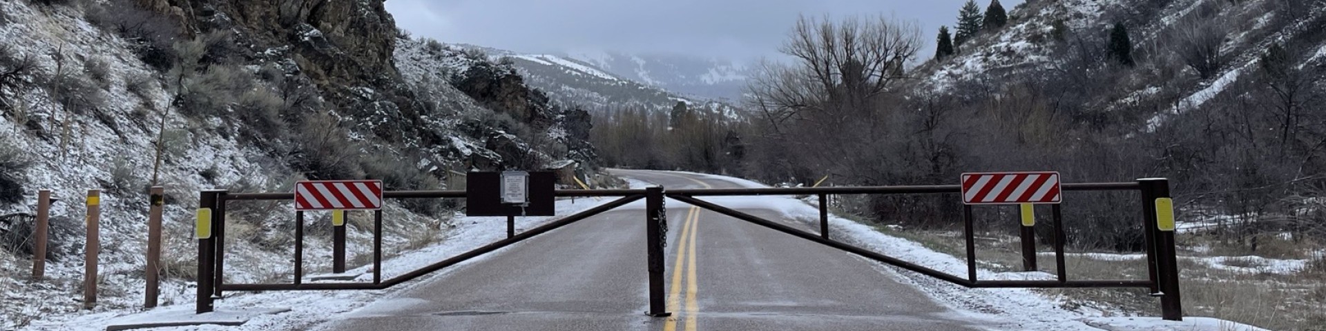
04-15-26-302 Tunnel Fire Closure
The purpose of this Order is to provide public and firefighter safety for the Tunnel Fire. -
04-15-25-304 Soda Springs Area and Road Closure
The purpose of this Order is to protect property during restoration activities. -
04-15-25-301 Road Closure - Soda Springs
Road closed -
04-15-25-219 5 Day Stay Limit Order
To manage high recreation use in the Described Areas, it is prohibited to: Camp within the same 5-mile radius for more than 5 days in any 14 day period from May 1 to Sept. 1 in Described Areas A and B. Camp with in the same 5-mile radius for more than 5 days in any 14 day period year-round in… -
04-15-25-218 Teton Basin-Palisades Dog Closure
Starting each winter, dogs are not allowed on or within 200 yards of groomed ski trails in certain areas of the Caribou-Targhee National Forest. This rule is in place to protect ski trails and winter recreation. See the attached map for specific areas. -
04-15-23-216 - Coffee Pot Stay Limit Order
To manage high levels of recreational use within and near Coffeepot Campground, it is prohibited to camp within the same one-mile radius for more than 5 days in any 14-day period. -
04-15-23-217 - Food Storage Order
To protect public safety and wildlife, it is prohibited to possess or store food or refuse that is not secured in a Forest Service-approved storage method. It is also prohibited to camp within 100 yards of secured food or within ¼ mile of an unsecured animal carcass. -
04-15-23-202 - Wilderness Camping (Grazing)
To protect sensitive Wilderness Lake and basin resources, it is prohibited to: Camp within 200 ft of any lakeshore, or 100 ft of any stream bank. Camp with or graze any pack, saddle or stock areas in described areas. Build or maintain a fire or campfire in described areas. Camping longer than… -
04-15-23-215a - Winter Range Areas (Dubois)
To protect wintering wildlife habitat, natural resources, and minimized user conflicts, it is prohibited to possess or use any type of over-snow vehicles off designated routes in Described Area A. -
04-15-23-215b - Winter Range Areas (Ashton/Island Park)
To protect wintering wildlife habitat, natural resources, and minimized user conflicts, it is prohibited to possess or use any type of over-snow vehicles off designated routes in Described Area A. -
04-15-23-200 Forest 14 Day Stay Limit Order
The purpose of this Order is to reduce displacement of other Forest visitors desiring to utilize a particular area, by reducing the opportunity for one visitor or group of visitors from monopolizing a campsite for long periods of time (in excess of 14 days). It also reduces the environmental… -
04-15-23-215c - Winter Range Areas (Teton Basin)
To protect wintering wildlife habitat, natural resources, and minimized user conflicts, it is prohibited to: Possessing or using any type of over-snow vehicles off designated routes in Described Area A. Going into or being on the Described Area B shown on the attached map between Dec. 15 to April… -
04-15-23-215d - Winter Range Areas (Palisades)
To protect wintering wildlife habitat, natural resources, and minimized user conflicts, it is prohibited to: Possessing or using any type of over-snow vehicles off designated routes in Described Area A. Going into or being on the Described Area Band shown on the attached map between Dec. 15 to… -
04-15-23-214 - Ashton Island Park Ski Trails
For public health and safety, it is prohibited to do the following on groomed ski trails: Allow dogs on described areas and trails. Snowshoeing or pulling sleds. Possessing or using an over-snow vehicle. possessing or using a wheeled motorized or non-motorized vehicle. -
04-15-23-201 - Traffic and Alcohol
For public health and safety, it is prohibited to: Operate a vehicle of NFS roads in violation of state law on the operation of motor vehicles. Operating vehicles carelessly, recklessly, or without regard for the rights or safety of other people. Parking or leaving a vehicle in violation of… -
04-15-23-213 - Targhee Common Loon
These restrictions are necessary to protect wintering wildlife habitat from the disturbance caused by motorized over snow vehicles, to protect natural resources and separate motorized and non-motorized recreation uses to minimize user conflicts. -
04-15-23-203 - Construction Debris Wood Pallets
For public health and safety, it is prohibited to posses or store any materials containing nails, screws, or other metal hardware. This includes wood pallets and construction debris that could be used as firewood. -
04-15-23-204 - Crestline Trailhead Stay Limit
To help manage high levels of recreation near the Crestline Trailhead, it is prohibited to camp within the same 5-mile radius for more than 5 days in any 14-day period. -
04-15-23-207 - South Fork Snake River Restriction
For public health and safety, and to protect natural resources, it is prohibited to boat or camp longer than one day without a portable sanitary device for all human waste. It is also prohibited to camp overnight in the described area without a self-issue permit. -
04-15-23-208 - Big Hole Summer Travel
Having or using any type of bicycle outside of Forest Development roads and trails is prohibited within the described area seen in the attached map. -
04-15-23-209 - Big Springs Area Closure
To protect the waterway and stream bank along the Henry's Fork River and protect critical fish habitat, it is prohibited to enter or be in the water or land around Big Springs. See the attached map for specific locations. -
04-15-23-210 - Grandview Boat Ramp Order
To prevent damage to the boat launch and erosion on the shore of the Henry's Fork River, it is prohibited to launch a boat in the described area outlined in the attached map. -
04-15-23-211 - Sawtell Peak Road Closure
For public health and safety during snow removal activities, Forest Road 024 is closed from the gate at the forest boundary to its end at the Sawtell Federal Aviation Radar Tower from November 1 to June 1, annually. -
04-15-23-212 - Mesa Falls Scenic Walkway
For public safety and protection of vegetation outside of the walkway, it is prohibited to enter or use the described area.