
Discover History
Discover History: Caribou-Targhee National Forest
A Land Shaped by Time
Spanning over 3 million acres across southeastern Idaho, western Wyoming, and a sliver of northern Utah, the Caribou-Targhee National Forest is more than just a natural wonder—it’s a living history book. From ancient Indigenous hunters to weary Oregon Trail pioneers, gold-crazed prospectors, and rugged fur trappers, this land has witnessed millennia of human stories unfold against its dramatic landscapes.
Early Inhabitants: 11,000 Years of Life
Long before it was a national forest, this region was home to Indigenous peoples who arrived around 11,000 years ago, at the tail end of the last Ice Age. Small bands of hunters roamed the area, tracking herds of game like mammoths and bison that thrived in the post-glacial environment. As the climate shifted and big game dwindled, these groups adapted, turning to plant gathering and seasonal migrations. In spring and summer, families moved from winter villages along the upper Snake River into the mountains, following blooming vegetation. By fall, they hunted mountain sheep and other game, descending with the animals to lower winter ranges. The Shoshone-Bannock Tribe, whose ancestral treaty rights still connect them to this land, are among the descendants of these early stewards.
Fur Trappers and the Teton Basin Rendezvous
By the early 19th century, the forest’s rivers and valleys drew fur trappers in search of beaver pelts. Between 1810 and 1840, the Targhee region buzzed with activity. Two legendary trapper rendezvous—rowdy gatherings of mountain men, traders, and Indigenous peoples—took place in the Teton Basin, leaving echoes of a wild, fleeting era. By the 1840s, the beaver population crashed, and the trappers moved on, paving the way for a new wave of travelers.
The Oregon Trail: Pioneers on the Move
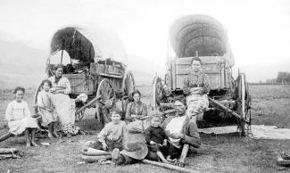
Family on the Oregon Trail around 1850
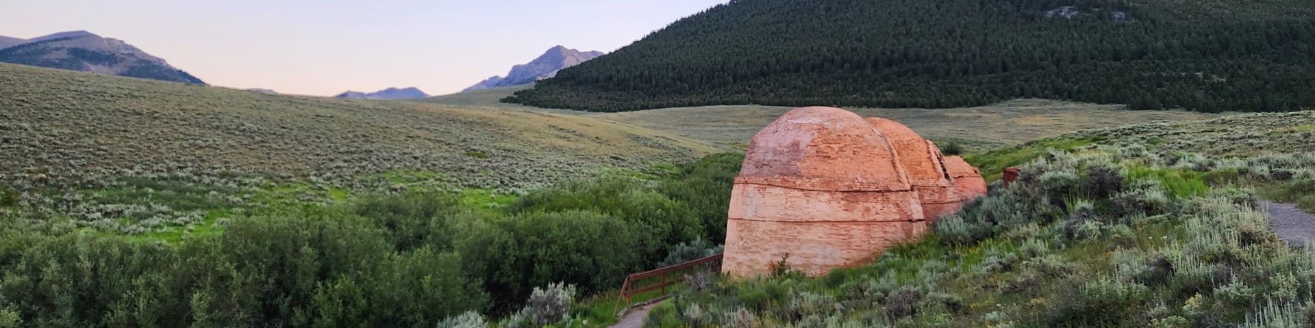
In the 1840s and 1850s, the Caribou-Targhee region became a crossroads for thousands of emigrants bound for Oregon and California. The Oregon Trail, one of America’s great migration routes, skirted the forest’s northern edges near present-day Soda Springs. Seeking fertile farmland and a new life, families in covered wagons braved the rugged terrain, battling scorching summers, early snows, and the constant threat of exhaustion. Soda Springs, with its naturally carbonated waters, became a welcome oasis—a place to rest, repair wagons, and marvel at geysers like Hooper Springs. Some pioneers even split off here, following the Hudspeth Cutoff westward or the California Trail south. Today, traces of their journey linger in wagon ruts and historic markers, a testament to their grit and determination.
Gold Fever and Cariboo Jack
The Caribou half of the forest owes its name to a colorful character: Jesse Fairchild, better known as “Cariboo Jack.” In 1870, this larger-than-life prospector, famed for spinning tall tales of Canada’s Caribou Country, struck gold near what’s now Caribou Mountain. Alongside two partners, he sparked a nearly 20-year gold rush that churned out $50 million in placer gold. Boomtowns like Keenan City (population 900) and Iowa Bar (later Caribou City, population 1,500) sprang up, fueled by dreams of striking it rich. Though the gold eventually ran dry, Cariboo Jack’s legacy endures in the forest’s name and the rugged spirit of those early miners.
A Forest Born: Theodore Roosevelt’s Vision
The modern Caribou-Targhee National Forest took shape in the early 20th century, rooted in America’s conservation movement. President Theodore Roosevelt established the Caribou National Forest in 1907, followed by the Targhee in 1908—named for a Bannock warrior. These forests, originally separate, were carved from lands set aside as early as 1891. In time, they merged into the sprawling Caribou-Targhee we know today, a testament to Roosevelt’s push to protect America’s wild places for future generations.
Rails, Grazing, and a Working Landscape

Cattle grazing in the 1930's.
The forest’s history isn’t just about preservation—it’s a working landscape too. The Oregon Short Line Railroad, completed across Monida Pass in 1880 (now paralleled by Interstate 15), opened the region to settlers and industry, building on the trails blazed by Oregon-bound pioneers. By the early 1900s, grazing became a cornerstone of the forest’s use. Today, permits allow around 22,000 cattle and 91,000 sheep to roam 140 allotments each year, making it some of the best range land in the Intermountain West. Firewood cutting, fence posts, and poles also tie locals to this land, blending history with everyday life.
A Legacy of Wilderness
In 1984, two wilderness areas—Jedediah Smith (123,451 acres) and Winegar Hole (10,721 acres)—were designated within the forest, preserving its untamed heart. Jedediah Smith, hugging the Teton Range, showcases karst limestone caves and stunning views, while Winegar Hole, near Yellowstone, safeguards prime grizzly bear habitat. These areas honor the forest’s ancient roots while ensuring its wild essence endures.
Visit the Past Today
History isn’t just a story here—it’s an experience. Stop by the Carriboo Jack Memorial in Soda Springs, dedicated in 1996, to toast the miner who named a forest. Visit the Soda Springs area to see Oregon Trail ruts and sip from the same bubbling springs that refreshed pioneers. Explore the Mesa Falls Visitor Center at Big Falls Inn, a historic 1915 building, for a window into the area’s natural and cultural past. Or hike the trails where trappers, miners, and Indigenous peoples once walked. The Caribou-Targhee National Forest invites you to step into its history—and discover your own connection to this timeless land.