
About the Area
Exploring the Caribou-Targhee National Forest and Curlew National Grassland
Welcome to a wild corner of the West where rugged mountains meet rolling grasslands! The Caribou-Targhee National Forest and Curlew National Grassland stretch across a stunning patchwork of landscapes, offering endless adventure and natural beauty. From towering peaks to wide-open plains, this area is a playground for hikers, campers, and nature lovers. Let’s dive into what makes this region so special!
Caribou-Targhee National Forest: A Mountain Mosaic
Spanning over 3 million acres, the Caribou-Targhee National Forest sprawls across southeast Idaho, nudging into western Wyoming and northern Utah. It’s a land of contrasts—sagebrush flats in the west climb into the sky-high Teton Range in the east, where peaks like Diamond Peak (12,197 feet!) pierce the clouds. The forest hugs the Greater Yellowstone Ecosystem, cozying up to Yellowstone and Grand Teton National Parks. Picture volcanic calderas like Island Park, carved by eruptions 1.3 million years ago, and rivers like the Henrys Fork cutting through ancient ash. Whether you’re gazing at Mesa Falls’ misty drop or hiking the Jedediah Smith Wilderness, this forest is a feast of forests, meadows, and wild wonders.
Curlew National Grassland: Open Plains, Big Skies
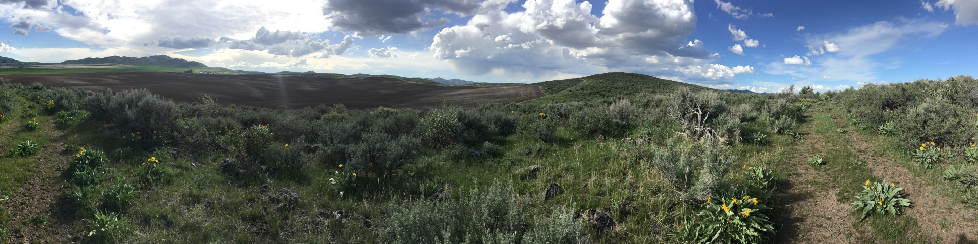
Down south, the Curlew National Grassland rolls out over 47,000 acres in Oneida and Power Counties, Idaho, brushing the Utah border. Born in the 1930s to heal overgrazed soils, this grassland is a sea of sagebrush and native grasses, dotted with the occasional juniper. It’s flatter and drier than the forest’s peaks, sitting at about 4,700 feet, with Stone Reservoir as a shimmering centerpiece. Famous for sage grouse strutting their stuff in spring, it’s a quiet expanse where the horizon stretches forever—perfect for birdwatching or just soaking in the big-sky vibe.
Where They Fit Together
Managed as one by the Forest Service from Idaho Falls, these two areas complement each other like siblings. The Caribou-Targhee’s mountains and forests tower in the north, while Curlew’s grasslands anchor the south, linked by a shared mission to keep the land thriving. Together, they cover a slice of the West that’s as diverse as it gets—volcanic highlands to grassy lowlands, all within a day’s drive. Highways like 20 and 89 tie them to towns like Ashton, Driggs, and Malad, making it easy to jump from pine-shaded trails to sage-scented plains.
Why Visit?
This area’s got it all—over 1,600 miles of trails, campgrounds galore, and views that’ll stop you in your tracks. In Caribou-Targhee, explore limestone caves like Minnetonka or fish for cutthroat trout in legendary streams. In Curlew, watch sharp-tailed grouse dance or camp under a star-packed sky. It’s a place where nature’s history—from ancient eruptions to grassland rebirth—meets today’s adventures.
Getting Here
Fly into Idaho Falls (45 minutes from the forest’s heart) or Jackson, Wyoming (near the Tetons), or Pocatello, Idaho (just over an hour from several key access points), then hit the road. Highway 20 threads through the forest, while Highway 84 skirts Curlew—just watch for seasonal road updates. Whether you’re chasing peaks or plains, the Caribou-Targhee National Forest and Curlew National Grassland are ready to welcome you with open arms—and wide-open spaces!
District Office Locations
Tucked along Highway 20, Ashton (population ~1,000) is a small farming town with big outdoor appeal, serving as the Ashton/Island Park Ranger District’s southern hub. Known as the “Seed Potato Capital of the World,” it’s surrounded by golden fields of spuds, barley, and alfalfa, with the Mesa Falls Scenic Byway kicking off right here. This 28-mile drive winds past Upper and Lower Mesa Falls, where the Henrys Fork plunges over ancient volcanic tuff—a must-see in the Caribou-Targhee National Forest. Ashton’s got a cozy, old-school vibe with a handful of cafes and shops, plus easy access to fishing, camping, and snowmobiling in the forest’s 700,000-acre district. Just north, the forest’s lodgepole pines and aspen groves take over, blending farmland with wild beauty.
Driggs (population ~2,200) sits in the shadow of the Teton Range, hosting the Teton Basin Ranger District office off Highway 33. This artsy mountain town’s got a laid-back feel, with galleries, breweries, and a summer music festival that draws crowds. It’s a stone’s throw from the Jedediah Smith Wilderness, where trails like the Teton Crest offer jaw-dropping views of the Tetons’ western slopes. Surrounded by the Caribou-Targhee’s high country, Driggs is a launchpad for skiing at Grand Targhee Resort, hiking, and biking, with the forest’s limestone peaks and canyons right in its backyard. Population’s growing as remote workers and adventurers move in, but it still feels like a hidden gem.
Dubois (population ~600) anchors the Dubois Ranger District in the forest’s northeast corner, perched at 5,200 feet near the Centennial Mountains. This tiny ranching town along Highway 22 is all about wide-open spaces, with the third-highest peak in Idaho—Diamond Peak (12,197 feet)—looming in the Caribou-Targhee nearby. It’s a quiet spot with a general store, a diner, and a rodeo vibe, perfect for those craving solitude. The surrounding forest offers over 460,000 acres of trails for horseback riding, mountain biking, and skiing, plus campgrounds like Stoddard Creek. The Continental Divide cuts through here, splitting waters between the Atlantic and Pacific—a wild, high-altitude edge of the forest.
Island Park (population ~300) is a small town stretched along Highway 20, part of the Ashton/Island Park Ranger District. Famous for its 36-mile “longest main street in America,” it’s a summer-to-winter hotspot in the Caribou-Targhee National Forest. Big Springs, a first-magnitude spring pumping out 120 million gallons daily, kicks off the Henrys Fork here—great for fishing or floating. With over 60 miles of cross-country ski trails and snowmobile routes, it’s a winter mecca, surrounded by the forest’s volcanic caldera landscape. Cabins dot the area (many are vacation rentals), and the Island Park Caldera’s flat, forested expanse gives it an otherworldly feel, just 20 miles from Yellowstone.
Montpelier (population ~2,600) nestles in Bear Lake Valley, home to the Montpelier Ranger District off Highway 89. This historic town, once a stop on the Oregon Trail, blends pioneer roots with outdoor fun—think the National Oregon/California Trail Center and a charming downtown. It’s a gateway to the Caribou-Targhee’s southern reaches, where the Bear River Range rises with trails like the 55-mile Highline National Recreation Trail, offering gentle ridge walks and killer views. Surrounded by forest meadows and phosphate-rich hills, Montpelier’s a hub for camping, fishing, and grazing lands, with a peaceful vibe that’s pure Idaho.
Pocatello (population ~57,000), hosting the Westside Ranger District office near I-15 and I-86. Dubbed “Poky,” it’s a college town (Idaho State University) with a lively mix of eateries, historic brick buildings, and outdoor gear shops. The forest’s southern edge wraps around here, with sagebrush flats and phosphate mining zones giving way to trails and campgrounds. Nearby, the Portneuf Range offers hiking and biking in the Caribou-Targhee, while the Snake River Plain stretches west. Just south, the Curlew National Grassland unfolds with its open plains—a stark contrast to the forest’s hills. It’s a bustling basecamp for forest adventures, with a small-city feel and easy access to wild lands.
Soda Springs (population ~3,100) sits along Highway 30, home to the Soda Springs Ranger District and a quirky claim to fame: a man-made geyser that shoots 100 feet high every hour. This phosphate mining town has a pioneer past, with trails like the historic Lander Cutoff nearby in the Caribou-Targhee National Forest. The forest’s 360,000-acre district here blends sagebrush with pine, offering cross-country skiing, snowmobiling, and rustic cabin rentals. Soda Springs is a quiet spot with big nature all around.
Idaho Falls (population ~67,000) is the nerve center of the Caribou-Targhee National Forest, hosting the Supervisor’s Office at 1405 Hollipark Drive. Straddling the Snake River, it’s a growing city with a riverwalk, zoo, and bustling downtown—think coffee shops and the Idaho Falls Farmers Market. It’s the forest’s HQ, overseeing 3 million acres from here, with the Palisades Ranger District just east on Ririe Highway. The surrounding Caribou-Targhee includes volcanic plains and the Palisades Reservoir, perfect for boating or fishing, all within an hour’s drive. Idaho Falls blends urban perks with wild access, making it the forest’s beating heart.