South Park Ranger District
ADDRESS:
P.O. Box 219, 320 Hwy 285
Fairplay, CO 80440
Phone (719) 836-2031
Fax (719) 836-3875
Open Monday through Friday 8 a.m. to 4:30 p.m.
Located on the northwest corner of US Highway 285 and Colorado Highway 9, at the only stoplight in Fairplay.
About the Area
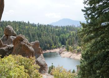
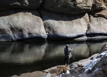
South Park Ranger District includes South Park, part of the Mosquito Range, Eleven Mile Canyon and Jefferson Lake Recreation Areas, and the Tarryall Mountains and Puma Hills.
The district manages 456,599 acres ranging in elevation from 7,100 to 14,285 ft. mostly in Park and Teller counties.
The main highways through the district include Highway 285 south of Kenosha Pass to Trout Creek Pass, and Highway 24 from Florissant, Colorado, to the intersection with Highway 285 at Trout Creek Pass.
Wildlife Seasonal Closure (January through July)
To protect nesting birds of prey, the Forest Service will be implementing annual area closures around the areas of the west side of LaSalle Pass, near the entrance to Elevenmile Canyon, Observatory Rock, and Eagle Rock. The closures comprise all activities in the area including hiking, rock climbing, and drone use. The climbing locations upcanyon from the Riverside Campground in Elevenmile Canyon will remain open year-round. The closures are in effect from January 1st through July 31st annually.
Eagle Rock/Observatory Rock closure order, map
LaSalle/Elevenmile closure order, map A, map B
Bald and golden eagles are sensitive to disturbance from people during their nesting season and excessive disturbance may cause frequent nest abandonment and resulting nest failure. These closures will protect long-established eagle nesting areas, allowing birds to settle into their nest site without human disturbance.
Federal and state law prohibit disturbing any nesting birds of prey. Visitors can help protect wildlife by respecting closures and locations that are signed for other raptor nesting areas. Signs will be posted at key access points into the closed areas.
Personal Use Fuelwood and Transplant Sales
South Park Ranger District now sells fuelwood and transplant permits year-round. First time buyers must come into the office. After your first puchase, you can download and mail-in requests:
Fuelwood order form and fuelwood information
Transplant order form and information:
We encourage people to transplant their trees and shrubs either in the spring before buds begin to open, or in the fall after the plant has gone dormant. This will increase the plant’s chances of survival and reduce the amount of work it takes to keep them alive.
The allowable species to transplant:
SHRUBS: Cinquefoil, Kinnikinick, Buffalo Berry, Woods Rose, Gooseberry and Common Juniper.
TREES: All tree species.
The transplant program provides an excellent opportunity to plant trees and shrubs on your property while adding an aesthetic value to your community. A tree’s chance of survival is greatly increased if its new home is similar to its old home. By digging transplants on the national forest you can stay close to home for your planting stock.
CONDITIONS:
• Permits are non-refundable.
• No machine digging.
• Maximum allowable height is eight feet.
• All holes dug shall be filled in.
• Trees removed must come from the South Park Ranger District.
• Prohibited areas include: Bristlecone Pine Scenic Area, Jefferson Lake Recreation Area, Eleven Mile Canyon, Campgrounds, Picnic Areas, Lost Creek Wilderness, and Buffalo Peaks Wilderness.
Travel Management
Seasonal gate closures are in place for several reasons including protection of big game species and protecting roads from damage during certain times of the year.
Note: Forest Service Road 659 in Beaver Creek and 669 in Crooked Creek are closed to all Off Highway Vehicles including ATV’s, UTV’s, and motorcycles that do not have a state license plate. This closure has been in effect since 2010.
Please refer to Motor Vehicle Travel Maps to determine legal routes. A final record of decision for motorized travel management was signed on Sept. 26, 2022.
Prescribed (RX) Fire on the South Park Ranger District:
The South Park Ranger District regularly post Tweets about our prescribed fires. Follow us on Twitter: @PSICC_NF for updates.
Winter 2022-23 Pile Burn Projects:
Road 98 Thinning: Located about eight miles southwest of Lake George, about a half-mile south of Wagon Tongue subdivision along CR 98. Piles are made up of tops and limbs, as well as smaller boles. The slash is a result of hand thinning and hand piling by Forest Service crews of small conifer regeneration. There are approximately 200 piles.
Lake George East Contract Thinning: Located just east of Lake George adjacent to the Forest Service work center; north of Highway 24, east and south of Trail Creek Road on both sides of Flagstaff Mountain. The piles are small landing piles of the slash and cull material after larger trees were thinned, brought to the landings, and delimbed. There are approximately 250 of these machined piles to be burned.
Vicinity map of 2023 pile burns.
For all pile burns use the Twitter hashtag: #LkGeoRx
What To Expect (Pile Burns):
Before
Detailed burn plans are also prepared for pile burning which are used to guide the implementation of these burns. A GO/NO GO checklist is performed prior to ignition to make sure all requirements to burn are in place before the final decision to burn is made. Piles are burned with snow cover.
During
Piles are typically ignited mid to late morning. Hand piles will burn actively for approximately an hour; the most smoke is produced during this time. Afterwards, crews will go back and “chunk” any unburned material back into the pile to improve consumption. There will be a short burst of higher activity and smoke. The piles will then burn down over the next several hours. The majority of piles will be out by evening or overnight. Smoke production after the first day is very limited to none.
The large “landing” piles will burn actively for several hours and will take longer to burn down then the hand piles described above. Most smoke production will be done by evening, but they may continue to smolder through the night. They typically will take a few days to go out.
After
Burn units will be patrolled daily unless snow covered or out. Conditions will dictate patrol time and duration as well as the number of firefighters and equipment. Piles will be mopped up if needed.
Fall 2023 Broadcast Burn Project locations to be announced:
What To Expect (Broadcast Burns):
Before
Very detailed burn plans are prepared well ahead of time, which are used to guide the implementation of these burns. A GO/NO GO checklist is performed prior to ignition to make sure all requirements to burn are in place before the final decision to burn is made. Weather and fuel conditions are critical to making the decision to burn and can result in last minute cancellations.
During
Actual ignition of the units will take approximately two to five hours depending on conditions and unit size. Typical flames will range from less than a foot to three feet. It is during this time and just after that the most smoke will be produced. A smoke “column” will be highly visible for a long distance away, but especially from Lake George to Woodland Park and Highway 24 corridor. This smoke column will diminish over the hours following ignition, but smoke will be visible till dark. The next day smoke will still be visible from the burn, but much less (if no other units are ignited). Often, a general light haze over the Lake George area will be present the morning after ignition due to overnight inversions. Smoke will diminish each day but may be visible until rain or snow occurs.
Burn units will be patrolled until they are out. Conditions will dictate patrol frequency, time, and duration as well as the number of firefighters and equipment.
After
Most of the area along County Road 61 and 98 have been burned in the past. A large number of smaller trees that carry fires into the tops of large trees and which will also grow into an overly dense future forest were killed in previous Wilson prescribed burns. Lower limbs of the larger trees were killed too which is a natural process to reduce the likelihood of fires moving into the crowns. The dead limbs and needles fall off over several years.
Surface fuels such as the forest duff and down dead are also reduced throughout the burn. Grass and shrubs were regenerated and green up in the spring faster and more robust than adjacent unburned areas.
Prescribed fire smoke may affect your health. For more information, please visit: https://www.colorado.gov/cdphe/wood-smoke-and-health.
Visit our forest's home page for general information about prescribed fire.
For further information regarding prescribed fire in the South Park Ranger District, contact Chris Rokosh at 719-748-8505.