
Visitor Maps and Guides
Whether you "hit the trail" on foot, horseback, or mountain bike, it's a good idea to do a little homework first. One excellent planning tool is a good map. A number of maps of the Chequamegon-Nicolet National Forest are available for free or purchase at the Supervisor’s Office, Ranger Districts, and David R. Obey Northern Great Lakes Visitor Center.
Chequamegon-Nicolet National Forest has different map products available:
- USGS Topographic Maps
- Forest Visitor Maps
- Motor Vehicle Use Maps
- Trail Maps
- GIS Data
Forest Service Digital Maps

Looking for a map to help plan your trip to a national forest or grassland? Click the link below to access free downloadable maps.
Forest Visitor Map

Forest Visitor maps are forest-specific maps that provide forest-wide information on attractions, facilities, services, and opportunities. They are professionally printed with tear and water-resistant paper. Available for purchase in print and digital.
Interactive Visitor Map

We have released the next-generation Interactive Forest Visitor Map! Map 2.0 provides the public with an online and mobile view of Forest Service roads, trails, recreation sites, wilderness areas, and wild and scenic rivers.
Eastern Region Motor Vehicle Use Map (MVUM) Finder
The interactive map below provides links to download Motorized Vehicle Use Maps. Each map is represented by a box indicating its coverage area. Downloads are available in geospatial PDF format or through the Avenza Map Store.
To locate a map to download
- Use the dropdown menus to select a forest or ranger district. After selecting, the map will zoom to your choice.
- Pan and zoom around the map and find the extent of the map you want to download and select it.
- To pan, click/tap and drag around the map.
- To zoom, use your mouse’s scroll wheel, pinch to zoom, or use the +/- buttons on the map.
- Once selected, a popup will display for the map extent. This will contain links to download the map directly or in the map in the Avenza Maps store.
Note: more than one map may be selected when you click or tap an extent. Select/tap the arrows or use the select features menu at the bottom of the popup to toggle between selected extents.
Ordering Maps
On-line Digital Purchases
Topographic Maps and Forest Visitor maps are available from USGS Store
From an Office
Call or visit an office to find the map you need. Credit card sales are accepted over the phone.
Forest Service Digital Maps
The Forest Service National Maps products are created, maintained, and produced by the USDA Forest Service Field Service & Innovation Center - Geospatial Office in Salt Lake City. The Forest Service National Maps are freely distributable and are available for download on the Forest Service National Maps Website.
Interactive Maps and Apps
Avenza
Avenza is a an app and a website where USDA Forest Service makes maps available to the public. Visit their website to download the app or download a map.
Motor Vehicle Use Maps (MVUM)
The MVUMs display the CNNF's designated network of roads and trails for public motor vehicle use. The MVUM is your tool for knowing where you can legally operate your motor vehicle.
More Information and Downloads
Hard copy maps are available by contacting any local Forest Office.
Recreation Area Maps (PDFs)
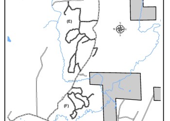
These maps show sections of the forest and include all campgrounds, day use, trails, and autotour stops. Notes have been provided to indicate what is on each map so you can download the right map for what you need. Detailed hunter hiking trail maps are under the Hunter Hiking Trails header below. Other nonmotorized trail maps have been provided when available.
Eagle River/Florence Ranger District
- Nonmotorized Trail, Trail Maps
Lakewood/Laona Ranger District
- Area Maps - show multiple trails, routes, etc.
- Snowmobile Trail Maps
- Nonmotorized Trail, Trail Maps
Medford and Park Falls Ranger District
Washburn Ranger District
Hunter Walking/Hiking Trails (PDFs)
For more information, contact the District Office in the area you plan to visit.
Hunters, hikers and those looking for a great place to go for walk are encouraged to check out the hunter walking trails across the Forest. The Forest manages these trails as linear wildlife openings and they are kept clear for visitors to enjoy. For hunter walking trail maps, click on the Ranger District you would like to explore.
Vicinity Maps of the Hunter Walking Trails


Eagle River/Florence Ranger District
Great Divide Ranger District
Lakewood - Laona Ranger District
Medford and Park Falls Ranger District
Washburn Ranger District
Aspen Age Class Maps (PDFs)
- Eagle River-Florence
- Medford
- Lakewood-Laona
- Park Falls
- Great Divide
- Washburn
Beaver Colony Maps
Aerial beaver colony surveys are conducted annually after leaf drop, in mid to late autumn. Active colonies are noted with a location dot which will place trappers within the vicinity of a colony, but not in an exact location. This survey only includes streams within the National Forest boundary; lakes are not included. Please note that on the Chequamegon land base not all streams are included in the aerial survey, particularly in Taylor County.
Trappers looking for beaver colony locations are encouraged to check out the Beaver Colony Maps across the Forest. The Wisconsin Department of Natural Resources may have additional information on beaver populations outside the National Forest.
Comments or questions regarding maps or the beaver program can be directed to:
Forest Fish and Wildlife Program Manager Tara Anderson
Chequamegon-Nicolet National Forest,
1170 4th Ave South, Park Falls, WI 54552
Phone: 715-762-2461 ext. 5125 or Email: tara.anderson@usda.gov
For more information
Contact the District Office in the area you plan to visit.
Geospatial Data
*Map files are large portable document format (PDF) files and may download slowly. The full map size is 44" x 33." To print a section of the PDF file, use the zoom feature of Adobe Reader to zoom into the area of interest. Next, select File, Print, Current View and Print