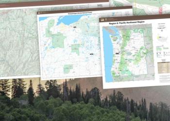
Visitor Maps and Guides
Free, Downloadable Maps
Forest Service Topography Maps

These maps overlay Forest Service assets such as roads, trails, and campgrounds, on USGS's topographic maps. They are available for download by quadrangle.
Geospatial Data

Digital data (GIS) is available at the USDA Forest Service Geodata Clearinghouse.
Current Motor Vehicle Use Maps

MVUMs are a single purpose map developed to display National Forest System routes (roads, trails and areas) designated for motorized travel.
Winom-Frazier OHV Complex and Desolation OHV Trail System

The Winom-Frazier OHV Complex is located on both the North Fork John Day Ranger District of the Umatilla National Forest as well as the La Grande Ranger District of the Wallowa-Whitman National Forest. The Desolation Trail System is located solely on the North Fork John Day Ranger District of the Umatilla National Forest.
Buy Maps and Publications Online
Discover Your Northwest

A nonprofit partner carrying a wide selection of maps, books, guides, and other interpretive products that highlight the Northwest’s natural and cultural history and support educational programs and services on public lands.
US Geological Survey

The national source to find, order, or download topographic maps, including quadrangles or “quads”.
Buy Maps at any Umatilla National Forest Office
Maps can be purchased by contacting us via email, by calling (541) 278-3716, or by visiting us in person at any of our Forest Service offices. Mail in orders are also accepted. View a list of maps available at all Umatilla National Forest offices below.
For mail orders please send a note including the desired map, your return address, and a check or money order for the map purchased to:
Umatilla National Forest
72510 Coyote Road
Pendleton, OR 97801
*Note: Some maps may only be available at the Umatilla National Forest Headquarters office.
Umatilla National Forest | |||
| Title | Scale (inches/mile) | Printing Date | Price |
| Heppner Ranger District | 1" | 2012 | $14 |
| North Fork John Day Ranger District | 1" | 2013 | $14 |
| Pomeroy Ranger District | 1" | 2013 | $14 |
| Wenaha-Tucannon Wilderness | 1" | 2002 | $10 |
| Walla Walla Ranger District | 1" | 2020 | $14 |
| Umatilla National Forest | 1/2" | 2003 | $14 |
Wallowa-Whitman National Forest | |||
| Title | Scale (inches/mile) | Printing Date | Price |
| Baker Ranger District | 1" | 2002 | $6 |
| Eagle Cap Ranger District | 1" | 2002 | $6 |
| Hells Canyon NRA | 1" | 2006 | $14 |
| La Grande Ranger District - East | 1" | 2002 | $6 |
| Pine Ranger District | 1" | 2002 | $6 |
| Unity Ranger District | 1" | 2002 | $6 |
| Wallowa-Whitman National Forest | 1/2" | 2000 | $14 |
| Wallowa Valley Ranger District | 1" | 2004 | $6 |
Malheur National Forest | |||
| Title | Scale (inches/mile) | Printing Date | Price |
| Bear Valley Ranger District | N/A | 1995 | $5 |
| Burns Ranger District - East | N/A | 1995 | $5 |
| Burns Ranger District - West | N/A | 1995 | $5 |
| Long Creek Ranger District | N/A | 1995 | $5 |
| Prairie City Ranger District | N/A | 1995 | $5 |
| Southern Blue Mountains | 1" | 2018 | $14 |
| Steens High Desert Country | 1" | 2014 | $14 |
| Strawberry Mountains | N/A | 2001 | $6 |
Other Areas | |||
| Columbia River Gorge National Scenic Area | 1" | 2007 | $14 |
| Deschutes National Forest | 1" | 2000 | $14 |
| Ochoco National Forest | 1" | 2000 | $14 |
| Snake River Boater's Guide | N/A | 2014 | $14 |


