
Management
Wildland fires are a force of nature that can be nearly as impossible to prevent, and as difficult to control, as hurricanes, tornadoes, and floods.
Wildland fire can be a friend and a foe. In the right place at the right time, wildland fire can create many environmental benefits, such as reducing grass, brush, and trees that can fuel large and severe wildfires and improving wildlife habitat. In the wrong place at the wrong time, wildfires can wreak havoc, threatening lives, homes, communities, and natural and cultural resources.

The Forest Service has been managing wildland fire on National Forests and Grasslands for more than 100 years. But the Forest Service doesn’t – and can’t – do it alone. Instead, the agency works closely with other federal, tribal, state, and local partners.
This is more important than ever because over the last few decades, the wildland fire management environment has profoundly changed. Longer fire seasons; bigger fires and more acres burned on average each year; more extreme fire behavior; and wildfire suppression operations in the wildland urban interface (WUI) have become the norm.
To address these challenges, the Forest Service and its other federal, tribal, state, and local partners have developed and are implementing a National Cohesive Wildland Fire Management Strategy that has three key components: Resilient Landscapes, Fire Adapted Communities, and Safe and Effective Wildfire Response.
Learn how U.S. Forest Service fire managers respond to wildfires on National Forest System lands.
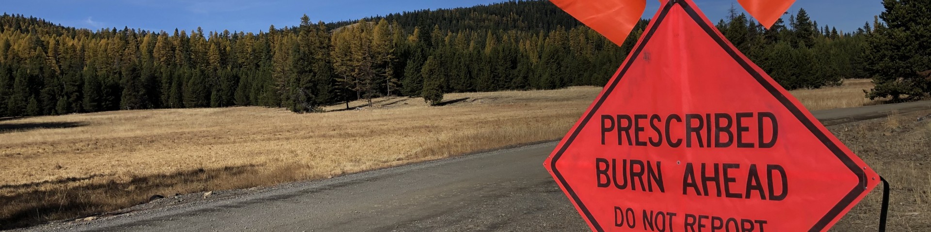
Proposed Prescribed Burning Operations

The Umatilla National Forest is planning and preparing for both the early (typically spring) and late (typically fall) prescribed burning program. Forest visitors and hunters can expect to encounter prescribed burning activities and need to avoid entering or camping near one of the treatment areas.
Check out our interactive prescribed fire information map for more information on active burn units, locations and more! This interactive map allows the user to zoom in on certain areas and click on a burn unit for more information (such as acreage, status, etc.).
Prescribed Fire Status:
- Active - Unit is planned to be burned shortly, is currently being burned, or was burned recently
- Completed - Burn is declared out
- Upcoming - This unit is planned for burning within the next 2 years. Visitors may see fire crews preparing control lines
- Out-year Planning - Identified for prescribed burning in 2-5 years pending completion of other activities
The data represents the recently completed, active, upcoming, and out-year prescribed fire planning for the Umatilla National Forest. All units have been analyzed under the National Environmental Policy Act (NEPA). Burning typically takes place once all other activities described in the project analysis have been completed. Prescribed burning is highly dependent on precise weather and fuel conditions, and managers coordinate with the Oregon Department of Forestry to minimize air quality impacts to local communities.
Why prescribed burn?
Prescribed burns are used to achieve several goals. Most burns are prescribed to reduce the risk of catastrophic wildfire by reducing dead fuel accumulation, rearranging fuel accumulations and effecting the live vegetation in the area.
Research has shown that, in areas where prescribed burning has taken place, wildfires are more likely to stay in the surface fuels, close to the ground, and out of the tree crowns. Previous fuel treatments and prescribed burns on Umatilla National Forest Lands played a significant role in stopping the progress of the 2006 Columbia Complex Wildfire and the 2005 School Wildfire.
Prescribed burning is also used to significantly lower the risks that wildland fires represent to local communities, such as public safety and loss of private property.
Prescribed Fire – What is it? Check out this webinar and learn about prescribed fire as a forest management tool, including anticipated use in the Mill Creek area to reduce wildfire risk. This webinar is a collaborative event brought to you by the OSU and WSU Extension Services, the Umatilla National Forest, the Confederated Tribes of the Umatilla Indian Reservation, the City of Walla Walla, and other partners. https://media.oregonstate.edu/media/t/1_vkch9oge
Positive Benefits for Wildlife
Prescribed fire activities produce many positive benefits for big game animals such as mule deer, Rocky Mountain elk, and whitetailed deer. The absence of frequent low intensity fires in the landscape due to past fire suppression has caused a decline in forage quantity and quality in many areas of the Blue Mountains.
Also, with years of conifer encroachment, browse species such as bitterbrush, mountain mahogany, aspen, choke and bitter cherry, willow and other hardwoods species have declined or are essentially unavailable as forage. These hardwoods are an important source of high-quality forage for deer and elk, especially as they prepare for winter, and again in the spring as they replenish lost body mass from the previous winter.
Prescribed fire invigorates both hardwoods and native grass species, making them more palatable and nutritious for big game species. Prescribed fire conducted on big game winter ranges not only improve forage quality and quantity, but it can help keep deer and elk on public lands for longer periods and away from private lands where conflicts can occur.
When will prescribed burns take place?
Prescribed burning is highly dependent on weather conditions. Conditions have to be within a narrow criteria window in order to use prescribed fire. Wind speed and direction, temperatures, relative humidity, and fuel moistures are all taken into consideration. Fall and spring weather provide the best conditions for prescribed burning: moist soil, dry material and cooler temperatures.
Burning will only take place when and if the conditions are right. The spring prescribed burning program should be completed by the end of June if not earlier.
Why burn in the fall when it impacts hunters?
Fall burning more closely mimics fires when they naturally occur, and the fire effects are more in line with how the native vegetation has adapted to fire. So, from a restoration objective standpoint, late summer and fall is the best fit.
In the spring, we typically do not see natural ignitions (lightning fires) so fire is much less common or widespread. The fire effects on the vegetation are not as typical due to the increased moisture from green up in the spring. Spring burning is usually done to remove activity slash resulting from vegetation management treatments. While burning slash in the spring, the larger logs are much wetter and tend to remain through the burn which is a common objective. On a rare occasion, we may get a window to burn in the spring prior to green up which can be similar to fall conditions, however, access to the burn areas is hampered by snow and the burn windows are typically smaller and fleeting.
What is burned in a prescribed burn?
The burn program includes burning both activity fuels and natural fuels. Activity fuels such as “slash piles” consist of the non-merchantable material remaining after harvest activities. Activity fuel burns also reduce potential fire hazards and prepare the area for reforestation. Removing slash can stimulate plant growth for wildlife winter forage and reduces fuel accumulations. Natural fuels are created by the normal accumulation of dead and down material and can be compounded by insect and disease mortality. Natural fuel burns, or “landscape burns,” are low intensity burns conducted to meet forest management objectives and can take weeks to complete.
How do you conduct a prescribed burn?
Ignition will either be done on the ground by hand crews with drip torches or by aerial release of ping-pong balls, filled with a dark gray, granular substance called potassium permanganate that bursts into flames seconds after being injected with ethylene glycol (anti-freeze). Ping-pong ball ignition is an efficient, cost-effective method for igniting large areas. Ping-pong balls drop through the tree canopy, keeping flames small and close to the ground. Ground crews will monitor burn activities.
What about all the smoke?
All prescribed burning will comply with federal, state, and local air quality and smoke dispersal guidelines to reduce the impacts of smoke on forest visitors and local residents.