
Incident Information
To Report a Wildfire: Call 911
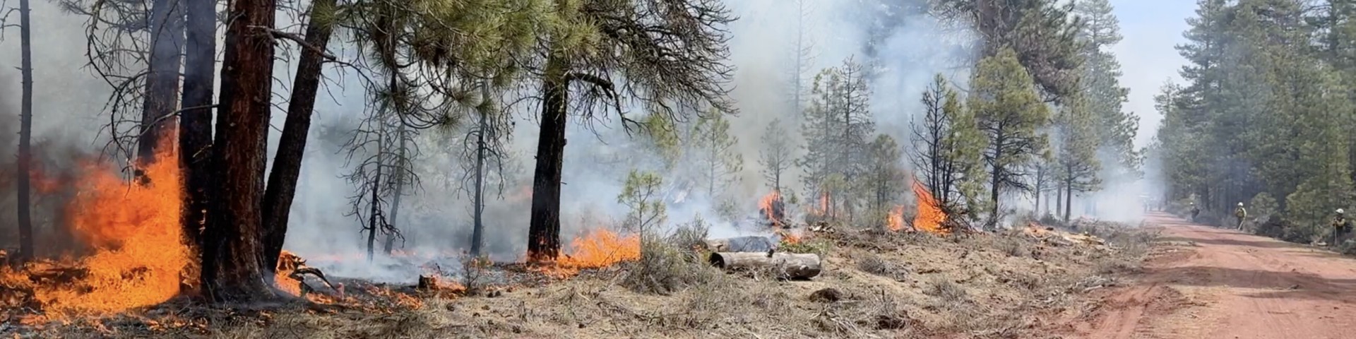
Active Fire Information
Updated July 21, 2026:
Visit the following InciWeb pages for the most up to date fire information.
- Salmon Fire InciWeb - https://inciweb.wildfire.gov/incident-information/orumf-salmon-fire
- Paradise Fire InciWeb - https://inciweb.wildfire.gov/incident-information/orumf-paradise-fire
- Hagen Fire InciWeb - https://inciweb.wildfire.gov/incident-information/orumf-hagen-fire
- Horse Ridge Fire InciWeb - https://inciweb.wildfire.gov/incident-information/orumf-horse-ridge-fire
- Bologna Fire InciWeb - https://inciweb.wildfire.gov/incident-information/orumf-bologna-fire
Fire Restrictions and Safety Information
Updated July 23, 2026
| *Definitions for PURs and IFPLs are included below the table. | ||
Public Use Restrictions (PURs) | Fire Danger Rating | Industrial Fire Precaution Level (IFPL) |
Effective Friday, July 24, 2026: Phase C Public Use Restrictions are in effect.
With tinder dry forest fuels and high daytime temperatures, conditions are prime for potential human-caused forest fires. We ask that you be extremely careful when out on the forest. For more information, view the Phase C Public Use Restrictions poster or view the Forest Order #06-14-00-26-03. | Effective Thursday, July 16, 2026: HIGH Image

| Effective Friday, July 24 at 12:01 a.m., the Umatilla National Forest is at an Industrial Fire Precaution Level (or IFPL) of [2].
|
*Call our Toll-Free Phone Line for Public Use Restrictions and Industrial Fire Precaution Level Updates at 1-877-958-9663.
Table Information:
*Public Use Restrictions prohibit certain activities to minimize the potential for human-caused fires. These restrictions generally apply to recreation activities like building campfires, smoking, off-road travel, the use of internal combustion engines or generators, and recreation-related chainsaw use.
*IFPLs are used by the Forest Service to minimize wildfire risk for commercial and industrial activities, such as timber harvest operations or commercial firewood cutting.
Fire Restrictions
Public Use Restrictions (PURS) are for smoking, off-road travel, internal combustion engines, generators, and chainsaw use. PURS are phased in collectively, as conditions warrant, and may differ from Forest to Forest. The Umatilla has Phase A, B, and C Public Use Restrictions in addition to seasonal fire restrictions.
Under Phase A:
- Use of Chainsaws or other Internal Combustion Engines: Chainsaws may be operated only between the hours of 8 p.m. and 1 p.m. local time. A one-hour fire watch is required after saw operations cease. Saw operators are required to have an axe (minimum 2 lb. head, 26” length), shovel (8” wide, 26” length), and fire extinguisher (minimum ABC 8 oz.) in their possession. Chainsaw operations associated with commercial and personal use firewood permits are regulated under Industrial Fire Precaution Levels (IFPLs) and are not impacted by this public use restriction.
- Generators will only be allowed in an area that has been cleared at least 10 feet in diameter of all flammable material or when factory installed in a recreational vehicle and the exhaust discharge is located in the center of an area at least 10 feet in diameter cleared of all flammable material.
- Traveling Off Developed Forest Roads and Trails is NOT allowed, except for the purpose of going to and from a dispersed campsite located within 300 feet of the open developed road. All motorized travel on roads closed by gates, barricades, berms, rocks, or logs is prohibited.
- No Smoking, except within an enclosed vehicle or building, developed recreation site or while stopped in an area at least 3 feet in diameter that is cleared of all flammable material.
- To reduce the risk of escaped fires the following are recommended for campfires, charcoal briquette fires, wood stoves, portable cook stoves, portable fire pits, and gas stoves:
- Campfires and charcoal briquette fires should be contained in an earthern pit, metal fire ring, or rock ring, with all combustible material removed within a 3 foot radius of the perimeter of the ring, and should be clear of overhanging material. Wood burning stoves should be equipped with a chimney at least 5 feet in length with a spark arresting screen consisting of 1/4-inch mesh hardware cloth. All combustible material should be removed within a 3-foot radius of the perimeter.
- Portable cooking stoves or portable fire pits that use liquefied or bottled gas as a fuel should have all combustible material removed within a 3-foot radius of the perimeter of the stove.
Under Phase B:
- Campfires, Wood Stoves or Briquette Fires are NOT allowed. Liquefied and bottle gas stoves and heaters may be used. Campfires are ONLY allowed in the provided fire pits at designated campgrounds and recreation sites (see table below).
- Use of Chainsaw or other Internal Combustion Engines (other than a motor vehicle) are NOT allowed unless under contract/permit in which case the operator must follow the conditions of the permit. Generators will only be allowed when located in an area that has been cleared at least 10 feet in diameter of all flammable material or when factory installed in a recreational vehicle and the exhaust discharge is located in the center of an area at least 10 feet in diameter cleared of all flammable material.
- Traveling Off Developed Forest Roads and Trails is not allowed, except for the purpose of going to and from a dispersed campsite located within 300 feet of the open developed road. All motorized travel on roads not cleared of standing grass or other flammable material, roads closed by gates, barricades, berms, rocks, or logs is prohibited. Vehicles must be parked in an area that is barren or cleared of all vegetation and flammable material.
- No Smoking, except within an enclosed vehicle or building, developed recreation site or while stopped in an area at least 3 feet in diameter that is barren or cleared of all flammable material.
Under Phase C:
- Campfires, Wood Stoves or Briquette Fires are NOT Allowed. Liquefied and bottle gas stoves and heaters may be used in an area cleared 3 feet of all flammable material.
- Use of Chainsaws or other Internal Combustion Engines (other than a motor vehicle) are NOT allowed. Generators will only be allowed when located in an area that has been cleared at least 10 feet in diameter of all flammable material or when factory installed in a recreational vehicle and the exhaust discharge is located in the center of an area at least 10 feet in diameter cleared of all flammable material.
- No Off Road/Off-Trail Vehicle Travel or travel on roads not cleared of standing grass or other flammable material; No vehicle travel on those Forest Service roads where access has been impeded or blocked by earthen berm, logs, boulders, barrier, barricade or gate, or as otherwise identified in the closure order. Vehicles must be parked in an area within 10 feet of the roadway that is barren or cleared of all flammable material.
- No Smoking. Smoking is allowed only in enclosed vehicles and buildings or cleared areas.
Visit the Alerts page or Blue Mountain Interagency Dispatch Center for more information.
DESIGNATED CAMPGROUNDS AND RECREATION SITES Campfire exemptions are permitted during Phase A and Phase B Public Use Restrictions only. Under Phase C Public Use Restrictions campfires are prohibited forest-wide. | |
North Fork John Day
Walla Walla Ranger District
| Pomeroy Ranger District
Heppner Ranger District
|
IFPL stands for Industrial Fire Precaution Level. It's a system used by the Forest Service to regulate work activities and prevent wildfires by adjusting the level of precaution needed based on fire danger. This system helps control activities like commercial firewood cutting and other industrial operations to minimize the risk of ignition.

IFPL I | Closed Season - Fire precaution requirements are in effect. A Fire Watch/Security is required at this and all higher levels unless otherwise waived. |
IFPL II | Partial Hootowl - The following may operate only between the hours of 8 p.m. and 1 p.m. local time:
|
IFPL III | Partial Shutdown - the following are prohibited except as indicated:
In addition, the following are permitted to operate between the hours of 8 p.m. and 1 p.m. local time:
|
IFPL IV | General Shutdown - All operations are prohibited. |
| NOTE: Where hauling involves transit through more than one shutdown/regulated use area, the precaution level at the woods loading site shall govern the level of haul restriction, unless otherwise prohibited by other than the industrial precaution level system. |
The following actions are prohibited year-round (36 CFR § 261.5):
- Leaving a fire without completely extinguishing it.
- Building, attending, maintaining, or using a campfire without removing all flammable material from around the campfire adequate to prevent its escape.
- Possessing or using an exploding target or any kind of firework or other pyrotechnic device.
- Operating or using any internal or external combustion engine without a spark arresting device that is properly installed, maintained, and in effective working order in accordance with USDA Forest Service Standard 5100-1.
- Firing any tracer bullet or incendiary ammunition.
Additional Resources and Prescribed Fire Information
Inciweb
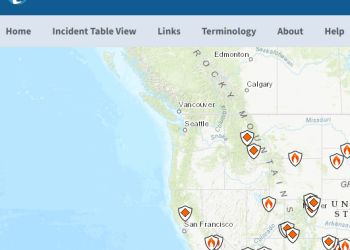
Stay informed about wildfires and natural disasters by visiting InciWeb. Click the button below for real-time updates, safety information, and resources to help you prepare and respond.
Prescribed Fire Information Interactive Map
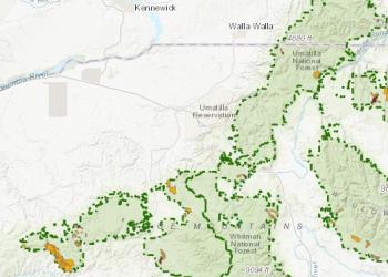
Includes current and planned burns for the Umatilla National Forest.
Drones (Unmanned Aircraft Systems-UAS)

Due to the emergency nature of some incidents, drones (UAS) are not permitted to fly in areas that have Temporary Flight Restrictions (TFR) in place, such as wildlfires. If you fly, we can't!