
Beef T/Copman's Tomb Observation Site
Beef Trail/Copman's Tomb Observation Site sits along the Bighorn Scenic Byway. Stop and see the spectacular valley views.
Copman’s Tomb
The red cliff face to your left flanks Sunlight Mesa. At the top is Elephant Head Rock, so named because of its shape. The triangle-shaped mountain to the right is named Pyramid Peak. To your far right is a prominent rock-topped mountain call Copman’s Tomb. Copman’s Tomb is named after Wolfgang R. Copman, a pioneer who was fascinated by the Canyon’s splendor, and asked that his ashes be scattered over the mountain when he dies.
At the bottom of Shell Canyon, Shell Creek flows as it has for the last million years, continuing to cut through these sedimentary and igneous rocks, deepening the Canyon. Shell Canyon was formed by this gradual process of stream erosion, cutting through layers of limestone, siltstone, shale, dolomite, and granite. The rolling landscape at the base of the cliffs was formed by slumping, the mass movement of soil and rocks from the cliffs into the valley.
Beef Trail
The hillside below the cliffs is managed as a wildlife winter range. Elk and deer in the Bighorn Mountains live at high elevations during the summer, but move down to the lower areas during the winter. The Forest Service helps maintain this winter range by supervising use of domestic sheep and cattle, and by conducting periodic prescribed fires to encourage the growth of essential forage plants.
Look on the hillside for the thin line of the “Beef Trail”, a livestock drive trail. This has been used for many years by domestic cattle and sheep traveling from their winter range in Shell Valley to the summer pastures high in the Bighorn National Forest.
General Information
weather dependent
No Camping, Pack It In, Pack It Out
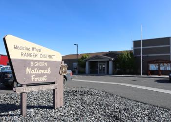
Address: 95 Highway 16/20 Greybull, WY 82426
Phone: (307) 548-5338
Hours: Monday, Thursday, and Friday 8:00 a.m. to 4:30 p.m. (Closed on federal holidays)
Office Email: SM.FS.bighorninfo@usda.gov
Getting There
Latitude / Longitude
Latitude: 44.58014681
Longitude: -107.6737961
Elevation
5,000 feet
Directions
From Greybull, WY, take Hwy 14 east - along the Bighorn Scenic Byway.
Facility and Amenity Information
Restrooms
Restrooms are not available at this site.