
Entrance Portal Interpretive Site
Entrance Portal Interpretive Site sits along the Bighorn Scenic Byway just as you enter the forest.
Syncline Thrust Fault
Across the road is a thrust fault/syncline formation, exposed by the road cut. The fault occurred when pressure caused the rock layers to push up creating the non-conforming layers and downward fold (syncline). The Bighorn Mountains reached their highest elevation about 60 million years ago. Uplift of the area by movement of the Earth’s crust caused this folding.
General Information
weather dependent
No Camping, Pack It In, Pack It Out
No Fees are required for this site.
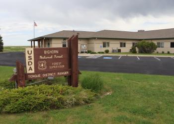
Address: 2013 Eastside 2nd Street Sheridan, WY 82801
Phone: (307) 674-2600
Hours: Monday-Friday, 8:00 a.m. to 4:30 p.m. (Closed on federal holidays)
Office Email: SM.FS.bighorninfo@usda.gov
Getting There
Latitude / Longitude
Latitude: 44.82168157
Longitude: -107.3221022
Elevation
5,550 feet
Directions
From Dayton, take Hwy 14 west for about 5.5 miles to the forest boundary. Pullout is on the right side of the road.
Facility and Amenity Information
Restrooms
Restrooms are not available at this site.
no