
Fallen City Interpretive Site
Fallen City Interpretive Site sits along the Bighorn Scenic Byway.
Fallen City
In the process of uplift which created the Bighorn Mountains, faults and fractures formed in the rocks. The thick layers of limestone in this area were fractured parallel to the valley. When a section of the Earth’s crust sank, huge chunks broke loose from a layer of rock, resulting in the massive boulder field before you. Because of the geometric shapes of the rocks, the boulders can be imagined as the toppled buildings of a “fallen city.”
General Information
weather dependent
No Camping, Pack It In, Pack It Out
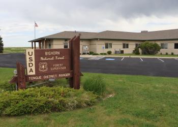
Address: 2013 Eastside 2nd Street Sheridan, WY 82801
Phone: (307) 674-2600
Hours: Monday-Friday, 8:00 a.m. to 4:30 p.m. (Closed on federal holidays)
Office Email: SM.FS.bighorninfo@usda.gov
Getting There
Latitude / Longitude
Latitude: 44.80503038
Longitude: -107.33206987
Elevation
6,600 feet
Directions
From Dayton, take Hwy 14 west for about 9 miles. Pullout is on the left side of the road.
Facility and Amenity Information
Restrooms
Restrooms are not available at this site.
no