
Aerial Detection Survey
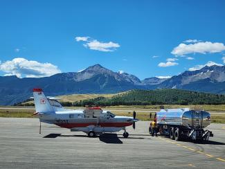
A USFS Kodiak awaits fuel at the Telluride Regional airport.
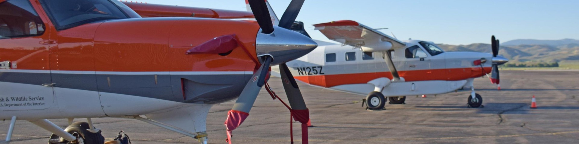
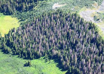
Photo Credit: Brian Howell, USDA Forest ServiceEach year during the summer and early fall, Forest Health Protection and its partners conduct aerial surveys to map forest insect and disease activity in Region 2. Aerial surveys provide an annual snapshot of forest health conditions over large areas more efficiently and economically than other methods. To conduct the survey, observers in small aircraft record areas of activity using a digital aerial sketchmapping system that incorporates a tablet, geographic information systems, and global positioning system technology. Aircraft used for these flights in the Rocky Mountain Region are typically small high-wing planes such as the Cessna T206 or Daher (formerly Quest) Kodiak. Aircraft fly in either a grid pattern over relatively flat terrain or following the contours of the terrain in mountainous or deeply dissected landscapes. The US Forest Service partners with State Cooperating Agencies in conducting the annual survey.
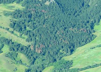
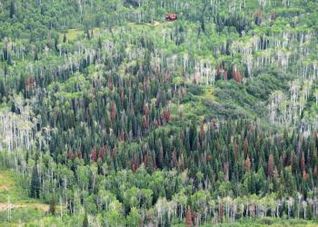
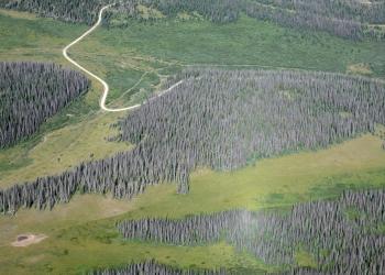
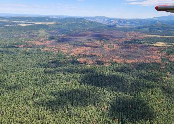
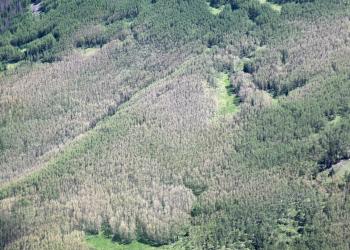
To identify insect and disease activity, the observer looks for characteristic signatures to distinguish the tree species and the type of damage that has occurred. Characteristics that observers use to determine the host tree species include the shape of the tree’s crown, slope position, elevation, and aspect. Variation in the color of the tree’s foliage indicates the presence and type of insect or disease activity. For example, bark beetle activity causes tree mortality which results in foliage color fading from green to a species-specific yellow, red or straw color. In contrast, defoliators remove some of the foliage, resulting in discoloration such as a gray, red, or yellow tinge. During the survey, all of the observed damages are recorded in a digital format which is compiled for use in the production of maps and summary statistics. When unknown signatures are observed, ground checks are conducted to verify the host and damage causing agent.
Aerial Signatures of Forest Damage in the Western US
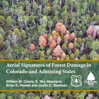
“Aerial Signatures of Forest Damage in Colorado and Adjoining States” is a revision and update of the USDA Forest Service, Forest Health Application and Applied Science Team (FHAAST), publication FHTET-01-06 “Aerial Signatures of Forest Insect and Disease Damage in the Western United States” (Ciesla 2006). This revision focuses on aerial signatures of forest damage in Colorado and other states that comprise the Rocky Mountain Region of the USDA Forest Service (R2). However, since the basic principles of aerial identification of affected host trees and damage patterns addressed in this manual are more or less standard, it also should serve as a reference for aerial forest health survey teams working in portions of the Northern Region (R1), Southwestern Region (R3) and Intermountain Region (R4), as well as portions of California (R5) and eastern Oregon and Washington (R6). The material presented in this publication reflects the experiences of the team of authors since the original aerial signatures manual was published (2006-2014). The authors have more than 75 years of combined experience conducting aerial forest health surveys. Included are refined descriptions of many of the “classic” aerial signatures under both endemic and epidemic conditions, as well as descriptions of additional damage signatures encountered in the Rocky Mountain Region. A discussion of the history and future direction of aerial forest health detection surveys and their unique challenges also is included.
Aerial Survey Images


2024 | 2023 | 2022 | 2021 | 2020 | 2019 | 2018 | 2017 | 2016 | 2015
2014 | 2013 | 2012 | 2011 | 2010 | 2009 | 2008 | 2007 | 2006 | 2005
2004 | 2003 | 2002 | 2001 | 2000 | 1999 | 1998 | 1997 | 1996 | 1995
Aerial Detection Survey Data Disclaimer:
Forest Health Protection (FHP) and its partners strive to maintain an accurate Aerial Detection Survey (ADS) Dataset, but due to the conditions under which the data are collected, FHP and its partners shall not be held responsible for missing or inaccurate data. ADS are not intended to replace more specific information. An accuracy assessment has not been done for this dataset. Please cite "USDA Forest Service, Forest Health Protection and its partners" as the source of this data in maps and publications.
Due to the nature of aerial surveys, the data will only provide rough estimates of location, intensity, and the resulting trend information for the agents detectable from the air. Many of the most destructive diseases are not represented because these agents are not detectable from aerial surveys. The data should only be used as a partial indicator of insect and disease activity, and should be validated on the ground for actual location and causal agent. This data shows locations where tree mortality or defoliation were apparent from the air. Intensity of damage is variable and not all trees within the areas are dead or defoliated
By removing the contents of this package or taking receipt of these files via electronic file-transfer methods, you understand that the data stored on this media are in draft condition. Represented features may not be in an accurate geographic location. The Forest Service makes no expressed or implied warranty, including warranty of merchantability and fitness, with respect to the character, function, or capabilities of the data or their appropriateness for any user's purposes.
Any aerial survey data not downloaded from this website should be considered draft and is not endorsed by Region 2 Forest Health Protection.
The Forest Service reserves the right to correct, update, modify, remove, or replace this geospatial information without notification. Using this data for purposes other than those for which it was intended may yield inaccurate or misleading results.