





Devil's Head Trail #611
Devil's Head Trail #611 begins at the picnic area adjacent to Devil's Head Campground and ends at the meadow area below the Devil’s Head Lookout Tower. The 1.4-mile trail takes approximately 45-90 minutes on a one-way hike to the base of the tower and has an elevation gain of 865 feet from the trailhead. The lookout is at 9,748 feet elevation.
This trail receives heavy use; please practice Leave No Trace principles.
General Information
Devil’s Head Fire Lookout, the last of the four original Front Range Fire Lookout towers still in continuous use, is over 50 years old and is listed on the National Register of Historic Places.
The lookout tower may be open to public visitation when staffed. The tower is typically staffed late May through early September.
May/June through November
The following regulations/restrictions apply:
- Hours for parking and trail use are limited to one hour before sunrise and one hour after sunset.
- No overnight camping and no campfires are allowed.
- Pets must be leashed at all times and are not allowed on the tower stairs or inside the lookout.
- Pack it in; pack it out.
- Practice Leave No Trace principles.
- Stay on the designated trail. Do not cut switchbacks.
Contact Name: South Platte Ranger District Office
Contact Phone: 303-275-5610
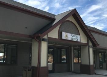
Address: 30403 Kings Valley Drive, Suite 2-115 Conifer, CO 80433
Phone: 303-275-5610
Hours: Monday-Friday, 8:00 a.m. – 4:30 p.m. (Closed on federal holidays)
Getting There
Parking
The main trailhead can fit 25 cars. If that lot is full, DO NOT PARK ON THE SIDES OF THE DIRT ROAD, as this prevents emergency vehicles from accessing the trailhead. The overflow parking lot is signed at the gate for "Devil's Head Campground and Trailhead." The walk from the overflow parking area is approximately 1/2 mile.
Directions
Devil's Head Lookout Trail can be reached by traveling approximately 10 miles west of Sedalia on State Highway 67 to Rampart Range Road. Turn left (south) onto Rampart Range Road (Forest Service Road 300) and continue for approximately 8.5 miles to the trailhead.

