





Weston Pass
Weston Pass road is not maintained for low-clearance vehicles on the Leadville side of the pass, which can be very rough in places with a few steep pitches. This scenic route travels along the south fork of the South Platte River and climbs into a high alpine valley above tree line. Weston Peak can be seen to the north and the Buffalo Peaks Wilderness area to the south.
General Information
For information about the Weston Pass Auto Tour, contact the South Park Ranger District.
Please be respectful of the private land around the pass summit.
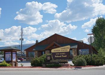
Address: 810 Front Street Leadville, CO 80461
Phone: 719-486-0749
Hours: 8:00 a.m. - 4:30 p.m. (Closed on federal holidays)
Getting There
Elevation
11,921 feet
Directions
From Leadville: Travel south on U.S. Highway 24 for about 6 miles. Turn left on to Lake County Road 7 and travel about 11 miles to the top of the pass.
From Fairplay: Travel south on U.S. Highway 285 for about 5 miles and turn right onto County Road 5. County Road 5 will turn into County Road 22 and travel about 13 miles to the top of the pass.
Facility and Amenity Information
Restrooms
Restroom information is not available for this site.
Water
Potable water is not available at this site.

