-
Payson RD Occupancy and Use Prohibitions
Details below.
Alert Start Date: July 8th, 2024
Alert End Date: June 30th, 2029
Order Number: 03-12-04-24-2
Associated Documents
Forest Order
IMMPLENTATION
This Order shall be in effect from July 3, 2024, at 08 p.m. through June 30, 2029, at 10 p.m., unless rescinded.
PROHIBITIONS
Pursuant to 16 U.S.C. § 551 and 36 C.F.R. § 261.50(a), the following are prohibited on the National Forest System (NFS) lands in the Payson Ranger District, Tonto National Forest, described below and shown on the attached map incorporated into this Order as Exhibits A1-A6 (the "Described Areas"):
- Camping. 36 C.F.R. § 261.58e.
- Possession or use of a vehicle off National Forest System roads. 36 C.F.R. §261.56
This Order shall be in effect from July 3, 2024, at 08 p.m. through June 30, 2029, at 10 p.m., unless rescinded.
EXEMPTIONS
Pursuant to 36 C.F.R. § 261.50(e), the following persons are exempt from this Order:
1. Persons with Forest Service Permit No. FS-7700-48 (Permit for Use of Roads, Trails, or Areas Restricted by Regulation or Order), specifically exempting them from this Order or a written determination by a Forest Service authorized officer that a permit is not required under 36 C.F.R. § 251.50(e)(1) or (2).
2. Any Federal, State, or Local Officer, or member of an organized rescue or firefighting resource in the performance of an official duty.
DESCRIBED AREAS
- Bear Flat - Exhibit A1
The area 200 feet on each side of Tonto Creek beginning at the southern boundary of the Bear Flat private property line and extending approximately .3 miles downstream to the point where Tonto Creek crosses the Hellsgate Wilderness Boundary.
- See Canyon Area - Exhibit A2
The area 200 feet on each side of Christopher Creek, starting at the northern boundary of the Mountain Meadow Subdivision property line and continuing approximately .20 miles north, and ending at approximately 400 feet north of the See Canyon Trailhead (Trail #184).
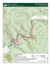
- Flowing springs - Exhibit A3
The area 200 feet on each side of East Verde River, starting on the east side of Highway 87 and following the river upstream approximately 2.4 miles to the southern boundary of the Flowing Springs Estates property.
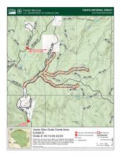
- Verde Glen Dude Creek Area - Exhibit A4
The area 200 feet on each side of the Dry Dude Creek beginning at the East Verde River and continuing in an easterly direction for approximately 1.4 miles, ending at NFSR 1572 and the area 200 feet on each side of the dry creek bed, beginning approximately 250 feet northeast of the intersection of NSFR 1190 and NSFR 64 (Control Road) and continuing in a southeasterly direction up the creek bed to its termination, a distance of approximately 1.3 miles.
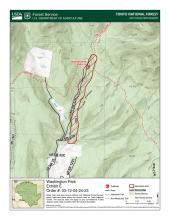
- Washington Park - Exhibit A5
The area 200 feet on each side of the East Verde River beginning at the northern boundary of Rim Trail Mountain Club private property and continuing approximately 1 mile and ending at the intersection of the East Verde River and the Highline Trail (Forest Trail 31).
- Webber Creek - Exhibit A6
The area 200 feet on each side of Webber Creek, beginning at the northeastern boundary of Geronimo Estate private property line, and continuing northwest approximately 2.8 miles to the Camp Geronimo private property line.
PURPOSE
The purpose of the Order is to protect and promote sustainability of sensitive riparian areas and other Forest resources and values while continuing to organize and manage recreational camping and OHV use.
Contact Name:
Payson Ranger StationContact Number:
(928) 474-7900Maps
Images below will open full size in a new window.


