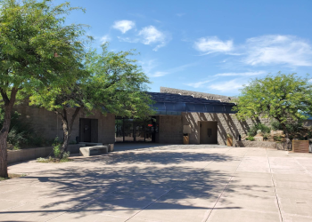
Crabtree Wash Shoreline Area
This site offers shoreline parking and boat access. Access is by the Apache Trail National Forest Scenic Byway, a scenic mountain road. Nearby are views of mountains with abundant wildlife.
General Information
There are no designated campsites at this shoreline area, but camping along the shore is allowed on a first come, first served basis.
High water levels will limit the amount of available shoreline in this area. Current lake level information can be found on SRP's Daily Water Report.
Open Season: Year Round
Quiet hours are 10:00 p.m. until 6:00 a.m.
The links below provide additional information on pricing and purchasing information.
- Tonto Daily Pass (and Watercraft Sticker, if required). Available at Tonto National Forest Offices and retail vendors (please call for availability).
- Tonto Discovery Pass. Available at Tonto National Forest Offices.
- Tonto Fee Machine Pass.
Restrictions
- Stay limit 14 days,
- State Hwy. 88 is a narrow winding mountain road, with a maximum vehicle length limit of 40 feet. (Not recommended for trailers over 22 feet).
- Rules and regulations are posted at all fee station areas. Please read and observe.
- Please use trash receptacles when available, or pack it in pack it out.
Day Use: $8/vehicle/day.
REQUIRED: Tonto Watercraft Sticker: $4/motorized watercraft.
Tonto Fee Machine Pass: $12
Tonto Forest Passes are Honored: $80/annual; $60/senior/access annual.
https://www.fs.usda.gov/detail/tonto/passes-permits/?cid=fseprd518434
Interagency Senior/Access Recreation Passes provide a 50% discount.
https://store.usgs.gov/recreational-passes
Please be prepared to pay with CASH or CHECK.
Address: 28079 N. AZ Highway 188, Roosevelt, AZ 85545
Phone: (602) 225-5395
Hours: Open Mon.-Fri. 8 a.m. - 4:30 p.m. (closed noon to 1:30 p.m.) Passes, permits and products not sold after 4 p.m. Closed Saturday and Sunday (Closed on federal holidays) (Closed on federal holidays)
Getting There
Latitude / Longitude
Latitude: 33.57322245
Longitude: -111.2552927
Elevation
1,900 Feet
Directions
This site is 12 miles south of Roosevelt Dam on the south shoreline of Apache Lake.
From Apache Junction: Drive north on State Hwy. 88 for 32 miles (the last 20 miles of State Hwy. 88 are unpaved) to FR 79. Turn left and continue to site approximately 1 mile.
From Mesa: Take State Hwy. 87/Beeline Highway north for approximately 60 miles to itsjunction with State Hwy. 188. Turn right onto State Hwy. 188 for 33 miles to its junction with State Hwy. 88. Turn right onto State Hwy. 88, and drive past historic Roosevelt Dam (unpaved) for 12 miles to FR 79. Turn right and continue to the site approximately 1 mile.
From the Globe area: Take State Hwy. 188 west for 30 miles to its junction with State Hwy. 188. Turn left onto State Hwy. 88, and continue past historic Roosevelt Dam (unpaved) for 12 miles to FR 79. Turn right and continue to the site approximately 1 mile.
Facility and Amenity Information
Restrooms
Restrooms are available at this site.
Water
Potable water is not available at this site.
Picnic Tables
Picnic tables are not available at this site.


