
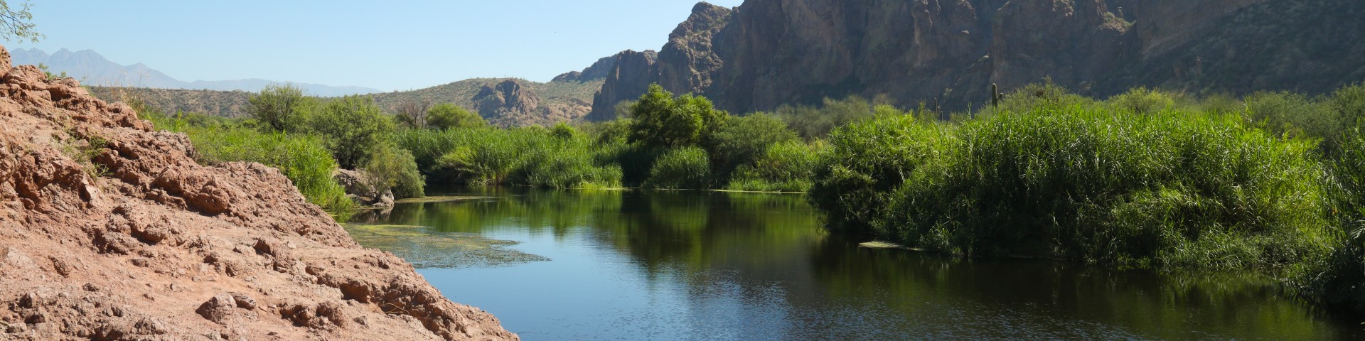
Water Users Day Use Area
Water Users is a popular site for kayakers and tubers. As one of the main points of river access for tubers, Water Users can become very busy during summer months. Beyond water access, Water Users also offers the opportunity to picnic with friends and family, hiking, horseback riding, and bird watching. Motorized boats are not allowed to launch at this site.
There is only one shade ramada with a table & grill. This site is most popular as a launch site; most picnickers choose other recreation sites with additional picnic tables further down stream or they set up their own chairs and wade in the cool water along the shore.
More photos available here.
General Information
Open Season: Year round
Day Use Only; no overnight camping.
Site reaches capacity on busy summer weekends and may be closed when full. Plan ahead and arrive early, and plan for alternative locations if the site is closed.
The links below provide additional information on pricing and purchasing information.
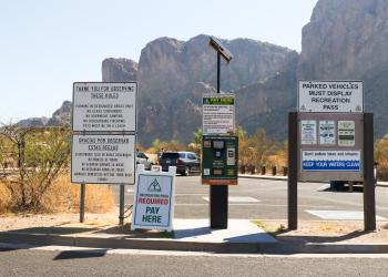
- Tonto Daily Pass (and Watercraft Sticker, if required). Available at Tonto National Forest Offices and retail vendors (please call for availability).
- Tonto Discovery Pass. Available at Tonto National Forest Offices.
- America the Beautiful Interagency Passes. Available at Tonto National Forest Offices and online at USGS.gov.
- Tonto Fee Machine Pass. Nearest locations are as follows: Pebble Beach, Saguaro Del Norte, Palo Verde, and Phon D Sutton.
Restrictions
- Day Use Only. No overnight camping
- Only trailers under 16' allowed. There is no designated trailer parking; do not park across multiple parking spaces or block other vehicles. The preferred method is to "pull through" the diagonal parking if you have a trailer.
- No motorized boats allowed
- Pets must be on leash at all times
- No glass containers in the Lower Salt River area
- To avoid injury wear shoes when wading in the river
- Caution: Fallen trees and other materials in the river can trap swimmers and floaters
- Beware: Alcohol, sun, and water are a deadly combination
Day Use: $8/vehicle/day.
Tonto Fee Machine Pass: $12
Tonto Forest Passes are Honored: $80/annual; $60/senior/access annual.
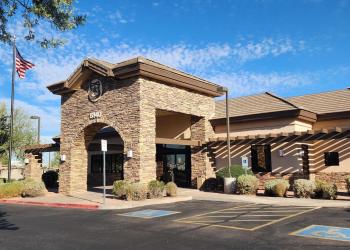
Address: 5140 E Ingram St, Mesa, AZ 85205
Phone: (480) 610-3300
Hours: Open Mon. - Fri. 8 a.m. - 4:30 p.m. (closed noon to 12:30 p.m.) Passes, permits and products not sold after 4 p.m. Closed Saturday and Sunday (Closed on federal holidays)
Getting There
Latitude / Longitude
Latitude: 33.555518
Longitude: -111.543833
Elevation
1,400 Feet
Directions
This site is located 19 miles northeast of Mesa. From Mesa, travel 7 miles east on the Superstition Freeway (US 60) to Power Road /Bush Highway/Forest Road (FR) 204 and turn north. Follow Bush Highway for 11 miles to FR 169, and turn right. Follow FR 169 five miles to the site. The entire route is paved. View and download a map.
Parking
NOTE: This parking lot reaches capacity on busy summer weekends. Plan ahead and arrive early, and plan for alternative parking locations such as Pebble Beach Recreation Site, Sheeps Crossing Recreation Site, or Phon D Sutton Recreation Site. Do not park illegally or park along Bush Highway in No Parking Zones. Illegal parking may be subject to fines and/or towing. Please recreate and drive responsibly.
Facility and Amenity Information
Restrooms
Restrooms are available at this site.
Water
Potable water is not available at this site.
Picnic Tables
Picnic tables are available at this site.