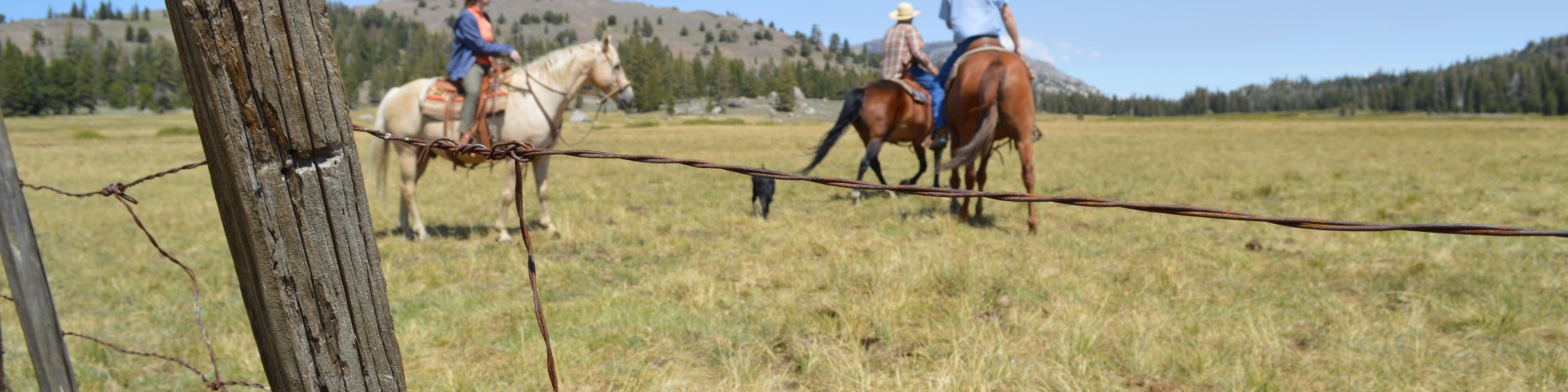
Horse Riding and Camping
Horseback riding is permitted on most national forests. Often, specific trails will be designated for horseback riding, so check the forest website before you hit the trails.
Trail etiquette for multiple use trails calls for horses to have the right-of-way. Hikers should yield to horses. Bicyclists should yield to horses and hikers. Horse riders are responsible for the control of their horse at all times.
Many trails are open to multiple non-motorized uses, meaning the trails are shared by hikers, horse riders, and bicyclists. Information on allowed trail uses is available on trailhead signs and the National Geographic-Trails Illustrated map for the area, or by contacting the nearest Ranger District office.
Pack it in, pack it out
Riders are responsible for:
- Ensuring that their horse has been tested for Equine Infectious Anemia.
- Carrying current written proof of a negative Coggins Test result.
- Providing proof of negative Coggins Test upon request.
Horseback Riding
Riding through a forest’s diverse landscapes, from dense woodlands to open meadows, offers a unique and intimate way to connect with nature and experience the wilderness's tranquility and beauty.
Horse Camping
There are several developed horse campgrounds on the forests. Horses are not permitted in developed areas (campgrounds and picnic areas) unless specifically stated.
Any food storage orders apply to all types of camping, horse camping or otherwise. Secure food away from wildlife.
Wherever you chose to camp, use the Leave No Trace camping style for all activities, including sanitation, food preparation, fires, high lines, etc. Be sure to keep campsites clean for everyone.
Search for Horse Riding and Camping Opportunities
Showing: 41 - 50 of 390 results
Burnside Lake Trail 1
The Burnside Lake 1 Trail is a 1.5 mile long non-motorized trail open to hikers, equestrians, and mountain bikers located near Markleeville, California. This trail starts near Burnside Lake at the…
Burt Canyon
The Burt Canyon Trail is a 11.14 mile long trail out and back trail which provides access into the Hoover Wilderness near Bridgeport, California. The trail follows Little Walker Creek along Burt…
Burt Canyon Trailhead
The Burt Canyon Trailhead is located of the Little Walker River Road west of the Obsidian Campground near Bridgeport, California. This trailhead serves as an access point into the Hoover Wilderness…
Camp Creek Trail
The Camp Creek Trail is a 5.8 mile long non-motorized trail located in the southern portion of the Jarbidge Wilderness near Jarbidge, Nevada. This trail starts on BLM public lands along Camp Creek in…
Camp Draw Trailhead
Camp Draw is a trailhead and horse camp that provides direct access to the Jarbidge Wilderness.
Canu Spur A Trail
The Canu Spur A Trail is a 1.4 mile long motorized trail located on the west side of the Spring Mountains NRA off State Route 160 near Mountain Springs, Nevada. This trail starts on the west at Canu…
Canu Spur B Trail
The Canu Spur B Trail is a 1.1 mile long motorized trail located on the west side of the Spring Mountains NRA off State Route 160 near Mountain Springs, Nevada. This trail starts at its junction with…
Cascade Creek Trail
The Cascade Creek Trail is a 1.38 mile long connector trail that connects the Pacific Crest Trail (22999) and the West Walker River Trail (22046) within the Hoover Wilderness near Bridgeport,…
Catch Pen/Deer Creek Trail
The Catch Pen/Deer Creek Trail is a 10.83 mile long non-motorized loop trail located on the south side of Lee Canyon Road near Las Vegas, Nevada. The trail can be accessed via the Blue Tree Loop…
Cattle Creek Route Trail
The Cattle Creek Route Trail is a 1.71 mile long spur trail off the Horse-Cattle Creek Trail (22076) in the Twin Lakes area near Bridgeport, California. This trail provides access to and is entirely…