
Water, Air and Soil
Watershed Management
The US Forest Service developed a six-step Watershed Condition Framework (WCF) process to evaluate, track, maintain and improve the conditions of all national forest lands on a watershed-scale. The WCF proposes to improve the way the Forest Service approaches watershed restoration by targeting the implementation of integrated suites of activities in those watersheds that have been identified as priorities for restoration.
As part of this national effort, the Inyo National Forest has identified priority watersheds and developed Watershed Restoration Action Plans (WRAPs) for those watersheds. The WRAPs identify essential projects and treatments needed to restore, maintain, or improve watershed condition over a five year period.
Oak Creek Watershed Restoration Action Plan (Oct. 2011)
Deadman Creek Watershed Restoration Action Plan (Oct. 2011)
Restoration Projects
Wild Horse Management
Montgomery Pass Wild Horse Territory
The Montgomery Pass Wild Horse Territory is administered by the Mono Lake Ranger District, Inyo National Forest. This is a jointly managed area that also includes lands under the jurisdiction of the Humboldt-Toiyabe National Forest and the Bureau of Land Management.
Wild horses are protected from harassment under the 1971 Wild Free Roaming Horses and Burros Act. For more information, see the Forest Service’s national Wild Horse and burro website.
Location and Herd History
The Montgomery Pass Wild Horse Territory comprises an area of roughly 200,000 acres in California and Nevada, including 65,942 acres on the Inyo National Forest. The remaining territory acres occur on the Humboldt-Toiyabe National Forest, and Stillwater and Bishop Field Offices of the Bureau of Land Management. It is located east of Mono Lake, in the southern portion of the Excelsior Mountains, approximately 40 miles north of Bishop, California along the Nevada-California state line.
The origin of the Montgomery Pass Herd is unknown, but it is speculated that the herd originated in connection to mustang drives between the Owens Valley and Nevada. In 1972, the population of the territory was documented as 50 horses. There are no wild burros in this wild horse joint management area, and no genetic work has been done on this herd. The herd consists of horses of many colors.
The Montgomery Pass Wild Horse Territory is managed for a wild horse herd size of 138 to 230 animals.
A 2024 census counted approximately 699 horses in the herd, which is 3 to 4 times the appropriate management level (AML) established in 1988, with the majority of them outside the territory. Wild Horses are documented approximately 20 miles outside the establish territory, causing sensitive resource damage and visitor impacts at Mono Lake and other properties.
Resource and Visitor Impacts
Wild horses, when found in areas that are outside their designated territories, can cause conflicts with user groups, safety concerns and negative impacts on natural resources. Wild horse presence in high-use recreation areas such as Navy Beach and South Tufa contribute to negative visitor impacts and unsafe interactions between humans and wild animals. Rangeland, hydrologic and wildlife habitat conditions are deteriorating on Forest Service, Bureau of Land Management, State and private lands outside of the established MPWHT due to horse presence; including trampling and manure damage to international migratory bird nesting areas, tufa formations at Mono Lake, natural springs, wetlands and Bi-state sage grouse habitat.
Public safety concerns include potential collisions of horses with motorists along Highways 6, 120 East, and 395. Vehicle-horse and bicycle-horse collisions have occurred in recent years resulting in injuries to the humans and animals.
Wild horses can be unpredictable and dangerous and should not be confused with a domestic horse or pet. Do not approach a wild horse, attempt to lure it toward you, or feed/bait the animal. Keep pets on leash near wild horses.
PROJECT PAGE: Removal of Wild Horses Outside the Montgomery Pass Wild Horse Territory (MPWHT)
For general questions about the Inyo National Forest's role in wild horse management, contact: SM.FS.InyoWH_B@usda.gov
Wilderness Management
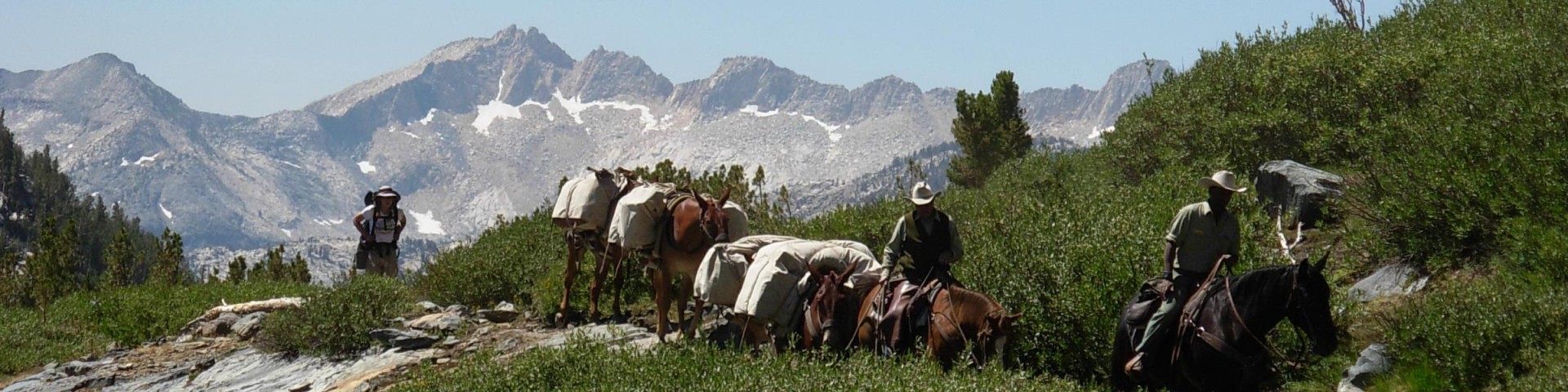
Inyo National Forest is a host to the Pacific Southwest Region's Pack Stock Center of Excellence, which assists in various programs throughout the forest including wildland fire, and trails and wilderness management.
The Center of Excellence concept has been successfully applied to a number of programs throughout the agency. It is generally defined as a team of people (part-time or full time) that promote collaboration and use best practices around a specific focus area to drive business results. A Center of Excellence provides:
- Support for their area of focus through services and subject matter experts.
- Guidance through development of standards, methodologies, tools and knowledge repositories
- Shared learning through training and certifications, skill assessments, and team building.
- Governance through allocating limited resources (money, people, etc.) across all their possible projects to ensure agency investment in the most valuable projects and create economies of scale for their service offering.
Pack Stock Center of Excellence Mission Statement:
Provide regional coordination for the efficient utilization of pack stock program resources to support the efforts of wilderness managers in preserving wilderness character, and to ensure ongoing capability for use of primitive skills and tools, by offering high quality, hands-on pack stock and primitive skills education, practical experience, community outreach, and field-going services in support of fire, ecosystem, and wilderness management.
Burned Area Emergency Response (BAER)
While many wildfires cause minimal damage to the land and pose few threats to the land or people downstream, some fires cause damage that requires special efforts to prevent problems afterwards. Loss of vegetation exposes soil to erosion; water runoff may increase and cause flooding; sediments may also move downstream and damage houses or fill reservoirs putting endangered species and community water supplies at risk.
After a fire, the first priority is emergency stabilization in order to prevent further damage to life, property or natural resources on Forest Service lands. The stabilization work begins before the fire is out and may continue for up to a year. The longer-term rehabilitation effort to repair damage caused by the fire begins after the fire is out and continues for several years. Rehabilitation focuses on the lands unlikely to recover naturally from wildland fire damage.
The Burned Area Emergency Response (BAER) program is designed to address these emergency situations through its key goals of protecting life, property, and critical natural and cultural resources. The objective of the BAER program is to determine the need for and to prescribe and implement emergency treatments on Federal Lands to minimize threats to life or property resulting from the effects of a fire or to stabilize and prevent unacceptable degradation to natural and cultural resources. More information about BAER.