
Epic Adventures
Mendocino National Forest is the only national forest in California not crossed by a paved road or highway. That makes this forest especially attractive to people seeking an outdoor experience of tranquility and solitude.
The forest is a working forest as well as a recreation area, and resource activities such as logging and grazing do occur on both National Forest lands and private holdings within the Forest.
Elevations range from 750 feet in the Grindstone Creek Canyon in the Sacramento Valley foothills on the forest's eastern edge to the 8,092 feet of South Yolla Bolly Mountain in the northern part of the forest. The average elevation is about 4,000 feet.
Berryessa Snow Mountain National Monument

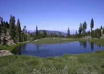
Berryessa Snow Mountain National Monument is managed by the Forest Service and Bureau of Land Management. The monument exhibits some of the most scenic and biologically diverse landscapes in California. These lands are rich with cultural significance and provide important habitat for plants and wildlife; they range from rolling, oak-studded hillsides to steep creek canyons, forests, and ridgelines with expansive views. To the north, Snow Mountain Wilderness provides a unique outdoor experience with forested trails and lush waterfalls. To the south, the Cache Creek and Knoxville areas provide exceptional opportunities for research and recreation.
Snow Mountain Wilderness
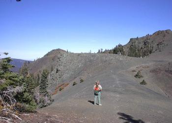
The 60,000-acre Snow Mountain Wilderness straddles the summit of the North Coast Range within Colusa, Glenn and Lake counties. The area is less than a four-hour drive from San Francisco, Santa Rosa, and Sacramento. The central feature of this wilderness is the broad-topped Snow Mountain, which drains water toward the Sacramento River on the east and the Eel River Basin on the west. The wilderness also has the largest known waterfall on the forest. Elevations range from 1,800 feet in the gorge of the Middle Fork of Stony Creek to 7,056 feet on the summit of East Snow Mountain Peak. Good drinking water is scarce during much of the summer. Plan ahead and refill canteens at every opportunity. Mountain streams may look inviting but may not be safe for drinking. Treat all water for drinking and cooking by processing through a portable water filter or boiling over a portable cook stove.
Yolla Bolly-Middle Eel Wilderness
In the Wintun Indian language, "Yo-la" means "snow covered", and "Bo-li" means "high peak." The second part of this Wilderness' name refers to the headwaters of the Middle Fork Eel River, which originates in this remote and rugged land. The Wilderness is roughly oval in shape, being about 19 miles long in the north-south direction and 24 miles wide in the east-west direction. The lowest point of the Wilderness is along Cottonwood Creek (2,600' elevation). This is just four and a half miles from the highest point, Mount Linn, at an elevation of 8,092 feet. Several other peaks push their way above 7,000 feet and provide fine views (weather and smoke permitting) of Mount Lassen, Mount Shasta, the Trinity Alps, the Kings Range and sometimes the Pacific Ocean.
Sanhedrin Wilderness

Elevations in the Wilderness vary from 6,175 feet at Big Signal peak to 1,600 along Thomas Creek. The major creeks in the area drain westward to the Eel River. Soils are moderately to highly erodible, and an unstable fault zone transects the Rocky Point-Ascherman Ranch area. Developed trails do not exist within the Sanhedrin, providing a truly untrammeled Wilderness experience. The only public access point for this area is by the lookout on Big Signal Peak at the end of Forest Road 20N04. From this location, visitors can enjoy off trail hunting, hiking, and camping activities. We recommend that when visiting the area you bring the U.S. Geological Survey (USGS) 7.5-minute topographic maps that cover the region: USGS maps for the Sanhedrin Wilderness include Sanhedrin Mountain, Brushy Mountain, Foster Mountain, and Van Arsdale Reservoir. PDF MAP »
Yuki Wilderness
The 53,887 acre Yuki Wildernes is a rugged land containing steep canyons with long, gentle ridges in between. The Yuki Wilderness ranges in elevation from almost 6,500 feet near Windy Gap in the southeast to roughly 1,150 feet along the Middle Fork Eel River. The area offers a variety of vegetation, including grasslands, chaparral thickets, oak groves and forests of Shasta red fir, white fir, Jeffrey pine, sugar pine, ponderosa pine, Douglas-fir and incense cedar. Six of California's fifteen species of oaks are found within the Yuki Wilderness. During spring you may encounter spectacular wildflower displays. The Middle Fork Eel Wild and Scenic River is home to rainbow trout, and threatened runs of steelhead and Chinook salmon. Many interesting animals call the area home, including bald eagle, pine marten, goshawk, northern spotted owl, prairie falcon, river otter, beaver, tule elk, mountain lion, black bear, porcupine, ringtail, gray fox, badger, golden eagle, blue grouse and pileated woodpecker. PDF MAP »