
Bald Eagle Mountain Trail 650
Enjoy incredible views, fields of wildflowers and glimpses of Pride Basin and Monte Cristo peaks on this 22.5-mile loop that includes the 9.7 Bald Eagle Mountain Trail. Travel along the boundary between the Skykomish and Darrington ranger districts in the Henry M. Jackson Wilderness on a loop linking Quartz Creek Trail 1050 to North Fork Skykomish Trail 1051, that reconnect at the trailheads on Forest Service Road #63.
From Curry Gap via the Quartz Creek Trail, follow switchbacks up to the ridgetop through partially open timber with views of Sloan Peak. Hike up near ridge tops and open meadows most of the way and skirt Bald Eagle, Long John and June mountains. East of June Mountain the trail intersects Pilot Ridge Trail 652 and departs north and downward to Little Blue Lake and Blue Lake in the Darrington Ranger District. Traverse large open slopes as you continue east on Bald Eagle Mountain Trail. In three miles meet the junction at Pacific Crest National Scenic Trail 2000 and North Fork Skykomish Trail 1051 at Dishpan Gap.
Specific Trail Information
Trail Number
Trail Type
General Information
Map: Green Trails #143 (Monte Cristo) /#144 (Benchmark)
Summer
A valid Recreation Pass required at Bald Eagle Trailhead.
Wilderness regulations apply within Henry M. Jackson Wilderness.
- The trail is closed to motorized vehicles and bicycles.
- Party size is limited to 12, people and/or stock combined.
- Camp in established campsites.
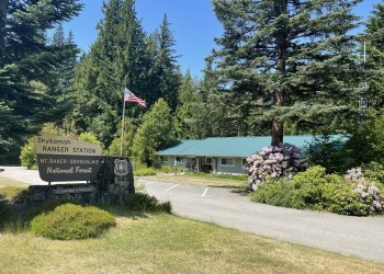
Address: 74920 NE Stevens Pass Hwy Skykomish, WA 98288
Phone: (360) 677-2414
Hours: Open Wed-Fri 9 a.m.- 12:00 p.m. and 1:00 p.m. - 4:00 p.m. (Closed on federal holidays)
Getting There
Directions
Drive US Highway 2 to just west of milepost 50 (located between the town of Skykomish and the Skykomish Ranger Station). Turn north onto Beckler Road #65, toward Beckler River Campground. From US Highway 2 on FS Road #65, drive 15 miles. Turn right on FS Road #63. Continue 4.2 miles to West Cady Trailhead. Quartz Creek #1050 starts on the north side of the parking lot. Follow Trail #1050 to the junction with Bald Eagle Mountain Trail #650 at Curry Gap (4.4 miles).
See also: Bald Eagle Trailhead.
Additional Information
Operated By
US Forest Service