

Piney Creek Wilderness
The United States Congress designated the Piney Creek Wilderness in 1980 and it now has a total of 8,178 acres. This wilderness is nestled on the west side of Table Rock Lake.
Wilderness Area History
Railroad companies were the principal loggers in this area in the late 1800’s, followed by settlers on the ridges who happily discovered that tomatoes and strawberries grew large and juicy here. Nonetheless, in the early 1950’s residents abandoned the last permanent households in the vicinity of Piney Creek.
Terrain and Topography
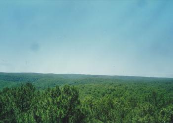
The ridgetops rise 400 or more feet above hollows and drainages that dissect the area. Numerous small springs feed several waterways, but the main stream is Piney Creek which drains to scenic Table Rock Lake in the heart of the Wilderness. All five miles of the Piney Creek watershed lie within the Wilderness.
Trails
There are 12.1 miles of trail.
Wilderness Environment
Shortleaf pine, oak, and hickory dominate the ridges today, and along the drainages you’ll find hardwoods such as sycamore, ash, elm buckeye, and walnut. Wildlife species are typical of the Ozarks, and armadillos also live here. Copperheads, eastern timber rattlers, and western pygmy rattlers are common. Great blue herons and pileated woodpeckers add to the local color.
Maps
Quadrangle maps for this wilderness are: Piney Creek Wilderness is located on the Shell Knob and Cape Fair quadrangle maps.
They are available for sale at Forest Service Offices or on the USGS Website.
Active Alerts
General Information
The Ozark climate is mild enough to make Wilderness visits feasible throughout the year, as long as visitors bring proper gear. When possible, take advantage of this opportunity and plan your 'visit outside the peak spring and fall use seasons.
Private Property – Piney Creek Wilderness is surrounded by private property. Please respect the rights and property of private landowners.
Safety Information
Wilderness has inherent dangers, and is a primitive setting where you meet nature on its own terms.
- Bring a map and compass, and first aid kit.
- During temperate months, be prepared for biting insects, poison ivy and high temperatures.
- Be advised of hunting seasons.
- Avoid using the trail during excessively wet periods.
- Be sure to tell someone your plans,
- don’t hike the wilderness alone and
- carry extra supplies so you are prepared to take care of yourself in case you get lost, injured, or delayed.
- The universal distress signal is three of anything: shots, shouts, smokes, whistles.
- Be prepared to sanitize water for drinking
For more safety tips visit the Safety section of the website.
Camping
There are self-registration stations at each wilderness trailhead entrance. Overnight and day use visitors are requested to register.
Protect the solitude; seek out campsites in the Wilderness that are out of sight and sound of trails and other camps. When sharing an area keep a low profile and maintain the solitude.
Pine View Tower Trailhead
There are 3 primitive campsites with picnic tables and fire rings.
Wilderness Camping
Dispersed camping is the term used for free camping anywhere in the National Forest OUTSIDE of a designated campground.
Dispersed camping means there are no toilets, no structures, no trash cans, no treated water, and no fire grates.
There are extra responsibilities required for this type of camp. It's a must to educate yourself before you try it, but we hope the adventure of dispersed camping in the Mark Twain National Forest calls to you!
Commercial use will not be permitted. Special uses will not be permitted, except for access to surrounded private property.
Wilderness
- Limit your party size to 10 persons;
- no camping within 100 feet of trails, water sources and other camps.
- Terrain is sometimes steep.
- No motorized or mechanized equipment allowed.
- Practice Leave No Trace outdoor ethics;
- Never tie stock directly to trees.
- Commercial use will not be permitted.
- Special uses will not be permitted, except for access to surrounded private property.
- Pack out all of your trash
Trailheads
- No trash containers; please pack out all your trash.
- Dogs on leash
- No fireworks
No fees at any traiheads
Trail Use
Dogs are allowed on hiking trails, as long as they are kept on a leash. Unleashed dogs can pose a danger to your pet, the natural resources of the area, and other forest visitors.
- Leashes must be six feet, or shorter, when in developed recreation sites, including trails within the boundaries (36 CFR 261.16(j)) when they are not inside an enclosed vehicle or tent.
- Yield your leashed dog around other hikers and horses.
- Pack out your dogs waste or bury it 100 feet from water and trails.
Camping
- Keep dogs on a six-foot, or shorter, leash when they are not inside a tent.
- Store dog food in bear-resistant containers and feed your pet away from the campsite.
- Pick up and bag your dog’s waste. Place it in a provided trash receptacle or pack it out.
- Do not leave your dog unattended at any time.
- Do not leave your dog in the vehicle on a hot day.
- Keep your dog in your tent or vehicle at night.
- Ensure that there is ample water available for your pet.
Wildlife
- Do not allow them to interact with wildlife

Address: 1006 S. Jefferson Ava, MO 65608
Phone: 417-683-4428
Hours: 8:00 am - 4:30 pm, Monday to Friday; District Offices closed 1 - 1:30 for lunch (Closed on federal holidays)
Office Email: sm.fs.marktwainnf@usda.gov
Getting There
Directions
Pine View Lookout Tower
From Shell Knob
- Go north on 39 Highway to the junction of 76 Highway
- Turn right onto 76 Highway.
- Turn right on Lake Road 76-6, go about a mile and turn right into the entrance.
From Branson
- located 32 miles west on Hwy 76 from Branson, MO.
- Turn left on Lake Road 76-6, go about a mile and turn right into the entrance.
South Piney Trailhead
From Shell Knob
- Take Highway 39 for 1 mile north.
- Turn right onto Lake Road 39-1/Forest Road 2185
- Travel for four miles to the South Piney Trailhead.
From Branson
- located 36 miles west on Hwy 76,
- turn left onto Hwy 39 at Hill City, and go 1 mile to Lake Road 39 1,
- then go 4 miles further to South Trailhead.
Parking
- Pine View Tower: 8 vehicles
- South Piney: 3 vehicles
Facility and Amenity Information
Accessibility
Restrooms
Restrooms are not available at this site.
There is a restroom available at Pine View Tower Trailhead
Water
Potable water is not available at this site.
Drinking water is not available in Piney Creek Wilderness, open water sources within the wilderness are not recommended for drinking. Bring your own drinking water or be prepared to boil or treat water chemically.
Recreation Opportunities
Day Hikes Info
Visiting the Wilderness is a primitive experience: trails are not well marked, and there are no bridges crossing streams.
Be aware of natural hazards that may occur within the Wilderness, and take precaution to maintain your safety.
We recommend you download a digital map or obtain a print map before heading into the wilderness.
About the Trail
There are 12.1 miles of wilderness trail. Portions of the trail system utilize old roads. The use of maps and compass are recommended. There is one full loop trail going north-south, with a second trail that goes through the middle, heading east-west.
The major east-west 4.6 mile trail follows Piney Creek. There is no trailhead for this section, you can access it from either the trail from the Pine View Tower Trailhead or the trail from the Piney Creek Trailhead. You’ll be going in and out of the creek drainage, and along the creek at points. If you’re coming in from the north or south you are going downhill into the creek drainage.
From Pine View Tower Trailhead on the north, two paths of approximately 1.5 miles each, for a total of 3.8 miles, leads south to Piney Creek. This section is mostly up on ridgetops until you get near the creek, then you hike downhill into the creek drainage.
From the South Piney Trailhead a 3.7 mile loop trail goes north towards the creek. On the western side of the loop you’ll be up on a ridgeline for a while before dropping down into a hollow that leads you to Piney Creek. On the eastern side of the loop you’ll follow ridgetops the entire way to Piney Creek.
Backpacking Info
Visiting the Wilderness is a primitive experience: trails are not well marked, and there are no bridges crossing streams.
Be aware of natural hazards that may occur within the Wilderness, and take precaution to maintain your safety.
We recommend you download a digital map or obtain a print map before heading into the wilderness.
About the Trail
There are 12.1 miles of wilderness trail. Portions of the trail system utilize old roads. The use of maps and compass are recommended. There is one full loop trail going north-south, with a second trail that goes through the middle, heading east-west.
The major east-west 4.6 mile trail follows Piney Creek. There is no trailhead for this section, you can access it from either the trail from the Pine View Tower Trailhead or the trail from the Piney Creek Trailhead. You’ll be going in and out of the creek drainage, and along the creek at points. If you’re coming in from the north or south you are going downhill into the creek drainage.
From Pine View Tower Trailhead on the north, two paths of approximately 1.5 miles each, for a total of 3.8 miles, leads south to Piney Creek. This section is mostly up on ridgetops until you get near the creek, then you hike downhill into the creek drainage.
From the South Piney Trailhead a 3.7 mile loop trail goes north towards the creek. On the western side of the loop you’ll be up on a ridgeline for a while before dropping down into a hollow that leads you to Piney Creek. On the eastern side of the loop you’ll follow ridgetops the entire way to Piney Creek.
Horseback Riding Info
Visiting the Wilderness is a primitive experience: trails are not well marked, and there are no bridges crossing streams.
Be aware of natural hazards that may occur within the Wilderness, and take precaution to maintain your safety.
We recommend you download a digital map or obtain a print map before heading into the wilderness.
When Visiting with Horses
- Don't tie saddle and pack stock to small trees as the rope rubbing and concentrated animal trampling will injure and eventually kill the vegetation. It's better to hobble or tie a rope between two large trees and use it as a hitch rail. When breaking camp, scatter manure and smooth up the area.
- Avoid prolonged stock grazing in one area; it can have a serious impact on vegetation. Bring concentrated supplement stock feed to help reduce this impact.
- Picket your stock at least 200 feet away from waterways trails, or camps. Avoid using the trail during excessively wet periods.
About the Trail
There are 12.1 miles of wilderness trail. Portions of the trail system utilize old roads. The use of maps and compass are recommended. There is one full loop trail going north-south, with a second trail that goes through the middle, heading east-west.
The major east-west 4.6 mile trail follows Piney Creek. There is no trailhead for this section, you can access it from either the trail from the Pine View Tower Trailhead or the trail from the Piney Creek Trailhead. You’ll be going in and out of the creek drainage, and along the creek at points. If you’re coming in from the north or south you are going downhill into the creek drainage.
From Pine View Tower Trailhead on the north, two paths of approximately 1.5 miles each, for a total of 3.8 miles, leads south to Piney Creek. This section is mostly up on ridgetops until you get near the creek, then you hike downhill into the creek drainage.
From the South Piney Trailhead a 3.7 mile loop trail goes north towards the creek. On the western side of the loop you’ll be up on a ridgeline for a while before dropping down into a hollow that leads you to Piney Creek. On the eastern side of the loop you’ll follow ridgetops the entire way to Piney Creek.
Recreation Groups
The United States Congress designated the Piney Creek Wilderness in 1980 and it now has a total of 8,178 acres.