
North Country National Scenic Trail
The 4,800-mile North Country National Scenic Trail takes visitors across federal, state, county and private land. Upon completion the trail will extend from Crown Point, New York to Lake Sakakawea, North Dakota. It will be the longest, continuous hiking trail in the United States.
The NCNST is marked with blue rectangle-shaped blazes. Connector trails are marked with white rectangle blazes on trees. For information on the NCNST visit the National Park Service website or North Country Trail Association website. For the Superior Hiking Trail visit the Superior Hiking Trail Association website.
North Country Trail Through the Superior National Forest
There are three sections of trail on the Superior. The Kekekabic Trail, Border Route Trail, and Superior Hiking Trail.
Kekekabic Trail
The 38.6-mile trail will take hikers through a mix of boreal forest. The trail features numerous rock outcrops while you hike past several lakes and wetlands. The trail will take you cross countless beaver ponds and through rugged wilderness. Hikers can stop and enjoy the Mueller Falls, evidence of historic iron mining near Mine Lake, and enjoy camping near Bingshick Lake. This hike is perfect for experienced hikers who want to test their wayfinding skills. Be prepared to get your feet wet in some locations as you cross boggy areas, but it’s worth it for the views at the top of several summits.
This section DOES take you through the Boundary Waters Canoe Area Wilderness.
Border Route Trail - Magnetic Rock and Gunflint Overlook Hike
Along the way, you’ll pass by Magnetic Rock a very interesting geologic feature - be sure to take out your compass near it. The trail also traverses the Cross River at Gunflint Lake, winds through the Gunflint Cross-Country Ski Trail system, and then climbs up to the Gunflint High Cliffs.
This section DOES NOT take you through the Boundary Waters Canoe Area Wilderness.
Border Route Trail - Rose Lake Cliffs Loop
The loop includes a combination of the Caribou Rock Trail, Border Route Trail / NCT, South Lake Trail, and Moss Lake Trail. It can be hiked as an overnight hike or a long, strenuous day hike. Along the way, you’ll hike the rugged Caribou Rock Trail with its many ups and downs, pass by Stairway Portage and Stairway Falls, and the Rose Lake Cliffs are nearby off the Border Route Trail.
This section DOES take you through the Boundary Waters Canoe Area Wilderness.
Superior Hiking Trail - Lutsen to Caribou Trail
Hike the Superior Hiking Trail / NCT through the Superior National Forest. Along the way you hike stretches paralleling the Poplar River while enjoying the beautiful Lake Agnes area and vistas of Poplar River Valley. Take the spur trail to White Sky Rock featuring amazing views of Caribou Lake before reaching the CR-4 trailhead.
This section DOES NOT take you through the Boundary Waters Canoe Area Wilderness.
Superior Hiking Trail - Britton Peak Trailhead to Temperance
Hike the Superior Hiking Trail / NCT through scenic Superior National Forest and Temperance River State Park. Along the way you hike over Carlton Peak enjoying sweeping views out onto Lake Superior and along the gorge of the Temperance River as it carves its way down to Lake Superior.
This section DOES NOT take you through the Boundary Waters Canoe Area Wilderness.
Camping and Campfires
Camping
In all sections you can dispersed camp along the trail, please consider using designated sites where available.
- Camping is permitted anywhere along the trail, as long as the campsite is 150 feet from the trail, lake, stream, portages, or other campsites.
- You may not leave your camping equipment unattended for more than 24 hours.
- Do not construct any “improvements” at your camp, including trenches.
Campfires
- Be aware of fire restrictions that apply to campfires outside of developed campsites. In dry conditions, campfires may be banned in the general forest, but still allowed in campgrounds.
- You may not cut live trees.
- Use a camp stove, or disperse all signs of a campfire if you use one.
- Do not leave a rock ring.
Trailheads
- Parking motor vehicles or trailers is not allowed where it will impede traffic, harm vegetation, or harm soils.
Boundary Waters Canoe Area Wilderness
A permit is required when hiking or camping in the Boundary Waters Canoe Area Wilderness.
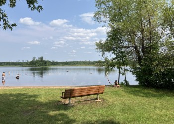
Lakes Along the Trail
There are several lakes along the trail, including:
- Shagawa Lake
- Fall Lake
- Garden Lake
- Pea Soup Lake
- Rookie Lake
- Tofte Lake
- Refuge Pond
- Section Twelve Lake
- Snowbank Lake (via spur trail)
- Parent Lake
- Becoosin and Benzie Lakes (via spur trail loop)
- Disappointment Lake
- Medas Lake
- Moiyaka Lake
- Mosquito Lake
- Loki Lake
- Agamock Lake
- Gabimichigami Lake
- Howard Lake
- Fay Lake
- Bingshick Lake
- Mine Lake
- Gunflint Lake
- Loon Lake (via spur loop)
- Topper Lake
- Mucker Lake
- Partridge Lake
- Duncan Lake
- Daniels Lake
- Rose Lake
- Clearwater Lake
- Gogebic Lake
- West Pike Lake
- Pine Lake
- East Pike Lake
- John Lake
- McFarland Lake
- South Fowl Lake
- Lake Agnes
Fall Lake Campground is located on the shores of Fall Lake and provides direct access into the Boundary Waters Canoe Area Wilderness.

Tofte Lake is 155 acres in size and reaches a depth of 70 feet. There are 4 back country campsites and a boat ramp on the lake.
Gunflint Lake is a 4,009 acre lake that is half in the US and half in Canada.
Loon Lake is a 1,095-acre lake with 14 miles of shoreline and a maximum depth of 202 feet.
Pine Lake, in Cook County, is a 98 acre lake with 3 miles of shoreline and a maximum depth of 34 feet.
South Fowl Lake is a large, 1,586-acre lake with 18.5 miles of shoreline that straddles the United States and Canada.