
Byron Glacier Trail
Extremely large cornices overhang Byron Glacier Valley. It is wise to avoid this area until the snow has avalanched. Snow and avalanche danger can persist into the summer months.
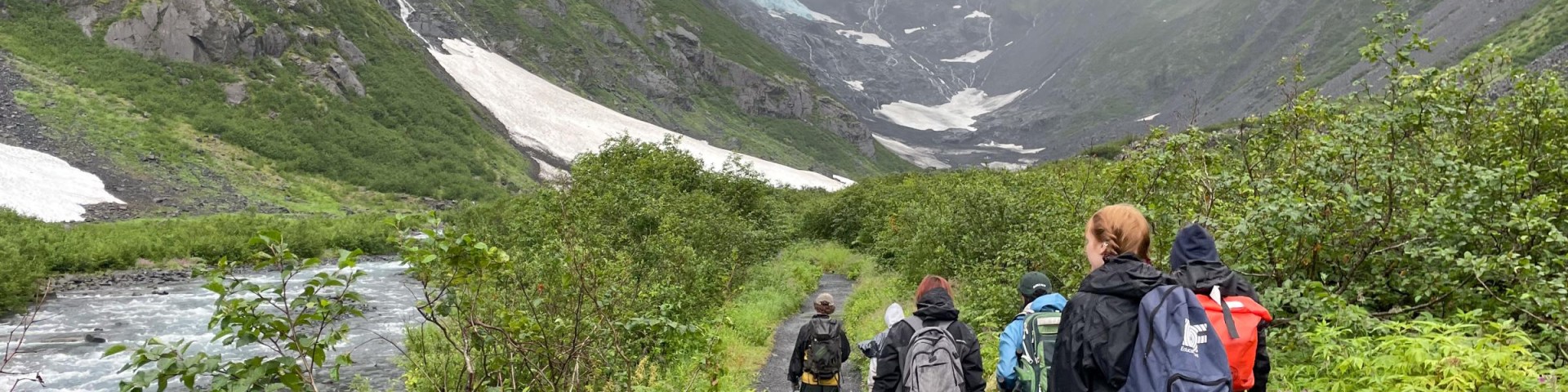
This 1.4 mile trail offers an easy walk for all ages. It allows a close-up view of a glacier with rugged, mountains in all directions.
A good family outing with a variety of things to do for the whole family.
The alder/cottonwood forest is lush with ferns for a serene beginning to the hike. Byron Creek is a cascading, whitewater, glacial creek.
Specific Trail Information
Trail Number
Trail Type
General Information
USGS Map: Seward D5
Trip Time (one way): 30 minutes
Difficulty: Easy
Public Use: Heavy
Recommended Season: Mid June-October
Length (one way): 1.4 mile
Elevation Gain: 100 feet
Location: At mile 79, Seward Highway (49 miles south of Anchorage), turn onto Portage Glacier Road. Travel 5 miles, turn on Portage Lake Loop Road and follow the signs to the trailhead parking lot, located approximately 1 mile from the Begich, Boggs Visitor Center via the Byron Glacier Road
Getting There
Directions
At mile 79, Seward Highway (49 miles south of Anchorage), turn onto Portage Glacier Road. Travel 5 miles, turn on Portage Lake Loop Road and follow the signs to the trailhead parking lot, located approximately 1 mile from the Begich, Boggs Visitor Center via the Byron Glacier Road.
Visit the nearest office for more information.
Office Page Here