Recreation
Select the district you plan to visit:
You can learn more by viewing our Recreation Opportunity Guides as well.
Make reservations at Recreation.gov.
Leave No Trace
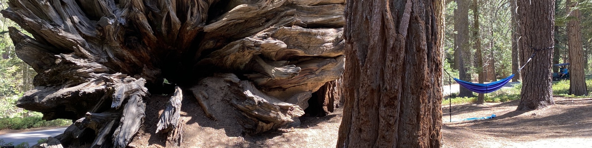
Remember to "Leave No Trace" when visiting the Forest so everyone can enjoy its scenic beauty for years to come!
Current Recreation Conditions
| Area Name | Status | Area Conditions |
|---|---|---|
| Alaska Flat Trail | Open | For Kern River Ranger District recreation information, please call 760-376-3781. |
| Albanita Trail | Open | For Kern River Ranger District recreation information, please call 760-376-3781. |
| Ant Canyon Dispersed Camping | Open | For Kern River Ranger District recreation information, please call (760) 376-3781 |
| Auxiliary Dam Campground | Open | Daily passes sold at onsite kiosk; $8/second vehicle. For Kern River Ranger District recreation information, please call 760-376-3781. |
| Belknap Campground | Closed | Scheduled to open April 15. For more information call 559-539-2607 |
| Big Meadow Trailhead | Closed | |
| Boyden Cavern | Closed | |
| Breckenridge | Open | For Kern River Ranger District recreation information, please call 760-376-3781. |
| Buck Rock Lookout | Closed | |
| Cabin Spur Trail | Open | For Kern River Ranger District recreation information, please call 760-549-9533 |
| Calkins Flat Dispersed Camping | Open | For Kern River Ranger District recreation information, please call (760) 376-3781 |
| Camp 4 Campground | Open | |
| Camp 9 Recreation Area Campground | Closed | For Kern River Ranger District recreation information, please call (760) 376-3781 |
| Cannell Meadow Trail | Open | For Kern River Ranger District recreation information, please call (760) 376-3781 |
| Chico Flat Dispersed Camping | Open | For Kern River Ranger District recreation information, please call 760-376-3781 |
| Corral Creek Dispersed Camping | Open | For Kern River Ranger District recreation information, please call (760) 376-3781 |
| Corral Creek Picnic Site | Open | For Kern River Ranger District recreation information, please call 760-376-3781. |
| Coso Mine Loop Trail | Open | For Kern River Ranger District recreation information, please call (760) 376-3781 |
| Coy Flat Campground | Closed | Scheduled to open April 15. For more information call Western Divide Ranger District 559-539-2607 Weather dependent - |
| Cyrus Canyon OHV Park | Open | For Kern River Ranger District recreation information, please call (760) 376-3781 |
| Cyrus Canyon Shooting Range | Open | For Kern River Ranger District recreation information, please call 760-376-3781.. |
| Delonegha River Access Boating Site | Open | For Kern River Ranger District recreation information, please call (760) 376-3781 |
| Democrat Raft Take-out Boating Site | Open | For Kern River Ranger District recreation information, please call (760) 376-3781 |
| Dutch Flat Trail | Open | For Kern River Ranger District recreation information, please call 760-376-3781. |
| Fish Creek Campground | Open | For Kern River Ranger District recreation information, please call (760) 376-3781 |
| Forks Of The Kern Trailhead | Closed | Weather dependent - Western Divide Ranger District |
| Freeman Creek Grove | Closed | Weather dependent - Western Divide Ranger District |
| Freeman Creek Trail | Closed | Weather dependent - Western Divide Ranger District |
| French Gulch Group Campground | Closed | For Kern River Ranger District recreation information, please call (760) 376-3781 |
| Generals Highway | Open | For Hume Lake Ranger District recreation information, please call 559-338-2251. |
| Golden Trout Wilderness | Closed | The North Road: FS 21S50 (North Road), the Lloyd Meadow Road: FS 22S82, and the following trailheads on the Western Divide Ranger District are open for the 2024 Season: Summit, Clicks Creek, Lewis Camp, Shake Camp (Long Meadow), Jerkey Meadow, and Fork of the Kern. The Black Rock Trailhead is also open for the 2024 Season. |
| Goldledge Campground | Closed | For Kern River Ranger District recreation information, please call (760) 376-3781 |
| Granite/broder Cutoff Trail | Open | For Kern River Ranger District recreation information, please call (760) 376-3781 |
| Grouse Valley Cabin Complex | Closed | Weather dependent - Western Divide Ranger District |
| Halfway Group Campground | Open | For Kern River Ranger District recreation information, please call (760) 376-3781 |
| Hanning Flat Dispersed Area | Open | For Kern River Ranger District recreation information, please call (760) 376-3781 |
| Headquarters Campground | Open | For Kern River Ranger District recreation information, please call (760) 376-3781 |
| Hume Lake Ranger District | Open | Weather Information: The National Weather Service is a good resource for information about weather. |
| Jennie Lakes Wilderness | Open | Access to all Jennie Lakes Wilderness trails are open to vehicle traffic. The closest TH from Big Meadows Winter Trailhead/Picnic Area is the Big Meadows TH about 3.5 miles. |
| Johnsondale Bridge River Access Boating Site | Open | For Kern River Ranger District recreation information, please call (760) 376-3781 |
| Kern River Ranger District | Open | For Kern River Ranger District recreation information, please call (760) 376-3781 |
| Kern River Trail | Open | For Kern River Ranger District recreation information, please call (760) 376-3781 |
| Kern Wild and Scenic River | Open | For Kern River Ranger District recreation information, please call 760-376-3781. |
| Kings Canyon Scenic Byway | Closed | |
| Kissack Cove Day Use | Open | For Kern River Ranger District recreation information, please call 760-376-3781. |
| Lake Isabella | Open | For Kern River Ranger District recreation information, please call 760-376-3781. |
| Leavis Flat Campground | Open | Open Year-round; Weather dependent - Western Divide Ranger District |
| Miracle Hot Springs Day Use Area | Closed | For Kern River Ranger District recreation information, please call 760-376-3781. |
| Monarch Wilderness | Open | Hume Lake Ranger District |
| Needles Creek-needles Camp Trail | Closed | Weather dependent - Western Divide Ranger District |
| Needles Lookout Trail | Closed | Weather dependent - Western Divide Ranger District |
| Old Goldledge Campground | Open | For Kern River Ranger District recreation information, please call 760-376-3781. |
| Paradise Cove Campground | Open | For Kern River Ranger District recreation information, please call 760-376-3781. |
| Piute Mountains | Open | For Kern River Ranger District recreation information, please call 760-376-3781. |
| Quaking Aspen Cabin | Closed | Western Divide Ranger District |
| Quaking Aspen Campground | Closed | Western Divide Ranger District |
| Quaking Aspen Group Campground | Closed | Weather dependent - Western Divide Ranger District |
| River Trail | Open | For Kern River Ranger District recreation information, please call 760-376-3781. |
| Riverkern Beach Picnic Site | Open | For Kern River Ranger District recreation information, please call 760-376-3781. |
| Roads End Picnic Area | Open | For Kern River Ranger District recreation information, please call 760-376-3781. |
| Scodie Mountains | Open | For Kern River Ranger District recreation information, please call 760-376-3781. |
| Sherman Pass Road | Closed | |
| South Sierra Wilderness | Open | For Kern River Ranger District recreation information, please call 760-376-3781. |
| Stine Cove Fishing Site | Open | For Kern River Ranger District recreation information, please call 760-376-3781. |
| Tillie Creek #1 Group Campground | Closed | For Kern River Ranger District recreation information, please call 760-376-3781. |
| Tillie Creek #2 Group Campground | Closed | For Kern River Ranger District recreation information, please call 760-376-3781. |
| Tillie Creek #3 Group Campground | Closed | For Kern River Ranger District recreation information, please call 760-376-3781. |
| Tillie Creek #4 Group Campground | Closed | For Kern River Ranger District recreation information, please call 760-376-3781. |
| Tillie Creek Campground | Closed | For Kern River Ranger District recreation information, please call 760-376-3781. |
| Tillie Creek Launch Ramp Boating Site | Open | For Kern River Ranger District recreation information, please call 760-376-3781. |
| Trail Of 100 Giants | Closed | Weather dependent |
| Trail Of 100 Giants Trail (Long Meadow Grove) | Closed | Weather dependent |
| Tule River Canyon | Closed | Western Divide Ranger District |
| Upper Richbar Picnic Site | Open | For Kern River Ranger District recreation information, please call 760-376-3781.. |
| Western Divide Highway | Closed | |
| Western Divide Ranger District | Open | Weather InformationThe National Weather Service is a good resource for information about weather. |
| Whiskey Flat Trail | Open | For Kern River Ranger District recreation information, please call 760-376-3781. |
| Wishon Cabin | Closed | Year Around-Western Divide Ranger District |
| Wishon Campground | Closed | Year Around-Western Divide Ranger District |
Spotlights
Jennie Lakes Wilderness
The 10,500-acre Jennie Lakes Wilderness is a lovely mixture of lakes, meadows, forests, and streams. Mostly above 7,000 feet in elevation, this wilderness contains scenic variations of alpine and sub-alpine forest of White & Red Fir, Lodgepole Pine, Western White Pine, Jeffrey & Ponderosa Pine, with an abundance of wildflowers in the spring and summer. The summit of Mitchell Peak is the highest point within Jennie Lakes Wilderness at 10,365 feet. Four trailheads access 26 miles of trails within the wilderness. Several of these trails also connect to Sequoia & Kings Canyon National Park's enormous backcountry.
There are four trailheads into Jennie Lakes Wilderness:
Waste
- Soap, even biodegradable, pollutes the water. Dispose of wash water at least 100 feet away from any water source.
- Bury human waste in a hole six to eight inches deep a minimum of 100 feet away from any water source, trail or campsite.
- Pack out toilet paper, feminine hygeine products and leftover food. Otherwise, animals can dig it up. It is never acceptable to bury trash. Follow the rule: 'if you pack it in, then pack it out.'
Camping
- Camp sites must be at least 100 feet from trails, lakes, streams and any water source. Please use an existing site. Before leaving, 'naturalize' your campsite by removing signs of your use.
- Obey posted signs prohibiting camping or other activities. Some campsites may be closed to allow the area to recover from overuse.
Trails
- Cutting switchbacks in trails is prohibited. Shortcuts cause severe erosion, eventually destroying the trail.
Campfires - For ANY flame, a California Campfire Permit is required.
California Campfire permits can be obtained online at http://readyforwildfire.org/prevent-wildfire/ or at the Hume Lake Ranger District Office in Dunlap, or the Kings Canyon Visitor's Center in Grant Grove Village.
- A lightweight backpacking stove is recommended. If a campfire is desired, build it in a manner that minimizes impact. Campfires should be at least 100 feet from lakes, streams and trails. Collect only dead and downed wood less than three inches in diameter. Remember: if you can't break it by hand, don't use it.
- Use existing fire rings. Avoid building fires above tree-line.
- Do not build a fire on exposed rock surfaces to prevent scarring.
- If possible, use a fire blanket or a fire pan (like a pan used to change motor oil). Place several inches of soil in the bottom of the pan and build the fire on this. Always use extreme caution and avoid building fires in dry or windy conditions.
Motorized Equipment
Motorized equipment and equipment used for mechanical transport is prohibited. This includes the use of motor vehicles, motorboats, motorized equipment, bicycles, hang gliders, wagons, game carts, portage wheels and the landing of aircraft including helicopters.
Minimum Impact Suggestions and Safety
- Water: All water can carry giardia, protozoa that affect the human intestinal system, and can cause serious illness. Water can be treated by boiling for 5 minutes, using iodine tables or filtering.
- Fires: Campfires are a tradition, but please consider their impacts:
- Dead and downed wood is a component of the ecosystem
- Concentrations of charcoal and ash sterilize soil so consider using a fire pan
- Many visitors consider fire rings an eyesore
- Food: Repackage food items to minimize plastic trash that you will need to pack out.
FOOD STORAGE AND BLACK BEARS
This is black bear country and therefore food must be stored properly when you are not preparing or eating it. Store anything with an odor even it's not food. Portable bear canisters are one way of properly storing food and can hold about one weeks worth of food for one hiker. Place canister on the ground at least 50 feet from your campsite. For more safety tips on canisters and bear safety in the Sierra, visit https://www.sierrawild.gov/.
Once a black bear gets human food, their natural behavior changes. They can lose their fear of humans and become aggressive in their search for human food. In some cases, bears that have recieved human food must be destroyed. PLEASE do your part and help keep wildlife wild!
Big Meadow Campground
This campground, at an elevation of 7,500 feet, is located near vast meadows and high granite mountains. There are 30 single units and 8 double units.
Natural Features: An open meadow that is surrounded by a variety of pines, including lodgepole, Jeffery and red fir. A creek runs through the meadow. A trailhead nearby leads into the Jennie Lakes Wilderness. Buck Rock Lookout, perched at an elevation of 8,500 feet, is a short drive away. Hume Lake is approximately 15 miles from the campground.
Recreation: Hiking into the Jennie Lakes Wilderness and fly fishing in Big Meadows Creek are popular options. Horseback riders have access to the nearby Horse Corral Pack Station. Numerous trailheads provide access to popular wilderness areas including Jennie Lakes, Monarch and National Park wilderness destinations. Guests looking for water activities can visit Hume Lake, only 15 miles away.
Features: Every unit in the campground are provided with a vault toilet and information board. Each Campsite will have a table, and metal fire ring and a food storage box. A camp host will be available in site # 7 (in Unit 1) to help you find your site and address any other concerns you may have.
ExplorUS
All developed campground areas on the Forest operate under a concessionaire permit with ExplorUS. For additional information, please visit ExplorUS - Hospitality Management (goexplorus.com) or call their home office at (559)335-5385.
Boyden Cavern
Boyden Cavern is located in Kings Canyon, Giant Sequoia National Monument, and lies beneath the massive 2,000 foot high marble walls of the famous Kings Gates. The cavern features stalactites, stalagmites, flowstone, pendants and shields. This 45 minute tour is suitable for all age groups, from kids to senior citizens. The cavern as accessed via a short but steep trail.
Although Boyden is located in the Sequoia National Forest, visitors must pass through Kings Canyon National Park to access the cave. The Park entrance is located near Grant Grove on Hwy 180.
Trail Of 100 Giants
Trail of 100 Giants offers an easy, accessible walk through the Long Meadow Grove, one of the premier groves of giant sequoias in our area. Along the trail, you'll see impressively large giant sequoia trees, estimated up to 1,500 years old. A 1.3 mile paved trail has several loop options with interpretive signs for some of the highlights. Located on the Western Divide Highway (M 107), facilities include a paved parking area, restrooms, picnic area and Redwood Meadow Campground nearby. A $12.00 per vehicle fee is charged to help maintain and improve these facilities. The roads leading to the Trail are typically closed by snow during the winter months. (November thru April)
On April 15, 2000, President William J. Clinton proclaimed the establishment of the Giant Sequoia National Monument and made his announcement beneath one of the giant trees at the Trail of 100 Giants. The grove contains approximately 125 giant sequoias greater than 10 feet in diameter and more than 700 giant sequoias less than 10 feet in diameter. The largest tree in the grove has a diameter of 20 feet and is 220 feet in height. The grove defined by the outermost giant sequoia trees covers 341 acres. It is estimated that the ages of larger giant sequoia trees in the grove are up to 1,500 years old.
A notable site along the Trail is where two giant sequoias fell on Friday September 30, 2011. The two trees had grown together at the base, appearing as one for approximately the first 30 feet. Then, during the winter 2018-2019 another large tree fell across these trees, damaging the newly constructed boardwalk. In 2021 the Windy Fire burned through the area, destroying the boardwalk, work is ongoing to re-construct this portion of the loop trail.
This trail is ONLY accessible by road during the summer months, weather depending, due to annual closures by Tulare County. The trail is located on Western Divide Highway (107) across the road from Redwood Meadow Campground and Trail of 100 Giants parking area. The trail is about an hours drive (45 miles) northwest of Kernville, a 90 minute drive (41 miles) southeast of Springville, and a 30-minute drive (15 miles) northeast of California Hot Springs.
ExplorUS
All developed campground areas on the Forest operate under a concessionaire permit with ExplorUS. For additional information, please visit ExplorUS - Hospitality Management (goexplorus.com) or call their home office at (559) 335-5385.
Freeman Creek Grove
Handouts: Freeman Creek Grove - President George H.W. Bush Tree (PDF - 228k)
Freeman Creek Grove (4,192 acres), also known as Lloyd Meadow Grove, is the largest unlogged grove outside of a National Park. This grove is the easternmost grove of giant sequoias and is considered to be among the most recently established. The sequoias are mainly south of Freeman Creek with approximately 800 large trees (10 feet in diameter or more). There are several large sequoias to see in this grove. Foremost among these is the President George H.W. Bush Tree. President Bush delivered his presidential proclamation in 1992, setting aside giant sequoia groves on National Forest System lands for protection, preservation and restoration while standing beside a large giant sequoia at the bottom of the grove. You can visit the President George H.W. Bush Tree by taking Forest Road 20S78 east to the trailhead.
This is the eastern-most grove of Sequoias. There are a couple of trees with 20-foot diameters, more than 100 trees with 15-foot diameters, and over 800 with 10-foot diameters. Note that the trees are almost all very young - perhaps less than 1,000 years old - and there are no fallen giants. Also there are many immature trees around -they are the ones with the feathery, pointy tops which look like inverted icicles. These are the signs of young giant sequoias - unlike the groves in the north.
The Freeman Creek Trail parallels the creek for a while and then veers to the north to cross a ridge where it commences to switch back down a ravine which is forested with sugar pine and black oaks. When the trail levels out you are again creek-side in the grove and there are several campsites about. Proceeding further down the trail reveals even more campsites.
Unless you have had the time and foresight to position a shuttle on the paved, yellow lined road at Lloyd Meadows (a 35 mile, one way, return trip by road), you should retrace from here. Beyond the campsites the trail is almost level on in to Pyles Camp at Lloyd Meadows.
Mountain bikes are still allowed on all the designated trails in the monument so while this is a short trail (around four miles one direction) it is worth it to go riding amongst these truly unique giants.
How to Get There: It is fairly easy to get to by car throughout the summer by dirt or paved road. You can reach Freeman Creek Grove only by round about routes. To reach the grove by paved road, you must travel from the south end. From the San Joaquin Valley Highway 99 take County Route SM56 east about 20 miles to California Hot Springs. At California Hot Springs, turn north on to SM50 (Parker Pass Road) continuing about 7.5 miles to Johnsondale. From the Kern Valley, take County Route SM99 (Mountain 99) northwest about 20 miles to Johnsondale. At Johnsondale is the junction with Forest Road 22S82 (Lloyd Meadow Road). Take FR22S82 right about 16 miles to the eastern end of Freeman Creek Grove. You'll have passed signs for Pyles Camp about 1 mile before the grove.
Another route from the San Joaquin Valley Highway 99 is on State Highway 190. Take Highway 190 east about 15 miles until the junction with Western Divide Highway (County Route SM107). Quaking Aspen Campground (GPS NAD 83: 36.12083, -118.54722), and the trailhead for FT 33E20 are also at this junction.
Monarch Wilderness
The Monarch Wilderness NORTH of the Kings River is currenlty CLOSED due to the Happy Fire.
The Monarch Wilderness, shared with Sierra National Forest, is split into two areas by the Kings Canyon Scenic Byway. Beautiful and dramatic, this wilderness rises from 2,000 feet in elevation at the South Fork of the Kings River to over 11,000 feet. The vegetation ranges from chaparral to sub-alpine, with Giant Sequoia groves dominating the southern sections of the area. Numerous mountain meadows, lakes, creeks, and spectacular geological formations add to the beauty. Three trailheads access over 30 miles of trails within the Monarch. In the northern section of the wilderness, several of these trails also lead you into Kings Canyon National Park's spectacular backcountry.
There are three trailheads into the Monarch Wilderness:
Belknap Grove
Handout: Belknap Complex (PDF - 224k)
Belknap Campground (PDF - 451k)
Belknap is a complex formed from the large sprawling McIntyre Grove, Wheel Meadow Grove and the smaller, compact Carr Wilson, or Bear Creek Grove. Beautiful trails through old-growth sequoias meander along Bear Creek and the Tule River. This grove is fairly easy to get to by driving paved roads in your car. You can visit this grove year round, but there may be snow and ice on the roads in winter so bring your tire chains. The grove is about 4,666 acres. There are several trails through this grove, including Forest Trail 31E30 and 31E31. Forest Trail 31E30 goes through the heart of the grove along the river and can be started at Belknap or Quaking Aspen campgrounds. You can stop and fish the Tule River along this trail.
Nearby Campgrounds: Belknap (GPS NAD 83: 36.14167, -118.59972), Coy Flat (GPS NAD 83: 36.12917, -118.61806), Quaking Aspen (GPS NAD 83: 36.12083, -118.54722)
| Season: | April through November |
| Distance: | 1.5 miles to the junction |
| Elevation: | Trail head - 5,000 feet Bear Ridge Junction - 6,000 feet Gain - 1,000 feet |
| Difficulty (hiking): | Up, Difficult - 2 hours Down, Moderate - 3/4 hour |
| Facilities: | Campground, restrooms, water |
Trail Description: The Belknap trail (31E23) trail starts in the McIntyre summer home tract from Belknap Campground. The trailhead is alongside the remains of an abandoned fence. It goes up several switchbacks at slopes in excess of 30% and passes one vista point with a view of Camp Nelson to the west.
After slightly less than a mile the trail and the terrain levels off. You are now in the lower half of the Belknap Camp Grove of sequoias. There are several recent (1983) giant windfalls here and the gentle slopes of the area make it a fine picnic spot. Two of the giants are almost at right angles to one another and a spring is located within their embrace, perhaps 150 feet from the corner intersection. Out of the bark of these fallen goliaths, which make wonderful scenic rest stops, sprout many young firs, pines and even sequoias.
Should you loose the trail, proceed up-slope to the top of the ridge (about 1/2 mile, but it will seem like 5 or 10) where you will meet the fairly well maintained COY FLAT - BEAR RIDGE TRAIL (31E31).
If you are still on the trail you will come to a "Y" where you can take the left trail on up to the upper half of the Sequoia grove, where you will pass several really large trees. The right branch will take you to Coy Flat.