
Recreation Opportunities

Plan a forest escape with camping or cabin stays perfect for unwinding in nature.
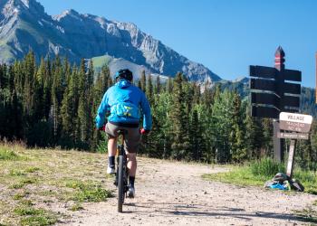
Cycling is a great way to travel through National Forest System lands. The GMUG National Forests offer remote, winding roads and mountain passes,…
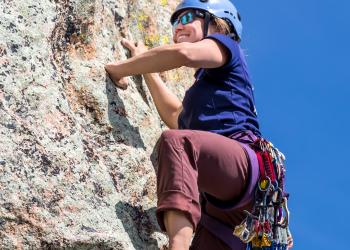
The GMUG National Forests offer many opportunities for climbing, from scrambling through canyon rock jams, following an arduous but rewarding trail…

The GMUG National Forests provide millions of acres of habitat, thousands of miles of streams and a variety of lakes and ponds. These beautiful…
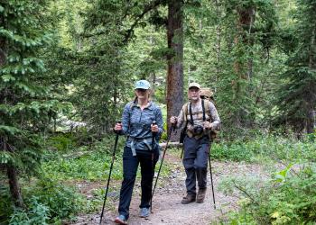
Hiking is a wonderful way to see and experience the many wonders of our nation’s forests. The GMUG National Forests maintain over 3,500 miles of…

The GMUG National Forests offer many trails suitable for horseback riding. Horses are allowed on hiking trails unless a trail is designated for foot…

The GMUG National Forests provide millions of acres of diverse habitat across stunning landscapes. These areas offer exceptional opportunities for…

There are numerous Off-Highway Vehicle (OHV) riding opportunities on the GMUG National Forests. Designated roads and trails are provided on every…
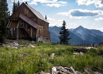
The GMUG National Forest is a great place to learn about local history and nature. There are many interpretive areas with signs explaining historic…

Somehow the food always tastes better when enjoyed in a beautiful forest. There are many developed day use picnic areas set up with tables for a…

Enjoy breathtaking views of western Colorado from the comfort of your vehicle as you explore the many miles of scenic byways and travel corridors on…

Looking to spend a hot summer day floating along the serene waters of a mountain lake or seeking a bit of adrenaline on a swift river rapid? Whether…

The GMUG National Forests boasts three developed ski areas alongside limitless backcountry options for skiing, snowboarding and snowshoeing, plus…