Rocky Mountain Range
The Rocky Mountain Range Geographic Area is located in portions of Teton, Pondera, Glacier, and Lewis and Clark counties. The closest communities are Augusta, Choteau, Bynum, Dupuyer, East Glacier, and Heart Butte. Great Falls is the nearest large population center, about an hour drive to the southeast. The geographic area is bordered by U.S. Highway 2 and Glacier National Park to the north. The Blackfeet Nation lands are to the northeast. The east and southeast are bordered by state, private, and BLM lands. The Upper Blackfoot Geographic Area is to the south. The continental divide and Flathead National Forest are to the west.
A large portion of the Rocky Mountain Range Geographic Area is designated wilderness and includes parts of the Scapegoat and Bob Marshall Wilderness areas. These two wilderness areas are components of a greater wilderness complex that totals well over 1.5 million acres, the 5th largest wilderness area in the lower 48 states. With the passing of the National Defense Act of 2015 in December 2014, an additional 67,112 acres were added to these wilderness areas. The geographic area’s proximity to this wilderness complex, Glacier National Park, and adjacent wild areas of Canada make it a critical component of the North Continental Divide Ecosystem.
This geographic area is a part of the larger Rocky Mountain front, which is the abrupt geologic uplift of the first range on the eastern edge of the Rocky Mountains. Here, the Canadian Rockies are represented by the Sawtooth and Lewis & Clark Ranges. Large bands of exposed limestone were upthrust into what is known as the Lewis Thrust. Two highlights of this upthrust formation are the Scapegoat Mountain, a large escarpment in the Scapegoat wilderness, and the Chinese Wall, a limestone escarpment that averages 1,000 feet high and extends for approximately 22 miles. The continental divide is located along the top of this long limestone escarpment. The distinct ridges are locally known as reefs.
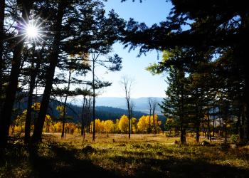
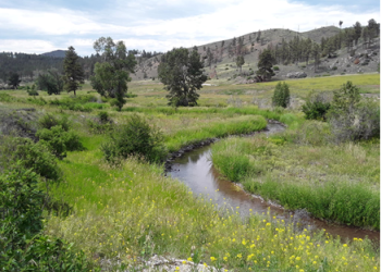
Water drains from the mountains eastward cutting perpendicular through the parallel ridges. Roads follow stream corridors providing access to interior valleys. Many of the streams and rivers are noted for their ecological and scenic value. Upon exiting the forest boundary, the majority of water is quickly captured in reservoirs for agricultural use. Most precipitation comes in the form of snow. Fierce Chinook winds frequently create extremely windy days. The Northwest Glaciated Plains are characterized by large open expanses of what was historically short grass prairie. It has been predominantly converted to wheat and barley production or ranchland. Kettle ponds seasonally dot the rolling foothills. Vegetation within the forest boundary is influenced by relatively natural processes. Prairie, limber pine woodland, and aspens cover lower foothills. Prairie vegetation extends into the front ridges and gives way to conifer forests. Exposed rock, aspen stands, and open grassland break up the forest.
The geographic area is a destination for Montanans as well as visitors from all over. People are drawn to the area because of its remoteness, stunning landscape, recreational opportunities, and because it is one of the few remaining wild places in the lower 48 states. Many lodges, resorts, camps, cabins, and ranches have intimate relationships with the area. Guard stations, work centers, and lookouts help the Forest Service steward the vast country.
Recreation use within the geographic area varies radically. Because of the large amount of designated wilderness there is substantial backcountry recreation that relies on traditional skills, solitude, and self-reliance. Backpacking, horseback riding, and outfitter guiding are the primary recreation opportunities presents in this remote reaches. Conversely, in the front country, one can find highly developed campgrounds and trailheads, commercial resorts, cabin rentals, and a downhill ski resort. Portions of the Old North Trail, an ice-free corridor for southward immigration of North America’s first peoples, are found here. More recent indigenous cultures revere the area as a sacred landscape with religious importance such as a place for dream quests. The use of its cultural and spiritual resources has initiated the Badger-Two Medicine area to be designated as a Traditional Cultural District. Archeological sites, such as pictographs, dot the entire geographic area.