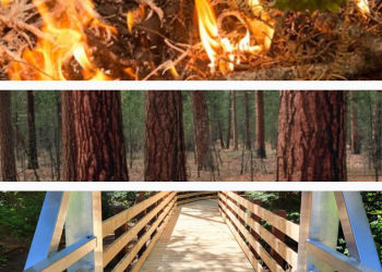
Investing in Willamette National Forest Recreation Sites
Planning for the Future:
The Willamette National Forest is developing a Recreation Facility Master Plan and wants to hear from you! Please take time to provide feedback on recreation programs by completeting our Recreation Use Survey.
Investing in Willamette National Forest Recreation Sites
The Willamette National Forest has a large, developed recreation program with 425 developed recreation sites, ranging from trailheads with a single sign board at a wide spot on a road, to campgrounds with flush toilets and showers. However, a recent analysis shows only enough funding to operate about two-thirds of these sites.
Additionally, over the last 7 years, many of these recreation sites have been affected by wildfire. Since 2016, over 25% of the Willamette National Forest has been affected by wildfire, including over 100 recreation sites and over 300 miles of trail.
To improve management of these sites and identify opportunities for investments and enhancements and changes in management, the Willamette National Forest is developing a Recreation Facility Master Plan and wants to hear from you about your preferences and ideas for managing recreation sites into the future and after wildfire impacts. The Forest is hosting a series of public meetings that are open to everyone. For anyone not able to attend a workshop in person, there is an online option for providing feedback.
Workshop schedule:
Wednesday, May 15 |
6:00-7:30 p.m. |
Sweet Home Senior Center 880 - 18th Ave Sweet Home, OR |
Thursday, May 16 |
6:00-7:30 p.m. |
Middle Fork Ranger District Office 46375 Highway 58 Westfir, OR |
Tuesday, May 21 |
6:00-7:30 p.m. |
Lowell Grange 51 E 2nd St. Lowell, OR |
Wednesday, May 22 |
6:00-7:30 p.m. |
Campbell Community Center 155 High St. Eugene, OR |
Thursday, May 30 |
6:00-7:30 p.m. |
Gates Fire Hall 140 E Sorbin St. Gates, OR |
Thursday, June 6 |
6:00-7:30 p.m. |
Upper McKenzie Community Center 54745 McKenzie River Drive, Rainbow, OR |
Human Ecology Mapping
The Human Ecology Mapping (HEM) tool is a set of protocols and procedures used to engage the public around critical forest management issues using maps and other geospatial applications. HEM enables planners and managers to understand public values and uses of forest and rangeland landscapes. The tool captures public preferences for ecosystem services as well as desired future conditions for forest management. HEM also can be adapted for many types of planning processes, including travel management planning, forest plan revisions, and sustainable recreation planning, among others.
Survey to submit feedback availble here.
Use
The tool can be used in many settings and in a variety of applications including with paper maps, electronic tablets and online applications. HEM is designed for use by forest planners and public affairs staff to bring together a diverse array of citizens, partners, stakeholders, landowners, and agencies together to provide systematic input to a planning process. The Olympic National Forest, Mount Baker-Snoqualmie National Forest, Deschutes National Forest, and Ochoco National Forest have used HEM to gather public input.
A copy of the participant handbook can be found at this link.