
Silvertip Trailhead
This is a free trailhead site located 68 miles south of the town of Hungry Horse on the gravel East Side Reservoir Road #38. The trailhead is located at an elevation of 4,400 feet and is open from June 1 until Labor Day.
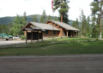
Silvertip Trailhead is situated at the end of the Spotted Bear River Road #568. The 6 parking spots are next to the road. The site is located in old growth stand of lodgepole pine. It gets moderate use. It is used as a base for accessing Spotted Bear River Trail #83 and Silvertip Creek Trail #89.
There are no tables, metal fire rings, or vault toilet. There is no potable water, but water is available from Spotted Bear River a mile away, and must be treated prior to consumption. Stock is allowed at the site. There is a hitchrail and unloading ramp. Weed Seed Free Feed is required on all national forest lands.
There is no garbage service and visitors need to plan to Pack It In, and Pack It Out. There is a food storage order in effect on all national forest land that requires that human and stock food, garbage, and other attractants be kept unavailable to bears. Your stay may not exceed 16 days.
This is a remote location and there is no cell phone service in the area. The closest public phone is located 15 miles west at the Spotted Bear Ranger Station. Phone, gas, and food are located 68 miles north in the town of Hungry Horse.
Active Alerts
General Information
6/1 to Labor Day
16-day stay limit. Special regulations related to food storage, camping, and other topics as well as trail conditions can be found on our Wilderness Page.
No fee required
Address: SUMMER PHYSCIAL ADDRESS: 52 miles south of the intersection between US Highway 2 and FS Road 38 Hungry Horse, MT 59919
Phone: 406-758-5376
Hours: Tuesday – Saturday, 8:00am - 4:30pm (Closed on federal holidays)
Getting There
Latitude / Longitude
Latitude: 47.93625
Longitude: -113.30875
Directions
Silvertip Trailhead is accessed from Highway 2. From the town of Hungry Horse, drive east on Highway 2 for ½ mile to the East Side Reservoir Road #38. Turn right (south) onto Road #38 and drive on through the town of Martin City. After two miles the pavement ends and the gravel East Side Reservoir Road continues on 54 miles to the Spotted Bear River Road #568. Turn left (east) on Spotted Bear River Road and drive 14 miles until the end of the road and Silvertip Trailhead, from 7/1-8/31. From 5/15 - 6/30, and 9/1-11/30 the trailhead is at Beaver Creek Campground Trailhead. NOTE: Road #38 between mileposts 37 and 53, and the entire Road #568 both have a winter wildlife closure from 12/1 - 5/14. The last 3 miles of Road #568 is open 7/1 - 8/31.
Facility and Amenity Information
Restrooms
Restrooms are not available at this site.
Water
Potable water is not available at this site.