
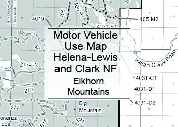
Motor Vehicle Use Maps
MVUMs on the Helena-Lewis and Clark National Forest
The Motor Vehicle Use Maps (MVUMs) and Over Snow Vehicle Use Maps (OSVUMs) can be printed at home or obtained from any Helena-Lewis and Clark National Forest Office for free upon request. All maps linked below are in PDF format and can be opened with Adobe Reader.
The Forest Service is committed to making its documents accessible to individuals with disabilities in accordance with Section 508 of the Rehabilitation Act (29 U.S.C. 794d), as amended in 1998. Not all features of Motor Vehicle Use Maps are accessible in electronic format. Please contact our office at 406-791-7700 (TTY 406-731-5331) to be sent a hard copy of this map.
Visit the Forest Service MVUM Information and Frequently Asked Questions page for more information.
The MVUM displays Forest roads and trails open to motor vehicles and when they are open. If a route is not shown on the MVUM, it is not open to public motor vehicle travel. Some routes may not be signed on the ground, and it is the user's responsibility to refer to the MVUM and ensure they are on an open route. The MVUM will be updated to reflect any changes in route status, and to correct errors. Special orders may be issued at any time that temporarily close routes for reasons such as safety concerns, resource damage, or fire.
The MVUM is a black and white map with few topographic features. It is best used in conjunction with a Forest Visitor Map or other topographic map.


Big Belt Mountains

The Big Belt Mountains MVUM map (2016/2023) shows the roads open to public motorized use in the North Belts. THERE IS A KNOWN ERROR - for roads 4143-A1, 4143-A3, 4143-A4. The MVUM shows these as open to the public, our newsprint map (based on MVUM) shows as open to the public BUT the sections of these roads that go through private land are not open to public motorized use, and the Forest Service has no legal easement through this private property.


