
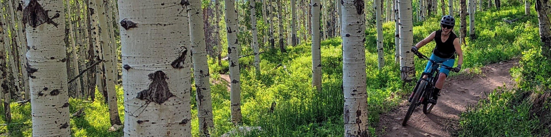
Biking
There are hundreds of miles of trails and roads accessible by mountain bike on the White River National Forest.
- Biking is allowed on designated roads and trails during the summer travel season, May 21 - November 22.
- Bicycles are not allowed in Wilderness areas
E-Biking
- Where can I ride an e-bike on the White River National Forest?
Class 1, 2 and 3 e-bikes are all considered to be motorized vehicles by the Forest Service. You may ride your e-bike on any White River National Forest road or trail open to licensed or unlicensed motorized use during the summer travel season.
Because e-bikes are considered motor vehicles, they are not permitted on White River National Forest non-motorized trails, including those that are open to non-motorized mountain bikes.
- How can I find out what roads and trails are open to motorized and e-bike use?
Summer motorized vehicle use maps are available at local ranger district offices and on-line. These maps detail the roads and trails open to motorized use, which are where e-bikes are allowed. Season dates for motorized use vary to protect sensitive resources like elk calving, and the maps also detail when the roads and trails are open to motorized use. It’s your responsibility to know the rules and regulations regarding e-bikes and motorized travel.
- What about riding e-bikes on paved paths managed by other jurisdictions, or summer trails at ski areas?
E-bike rules vary by jurisdiction and ownership. Several areas operated under special use permit on the White River National Forest allow e-bike use within their permitted areas, including some ski resorts. Please check with the local government or resort for specific guidance and rules regarding e-bikes.
Mountain Biking
Be considerate of hikers and equestrians, and yield the right-of-way to other trail users.
- Horses spook when they see an unfamiliar object, especially one that moves quickly and quietly.
- If necessary, dismount your vehicle or bicycle on the downhill side and wait for horses and hikers to pass.
Ride single file in the middle of the trail to avoid widening the trail
Use caution when passing others, and approach turns in anticipation of someone around the bend.
Control your speed at all times
Search for Biking Opportunities
Miners Creek TH #38
This trail starts near the town of Frisco and eventually takes you up and over the Tenmile Range and junctions with the Wheeler National Recreation Trail which ends at Copper Mountain. This is a…
Mount Of The Holy Cross Overlook Observation Site
This observation deck, also known as Julia's Deck, is accessed by an easy 1/8 mile accessible trail. It provides views of the Mount of the Holy Cross and is often reserved for wedding ceremonies. The…
New Castle Area
The town of New Castle is located along I-70 between Rifle and Glenwood Springs, CO. From here, it is a short drive north to Clinetop Mesa, Main Elk Creek, and East Elk Creek. This area includes…
North Fork Road (Swan River) TH #354
Approximately 3.3 miles from the beginning of the North Fork Road you will come to the ruins of the old mining camp of Rexford, just past Garibaldi Gulch. The North Fork Road leads you through thick…
North Vail TH #1896
The North Vail Trail trail begins at Vail's North Frontage Road at exit 176 off of I-70 and ends at the west end of North Frontage Road near exit 173 off of I-70. This trail has numerous trailheads…
Old Dillon Reservoir TH #87
This is a short, easy trail that has spectacular views of the mountains of the Tenmile Range and the Continental Divide. The Old Dillon Reservoir was built in the 1930’s to supply water to the…
Paulie's Plunge / Stone Creek TH #2349
This 2.2 mile trail connects Eagle Drive and the Beaver Creek Ski Resort. Hikers and snowshoers generally hike up from Eagle Drive and mountain bikers generally ride from Beaver Creek down to Eagle…
Peaks TH #45
This is a one way multi-use trail that starts from either the town of Frisco or Breckenridge, CO. The trail climbs in and out of numerous drainages for its entire length staying mostly in the…
Pennsylvania Creek Road TH #611
Pennsylvania Creek Road climbs up the valley and eventually after approximately 2.5 miles you can turn left and drop down to Indiana Creek Rd (FDR 593). At this point you can continue to Boreas Pass…
Peru Creek Road TH #260
This road offers amazing scenery, gorgeous hiking trails and access to other spur roads, all without being very difficult for most SUVs to access. It is a fairly mellow road with plenty of room to…