
Recreation

Trails webpages and information will not be available until May 2025. Thank you for your patience while we work through getting the most updated, accurate information for you during this time.

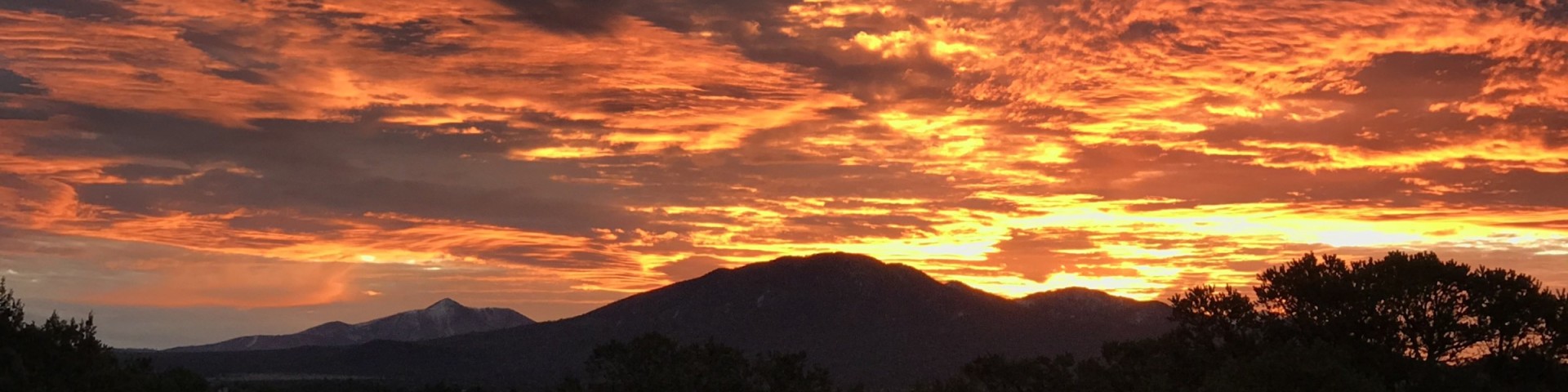
From canyons to prairies, peaks to plateaus, the Kaibab National Forest, which is nestled on the Colorado Plateau, offers layers of opportunity for discovery. The Mogollon Rim forms the southern boundary while extending to the north almost to the Utah border. Meanwhile, the majestic Grand Canyon National Park bisects the center of the forest.

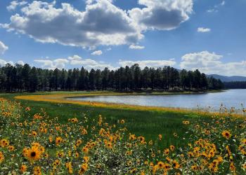
Elevations range from about 3,000 feet to 10,418 feet at the top of Kendrick Mountain. Beginning in low elevation grasslands and sagebrush, the forest steps up through forests of pinyon-juniper and ponderosa pine to fir, spruce and aspen. Summer temperatures range from 50° F at night to 80-90° F during the day. Summer thunderstorms, known as the monsoon, can build up quickly, especially during July and August. Snow is common from December through March.

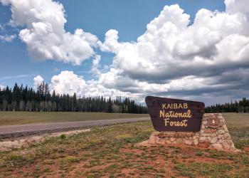
In all, the entire Kaibab National Forest is approximately 1.6 million acres. This includes four designated wilderness areas totaling about 114,845 acres that are managed for challenge and solitude. The Kaibab Plateau-North Rim Scenic Byway winds through meadows and forest ending at Grand Canyon National Park's North Rim. Opportunities for recreation including developed facilities such as campgrounds, picnic areas and viewpoints are plentiful.

Not all trail information may be present below - click here for a comprehensive list of Kaibab NF trails 

Showing: 21 - 30 of 34 results

Kanab Creek Wilderness

Site Open
Hiking
Flowing from its origin some 50 miles to the north in southern Utah, Kanab Creek and its tributaries have cut a network of vertical-walled gorges deep into the Kanab and Kaibab Plateaus. Within these…

Kendrick Mountain Wilderness

Site Open
Hiking Outdoor Science and Learning
Kendrick Mountain Wilderness is located on the eastern edge of the Williams Ranger District, straddling a boundary with the Coconino National Forest. Ranging from just over 7,000 feet to 10,418 feet.…

Le Fevre Overlook

Site Open
Outdoor Science and Learning
As you travel through the Kaibab National Forest north of the Grand Canyon heading toward Fredonia, Ariz., there is a gorgeous overlook where visitors can take in the vastness and beauty of the…

Marble Viewpoint

Site Open
Outdoor Science and Learning Hiking
Marble Viewpoint offers a spectacular, panoramic view of House Rock Valley, Vermilion Cliffs, Marble Canyon, North Canyon and Saddle Mountain Wilderness.Here is cool, summer camping, with excellent…

Monument Viewpoint

Site Open
Outdoor Science and Learning Hiking
From the parking area you do a short walk on the Bill Hall Trail on the Forest Service land before entering into the National Park. In the Forest Service boundaries you travel thru a sparsely…

North Timp Snowmobile Route #152

Site Open
Winter Sports
The route to Timp and North Timp Viewpoints is a beautiful drive through a ponderosa pine forest. Both points offer a panoramic view of the Grand Canyon and its tributary canyons. Timp Point is the…

Russell Tank

Site Open
Hunting, Fishing and Shooting
Opportunities for fishing on the Tusayan Ranger District are quite limited due to the lack of perennial ponds or streams. Russell Tank, which is located in the south central part of the district, is…

Saddle Mountain Wilderness

Site Open
Hiking Horse Riding and Camping
Elevations range from 6,000 feet to over 8,000 feet. The name originates from the profile of a prominent ridge that appears from the distance as a "saddle", horn and all. Vegetation is diverse. It…

Spring Valley Cabin

Site Open
Horse Riding and Camping Winter Sports
The Kaibab National Forest is pleased to offer historic Spring Valley Cabin to you through the Arizona Cabin Rental Program. Enjoy spectacular views, cross-country ski trails, and time "away from it…

Sycamore Canyon Wilderness

Site Open
Hiking Outdoor Science and Learning
Established in 1935, this area contains a unique canyon-land environment. Sycamore Canyon cuts through the Mogollon Rim, then drops off the Colorado Plateau with an unmatched flourish of red rock…