
Permits
Permits are required for the following forest activities:
- Cutting firewood
- Collecting other forest products, such as Christmas trees
- Commercial photography and filming
- Certain events (such as large parties and weddings)
- Research
- Outfitting and guiding services
- Establishing and maintaining infrastructure on the forest, such as cell towers
For recreation special use inquiries, including family reunions/weddings, commercial recreation events such as running or bike races, and outfitters/guides, please email pdl_r3_kaibab_rec_spec_use@usda.gov
Forest Product Permit Types
Learn more about Personal-use (Fuelwood, Cinders, and Christmas tree permits), Commercial-use, and Traditional-use permits below.
Personal-use Firewood Permits
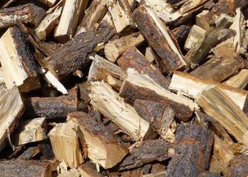
The Kaibab provides firewood for personal use both on a free-use permit and a paid permit basis.
Cinder Pits
Learn more about cinder pit permits on the Kaibab.
Christmas Tree Permits

Christmas tree permits are typically available on the Kaibab from October through December.
All commercial uses of forest products require a paid permit. It is a commercial use when the forest product will be sold by the permittee. The rules for gathering and the availability of different products vary considerably. All those interested in commercial uses of forest products should contact the local district office for detailed information on products available and pricing.
The Kaibab National Forest has a program for providing forest products for free to Native Americans for traditional uses. For information, please contact the local district office and identify the need to gather forest products for traditional Native American uses.
Special Use Permits
There are over 100 special-use types, however, the most common special-use permits include:
- Commercial Photography/Filming
- Events/Group Use of +75 People (i.e. Gatherings, Weddings, Parties.)
- Outfitter and Guiding
- Commercial recreation events, such as running races
- Infrastructure, such as powerlines or cell towers
Applying for a Special Use Permit
A special-use authorization is a legal document such as a permit, term permit, lease, or easement, which allows occupancy, use, rights, or privileges of NFS land. The authorization is granted for a specific use of the land for a specific period of time.
Each year, the Forest Service receives thousands of individual and business applications for authorization for use of NFS land for such activities as water transmission, agriculture, outfitting and guiding, recreation, telecommunication, research, photography and video productions, and granting road and utility rights-of-ways. The Forest Service carefully reviews each application to determine how the request affects the public's use of NFS land.
Normally, NFS land is not made available if the overall needs of the individual or business can be met on nonfederal lands.
- If you will need to occupy, use, or build on NFS land for personal or business purposes, whether the duration is temporary or long term.
- If there is a fee being charged or if income is derived from the use.
- If an activity on NFS land involves individuals or organizations with 75 or more participants or spectators.
- Your request must be consistent with laws, regulations, orders, policies of NFS lands, other federal laws, and applicable state and local health and sanitation laws.
- Your request must be consistent or made consistent with the standards and guidelines in the applicable Land and Resource Management Plan. Your request must not pose serious or substantial risk to public health or safety.
- Your request must not require exclusive or perpetual right of use or occupancy.
- Your request does not unreasonably conflict or interfere with administrative uses, other scheduled or authorized existing uses, or use of adjacent non-NFS lands.
- The proponent must not owe any fees to the Forest Service from a prior or existing special-use authorization.
- No gambling or providing of sexually oriented commercial services can be authorized on NFS land, even if permitted under state law.
- No military or paramilitary training or exercises by private organizations or individuals can be authorized on NFS land, unless it is federally funded.
- No disposal of solid waste or storage or disposal of radioactive or other hazardous substances can be authorized on NFS land.
- Contact the local Forest Service office representing the area for which you are seeking a special-use authorization. For recreation special use inquiries, including family reunions/weddings, commercial recreation events such as running or bike races, and outfitters/guides, please email pdl_r3_kaibab_rec_spec_use@usda.gov
- Prior to submitting the proposal, you are required to arrange a pre-application meeting at the local Forest Service office where the use is being requested. A staff member will discuss your proposal, potential land use conflicts, appropriate application for your purposes, application procedures and qualifications, probable time frames, fees, bonding requirements, additional coordination with other agencies, environmental reports, and field reviews.
- Most commercial uses require additional information with an application. You may need business plans, operating plans, liability insurance, licenses/registrations, or other documents. A commercial use is when an applicant intends to make use of NFS lands for business or financial gain.
- Complete and submit the appropriate application form, including supporting documents, to the local Forest Service office. An incomplete proposal could delay the processing.
Name and Address- Include the full name(s) to be used. If the application includes real property, the name(s) on the legal document must match the application.
Applicant's Agent- This person must be at least 21 years old and may or may not be the same as the applicant. Documentation should be included to verify that this person may sign on behalf of the applicant.
Project Description- Include enough detail to enable the Forest Service to determine feasibility, environmental impacts, benefits to the public, the safety of the request, lands to be occupied or used, and compliance with applicable laws and regulations.
Environmental Protection Plan- Include proposed plans for environmental protection and rehabilitation during construction, maintenance, removal, and reclamation of the land.
Map- Provide a detailed map (U.S. Geological Survey quadrangle or equivalent) or plat (survey or equivalent) showing the requested use in relation to NFS land, identification of applicant's property (if applicable), scale, map legend, legal description, and a north arrow.
Technical and Financial Capability- Provide documentation to assure the Forest Service you are capable of constructing, operating, maintaining, removing the use off NFS land, and reclaiming the land after the authorization terminates.
Alternatives- You must first consider using nonfederal land. Lower costs or fewer restrictions are not adequate reasons for use of NFS lands. Provide alternative locations for the proposal in your application.
Note- This is the basic information that will be needed. Additional information may be required depending on the specific special-use authorization being requested. You should check with your local Forest Service office for required information/documentation.
Cost Recovery Fees- An assessment of fees to recover agency processing costs for special use applications and monitoring costs for special use authorizations. These fees are separate from any fees charged for the use and occupancy of NFS lands.
Land Use Fees- This is an annual rental fee based on the fair market value for the uses authorized and is payable in advance. Fees are established by appraisal or other sound business management principles.
Other Associated Costs- You may be responsible for providing information and reports necessary to determine the feasibility and environmental impacts of your proposal; compliance with applicable laws and regulations; and terms and conditions to be included in the authorization.
Special-Use Authorizations to Conduct Research
- Federal regulations mandate that all commercial and non-commercial uses of NFS land be accounted for by special use permits. All research proposals require an assessment of whether the action is subject to the National Environmental Policy Act (NEPA). If the action requires NEPA, coordination with the forest will be required and a NEPA decision signed before the actions can take place.
- Many activities occur on the forest that may conflict with research projects, such as group recreational events, routine utility corridor maintenance, tree thinning, Christmas tree cutting, prescribed burns, habitat restoration, new land designations, and proposed land exchanges. Knowledge of research activities by Forest Service staff and regular communication can help minimize undesirable impacts to research projects.
- The Forest Service has a wealth of information about its land and resources. Resource specialists can direct researchers to areas most appropriate for their needs, as well as offer information on management history or historical events, such as wildfires. Research permits facilitate this communication.
- It is important to promote and facilitate integration and coordination of complementary research projects. Spatial data on the location of all permitted research projects will be maintained. Efforts will be made to link complementary projects and promote interdisciplinary research.
- Research proposals may require archaeological clearance, biological assessment, and/or other evaluations, depending on what's being proposed.
Principal Investigators (PIs) of all research projects located on lands managed by the Forest Service should apply for research permits. Failure to obtain a special use permit for research violates Forest Service policy and federal environmental regulations, and may jeopardize completion of the research.
- PI's name, phone number, and email address; name and address of PI's research organization/department.
- Statement of the scope and purpose of the research. Please be concise and avoid non-essential jargon as several different resource specialists will review the proposal.
- Exact location of the project. This is essential for resource specialist review of the proposal. (GIS maps and topographic maps at a 1:24,000 scale are recommended.) The location of your project needs to be compared with maps of archaeological sites and threatened and endangered species (TES). If you have large plots, the perimeter must be defined. If you have small plots or sites, place dots on the map.
- Methods used: Please provide specific information about how the research will be accomplished on the ground. This includes the following information:
- The area encompassed by the research: how it will be designated, laid out on the ground, and identified.
- Activities associated with the research: measurements, sampling methods, frequency and duration of entry into an area, equipment used, and the specific amount and nature of ground disturbance (depth and dimensions). Providing detailed information about methods will facilitate review. Failure to provide sufficient details may result in a delay in review.
- Time of the year and frequency of site visits, including the number of visitors. This information is critical to evaluate potential research impacts to TES and other forest resources. If research is in the proximity of a known TES, consideration of the number of people in the area and the timing and frequency of their visits is important.
- Duration of research: Estimate the likely duration of the research activities.
- The area encompassed by the research: how it will be designated, laid out on the ground, and identified.
- Please note: Failure to provide this information may delay review of your proposal.
Decisions on the need for archaeological clearance, biological assessment and/or other evaluations, and approval of the special use permit will be made by Forest Service staff.
What If I Have More Questions?
Please contact the local Kaibab National Forest Supervisor's Office for additional information.
For recreation special use inquiries, including family reunions/weddings, commercial recreation events such as running or bike races, and outfitters/guides, please email pdl_r3_kaibab_rec_spec_use@usda.gov