
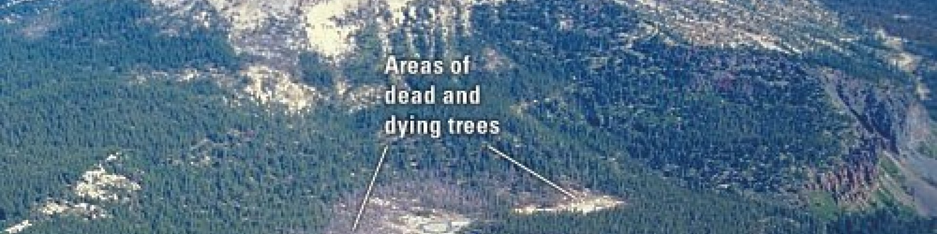
Horseshoe Lake CO2 Area
U.S.G.S scientists detected naturally occurring Carbon Dioxide (CO2) gas in the vicinity of Horeseshoe Lake and other areas on the Mountain in 1994. Since then they have been monitoring the gas, measuring the concentration and rate of gas discharged from the ground. The higher than normal concentrations of CO2 are responsible for killing approximately 120 acres of trees next to Horseshoe Lake and elsewhere on Mammoth Mountain.
Scientists believe that the CO2 is being released from a gas reservior that has existed for a long period of time deep under Mammoth Mountain. It is believed that earthquake and magmatic activity beneath the area in 1989 opened channels for the gas to reach the surface.
CO2 is heavier than air and can collect at high concentrations in depressions and enclosures, posing a potential danger to people, especially small children and pets.
General Information
Day use only: open 6:00 a.m. to 10:00 p.m.
Wilderness permit for Red Cones Trail is required for overnight trips.
No fees are required for this site
Dogs must be leashed in all developed recreation sites.

Address: 2510 Hwy 203 Mammoth Lakes, CA 93546
Phone: (760) 924-5500
Hours: Daily, 8:00am- 5:00pm
Getting There
Latitude / Longitude
Latitude: 37.6129
Longitude: -119.0203
Elevation
9,100'
Directions
From the town of Mammoth Lakes, continue westward on hwy 203 as it turns into Lake Mary Road and heads into the Mammoth Lakes basin. Lake Mary road dead ends at Horseshoe Lake.
Facility and Amenity Information
Restrooms
Restrooms are available at this site.
Water
Potable water is available at this site.