

Recreation
Quick Links
Enjoy Your National Forests Safely - Know Before You Go!
Recreation.gov is the website for making reservations

Monterey Ranger District offers camping, day hiking, backpacking, beaches, ocean swimming, surfing, fishing, hunting, scenic driving on Highway 1, wildflower displays in th
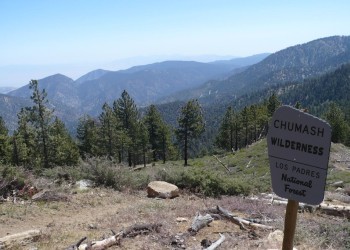
The Ojai area includes the Matilija Wilderness and part of the Sespe Wilderness. The Sespe Creek Wild and Scenic River crosses this area.
Santa Barbara Ranger District offers camping, day hiking, backpacking, fishing, horse riding and camping, mountain biking, hunting, OHV riding and camping, swimming in the
The Santa Lucia Ranger District offers a diversity of outdoor opportunities. These lands are yours - to visit, to care for, but most of all, to enjoy.