Winter Sports
Winter sports in the United States are popular, both professionally and rec
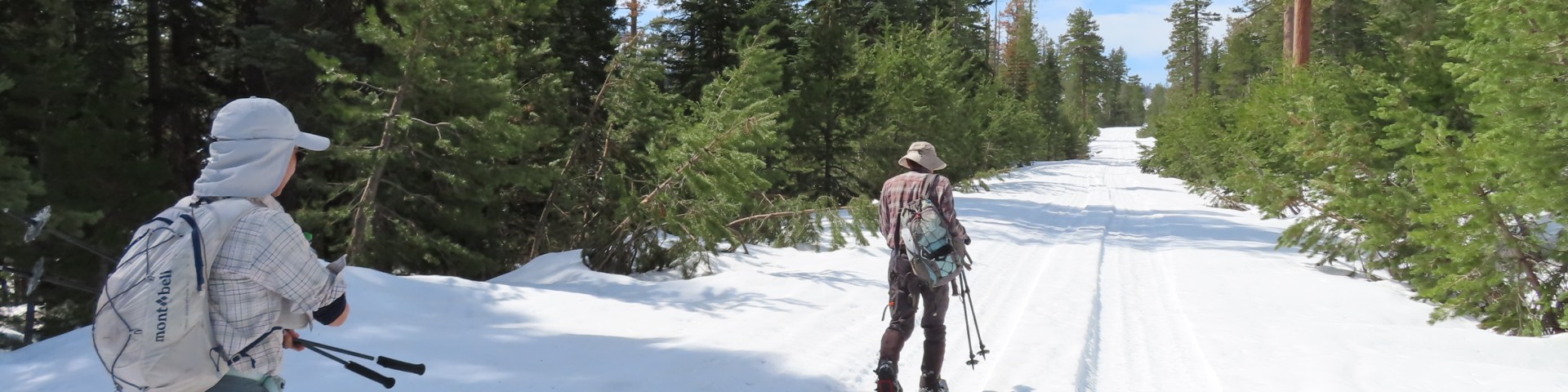
XC Skiing/Snowshoeing
The Bull Gap Nordic Ski Trails offer 8.1 miles of trails that pass through high alpine forests on Mt. Ashland. Trails range from “Easiest” to “Most Difficult,” so no matter your skill level, there is something for everyone. When the wind is blowing, Bull Gap is a good alternative to the Grouse Gap Trails on the south side of Mt. Ashland.
The 5.7 mile Bull Gap Trail links the Bull Gap Sno-Park to the Mt. Ashland Ski Area. Beginning at Bull Gap Snow-Park, the trail follows snow-covered road 2080 to Bull Gap (3.3 miles). The elevation loss is about 600 feet and the trip down is a pleasant one with some nice views, including Mt. McLoughlin to the northeast. Bull Gap is a four-way intersection at a saddle on the ridge between Neil Creek and Ashland Creek. From Bull Gap, the trail turns uphill on Forest Road 200 to the left and climbs 1100 feet in 2.5 miles to the Mt. Ashland Ski Lodge. The road from Bull Gap to the Ski Lodge is easy to follow.
The Crest Loop is a 2 mile side loop off of the Bull Gap Trail for skiers of advanced/intermediate skill. It is most enjoyable when skied in the counterclockwise direction. The loop begins at the junction of the Bull Gap Trail (Forest Road 2080) and the Pacific Crest National Scenic Trail, about 0.4 mile from the Sno-Park. The route follows the Pacific Crest National Scenic Trail for 0.8 mile, mostly through the trees, then zig-zags steeply downhill through the woods to Forest Road 050, which returns to the Bull Gap Trail. From the Sno-Park, the Crest Loop is 3.4 miles roundtrip, with 440 feet of elevation lost and regained.
Search for Winter Sports Opportunities
Showing: 11 - 20 of 27 results
Grouse Gap Sno-Park
Grouse Gap Sno-Park is located near the summit of Mt. Ashland, and is the access point to the Mt. Ashland Southside (Grouse Gap) Nordic Ski Trail System. A popular place starting place for…
High Cascades Ranger District
The High Cascades Ranger District serves the public at the following location:Prospect Ranger Station (541) 560-340047201 Highway 62Prospect, Oregon 97536
Lobster Creek Campground
Lobster Creek campground is set in the forest on a large gravel bar, fronting the mighty Wild and Scenic Rogue River.FacilitiesWater7 campsites (3 tent sites and 4 tent/trailer sites) with picnic…
Mt. Ashland Ski Area
Mt. Ashland Ski Area is located at the highest point in the Siskiyou Mountain Range. The Ski Area offers skiing and snowboarding on 240 acres, with 4 chair lifts and 44 runs! They have a full rental…
Nook Bar Camping and Day Use Area
Nook Bar provides dispersed campsites for tents or small trailers on a large river bar by the beautiful Wild and Scenic Chetco River. Enjoy summer fun in the crystal-clear waters of this outstanding…
North Fork Campground
North Fork Campground offers scenic views and opportunity for fishing, swimming and hiking. Fish Lake Traihead is just across street from the campground. Facilities9 campsites with picnic tables,…
Oak Flat Campground
This site is located along the Wild and Scenic Illinois River and the Illinois River West Trailhead. For tents and small trailers only.Facilities15 campsites with picnic tables and fire pitsNo…
Page Mountain Sno-Park
PLEASE NOTE: Due to significant road failures to Forest Road 48 (Grayback-Happy Camp Road) we agree with Josephine County that the road remains unsafe to snowplow this winter (2023-24). There will be…
Powers Ranger District
Powers Ranger District encompasses the northwestern portion of the RRSNF, and the office is located at:42861 Highway 242Powers OR 97466Phone: (541) 439-6200