






Cedar Creek Fire
The Cedar Creek Fire began on August 1, 2022, caused by a lightning strike. The fire started approximately 15 miles east of Oakridge, OR, and 5 miles west of Waldo Lake, on the Willamette National Forest. The fire grew rapidly in the first few days in inaccessible terrain, then was held at control features for around one month. In early September, hot, dry weather and a multi-day episode of strong, mostly easterly winds caused the fire to expand rapidly to the west, and eastward onto the Deschutes National Forest. The fire encompassed 127,311 acres, in a variety of forested ecosystems. The fire burned a mosaic pattern through most of the area, and the majority burned with low and moderate severity, although areas of high severity are present north and northwest of Waldo Lake and on high elevation ridges and spurs in the southern and western portions of the burned area. The burned area is 100% on National Forest lands.
Story Map
Cedar Creek Fire Story Map
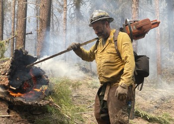
Explore an interactive multimedia timeline of the 2022 Cedar Creek Fire. Read narrative about the fire and response, explore maps, and view photographs.
Photo Gallery


After the Fire
Burned Area Emergency Response (BAER) Findings

Learn from scientists' analysis of post-fire landscape changes and hazards.
Vegetation Mortality Basal Area Loss
Explore the severity and geography of fire's impact in the Vegetation Mortality Basal Area Loss generated by scientists on the Burned Area Emergency Response (BAER) team.
Soil Burn Severity
View the Soil Burn Severity Map created by scientists on the Burned Area Emergency Response (BAER) team. Soil burn severity is a critical indicator of recovery.