





Fireline Loop Snow Trail
Ray Benson Sno-Park » Fireline Loop
This trail follows the old fireline eastward from Ray Benson Sno-park and loops through old fire roads and volcanic sand blowouts. This route is distinctive in that it travels the line between the forest and open burn areas.
This route is usually groomed weekly, depending on snow conditions, through a partnership with the Oregon Snowmobile Association and Mt. Jefferson Snowmobile Club.
General Information
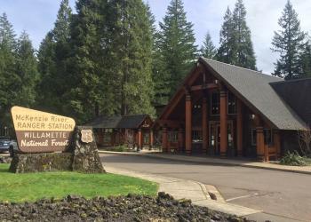
Address: 57600 McKenzie Highway McKenzie Bridge, OR 97413
Phone: (541) 822-3381
Hours: Monday-Friday, 10:00 a.m. - 4:30 p.m. (Closed on federal holidays)
Office Email: sm.fs.mf@usda.gov
Getting There
Trailhead/Starting Points
Access Fireline Trail from Ray Benson Sno-park.
Directions
From McKenzie Bridge, OR, drive 38 miles northeast on Highway 126 to Santiam Pass.
Turn right to go south on Forest Road 2690 towards Hoodoo Ski area.
Past Hoodoo Ski area, turn left east on Forest Road 920 into Ray Benson Sno-Park.

